File:Wutip 2019-02-25 0345Z.jpg
跳转到导航
跳转到搜索
本预览的尺寸:450 × 600像素。 其他分辨率:180 × 240像素 | 360 × 480像素 | 576 × 768像素 | 768 × 1,024像素 | 1,536 × 2,048像素 | 4,200 × 5,600像素。
原始文件 (4,200 × 5,600像素,文件大小:6.1 MB,MIME类型:image/jpeg)
说明
说明
添加一行文字以描述该文件所表现的内容
摘要
[编辑]
| 描述 |
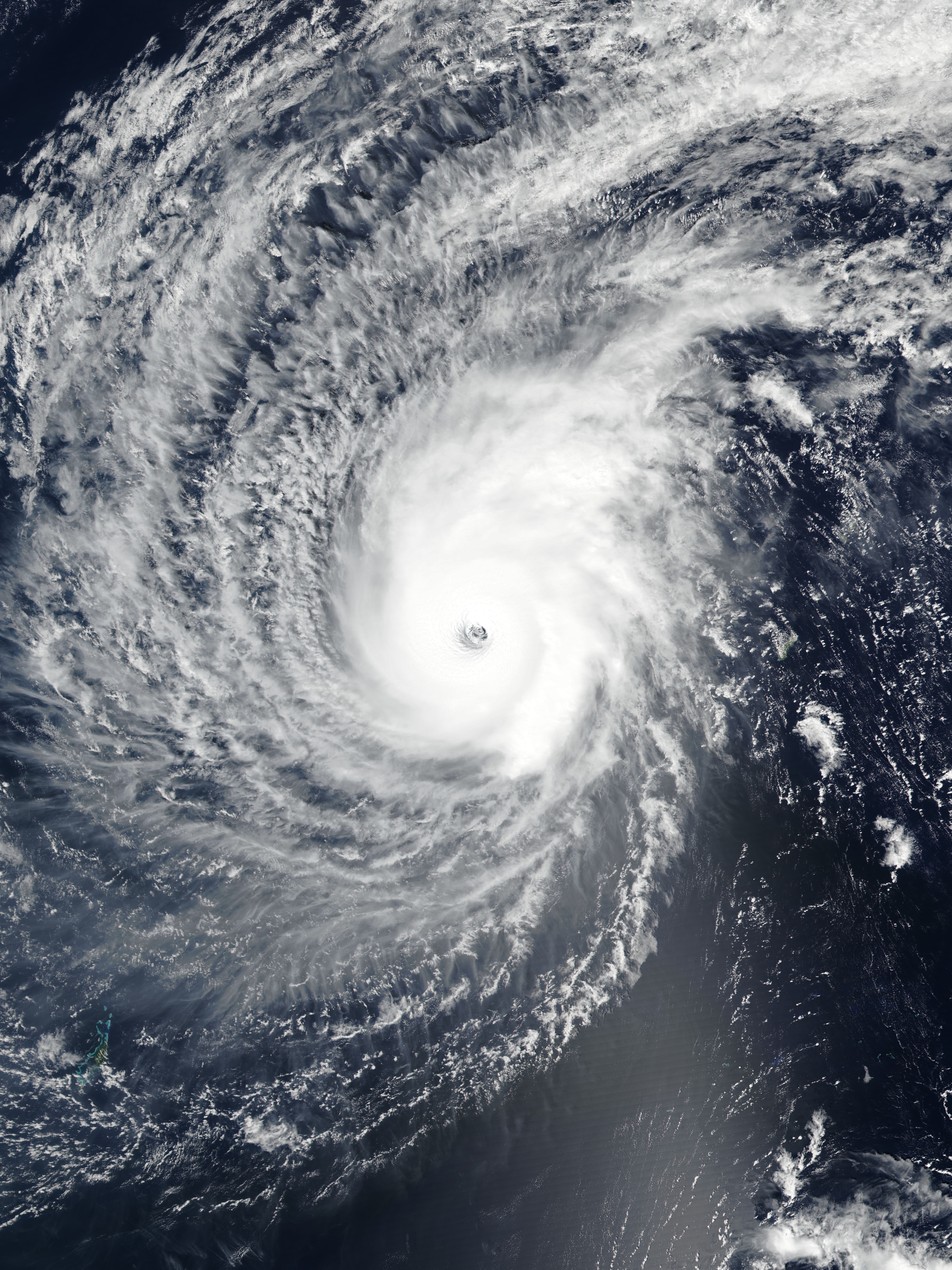
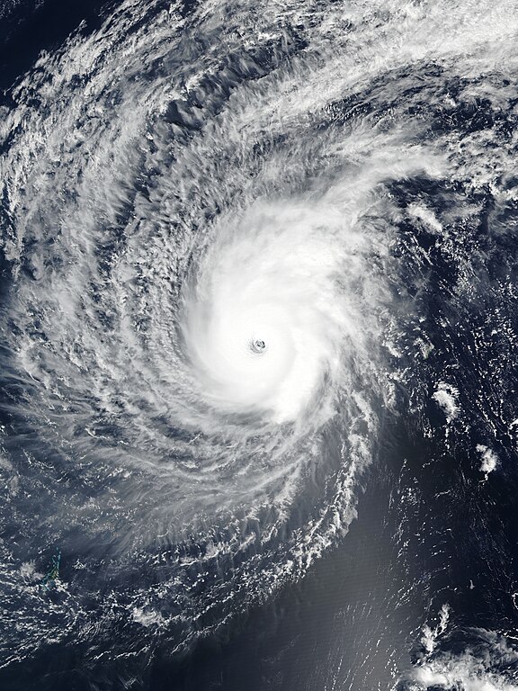
English: Typhoon Wutip near its secondary peak intensity west of Guam on February 25, 2019. |
| 日期 | |
| 来源 | EOSDIS Worldview |
| 作者 | VIIRS image captured by NOAA’s Suomi NPP satellite |
| 相机位置 | | 在以下服务上查看本图像和附近其他图像: OpenStreetMap |
|---|
许可协议
[编辑]
| 本文件完全由NASA创作,在美国属于公有领域。根据NASA的版权方针,NASA的材料除非另有声明否则不受版权保护。(参见Template:PD-USGov/zh、NASA版权方针页面或JPL图片使用方针。) | ||
 |
警告:
|
文件历史
点击某个日期/时间查看对应时刻的文件。
| 日期/时间 | 缩略图 | 大小 | 用户 | 备注 | |
|---|---|---|---|---|---|
| 当前 | 2019年2月25日 (一) 13:58 | | 4,200 × 5,600(6.1 MB) | Meow(留言 | 贡献) | Rebuilt and optimised the picture with the accurate resolution (375m), the proper ratio (also narrowed to 97.6%), and the correct location of the center. |
| 2019年2月25日 (一) 11:49 |  | 6,401 × 8,001(3.84 MB) | Nino Marakot(留言 | 贡献) | 250m resolution | |
| 2019年2月25日 (一) 07:29 |  | 1,324 × 1,839(350 KB) | ElenaCyclone(留言 | 贡献) | User created page with UploadWizard |
您不可以覆盖此文件。
文件用途
以下2个页面使用本文件:
全域文件用途
以下其他wiki使用此文件:
- en.wikipedia.org上的用途
- Portal:Tropical cyclones/Anniversaries/February
- Portal:Tropical cyclones/Anniversaries/February/23
- Wikipedia:WikiProject Tropical cyclones/Newsletter/Archive 35
- User talk:CooperScience
- User talk:KN2731/Archive 2
- Tropical cyclones in 2019
- User talk:Hurricane Noah/Archive 2
- User talk:Nova Crystallis/Archive 5
- User talk:Yellow Evan/Archive 28
- es.wikipedia.org上的用途
- ja.wikipedia.org上的用途
- ko.wikipedia.org上的用途
- pt.wikipedia.org上的用途
- th.wikipedia.org上的用途
- tl.wikipedia.org上的用途
- zh-yue.wikipedia.org上的用途
- zh.wikipedia.org上的用途