File:XII Magallanes-colored.svg
Jump to navigation
Jump to search

Size of this PNG preview of this SVG file: 400 × 600 pixels. Other resolutions: 160 × 240 pixels | 320 × 480 pixels | 512 × 768 pixels | 682 × 1,024 pixels | 1,365 × 2,048 pixels.
Original file (SVG file, nominally 400 × 600 pixels, file size: 128 KB)
Captions
Captions
Add a one-line explanation of what this file represents
Summary
[edit]
| Description |
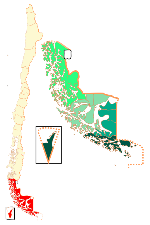
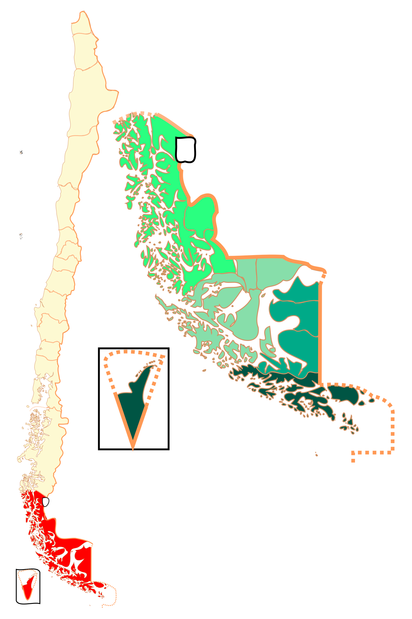
Español: Mapa de la XII Región de Magallanes y de la Antártica Chilena |
| Date | (UTC) |
| Source |
This file was derived from: XII Magallanes.svg:  |
| Author |
|
| This is a retouched picture, which means that it has been digitally altered from its original version. Modifications: + colors for provinces. The original can be viewed here: XII Magallanes.svg:
|
Licensing
[edit]
I, the copyright holder of this work, hereby publish it under the following license:
This file is licensed under the Creative Commons Attribution-Share Alike 2.5 Generic license.
- You are free:
- to share – to copy, distribute and transmit the work
- to remix – to adapt the work
- Under the following conditions:
- attribution – You must give appropriate credit, provide a link to the license, and indicate if changes were made. You may do so in any reasonable manner, but not in any way that suggests the licensor endorses you or your use.
- share alike – If you remix, transform, or build upon the material, you must distribute your contributions under the same or compatible license as the original.
Original upload log
[edit]
This image is a derivative work of the following images:
- File:XII_Magallanes.svg licensed with Cc-by-sa-2.5
- 2007-08-19T06:03:33Z B1mbo 800x950 (335600 Bytes) {{Information |Description= {{es|Mapa de la XII Región de Magallanes y de la Antártica Chilena}} |Source=own work |Date=19 de agosto de 2007 |Author=[[User:B1mbo|B1mbo]] |Permission={{self|cc-by-sa-2.5}} |other_versions= }}
Uploaded with derivativeFX
File history
Click on a date/time to view the file as it appeared at that time.
| Date/Time | Thumbnail | Dimensions | User | Comment | |
|---|---|---|---|---|---|
| current | 16:05, 10 February 2013 | | 400 × 600 (128 KB) | Keysanger (talk | contribs) | Size reduced |
| 16:03, 10 February 2013 |  | 400 × 600 (1.25 MB) | Keysanger (talk | contribs) | location in Chile added | |
| 15:35, 10 February 2013 |  | 800 × 950 (271 KB) | Keysanger (talk | contribs) | == {{int:filedesc}} == {{Information |Description={{es|Mapa de la XII Región de Magallanes y de la Antártica Chilena}} |Source={{Derived from|XII_Magallanes.svg|display=50}} |Date=2013-02-10 15:34 (UTC) |Author=*File:XII_Magallanes.svg: [[User:... |
You cannot overwrite this file.
File usage on Commons
There are no pages that use this file.
File usage on other wikis
The following other wikis use this file:
- Usage on el.wikipedia.org
- Usage on es.wikipedia.org
- Usage on fa.wikipedia.org
- Usage on ml.wikipedia.org
- Usage on pl.wikipedia.org
- Usage on ur.wikipedia.org