File:Yamal Peninsula, Terra MODIS 2021 (cropped to Baydaratskaya Bay).jpg
Jump to navigation
Jump to search
No higher resolution available.
Yamal_Peninsula,_Terra_MODIS_2021_(cropped_to_Baydaratskaya_Bay).jpg (600 × 600 pixels, file size: 287 KB, MIME type: image/jpeg)
Captions
Captions
Add a one-line explanation of what this file represents
Summary
[edit]| Description |
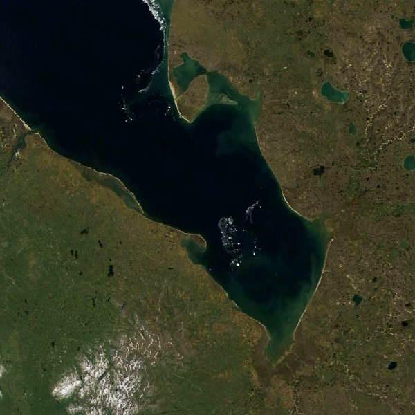
English: The Yamal Peninsula is shown in a natural-color image acquired by the Moderate Resolution Imaging Spectroradiometer (MODIS) on NASA’s Terra satellite on July 8, 2021. |
| Date | |
| Source | https://earthobservatory.nasa.gov/images/149246/reindeer-as-ecosystem-engineers |
| Author | Terra MODIS |
| Other versions |

.jpg&action=edit§ion=1)
Licensing
[edit].jpg&action=edit§ion=2)
| This file is in the public domain in the United States because it was solely created by NASA. NASA copyright policy states that "NASA material is not protected by copyright unless noted". (See Template:PD-USGov, NASA copyright policy page or JPL Image Use Policy.) | ||
 |
Warnings:
|
File history
Click on a date/time to view the file as it appeared at that time.
| Date/Time | Thumbnail | Dimensions | User | Comment | |
|---|---|---|---|---|---|
| current | 20:23, 5 February 2024 | | 600 × 600 (287 KB) | Argo Navis (talk | contribs) | File:Yamal Peninsula, Terra MODIS 2021.jpg cropped 67 % horizontally, 73 % vertically using CropTool with precise mode. |
| 20:21, 5 February 2024 |  | 900 × 900 (668 KB) | Argo Navis (talk | contribs) | File:Yamal Peninsula, Terra MODIS 2021.jpg cropped 50 % horizontally, 60 % vertically using CropTool with precise mode. |
You cannot overwrite this file.
File usage on Commons
The following page uses this file:
File usage on other wikis
The following other wikis use this file:
- Usage on hr.wikipedia.org
.jpg&oldid=849321420)