File:Yamato-Kogen-Tsukigase-Sat.png
Jump to navigation
Jump to search
Size of this preview: 765 × 600 pixels. Other resolutions: 306 × 240 pixels | 612 × 480 pixels | 980 × 768 pixels | 1,280 × 1,004 pixels | 1,408 × 1,104 pixels.
Original file (1,408 × 1,104 pixels, file size: 2.61 MB, MIME type: image/png)
Captions
Captions
Add a one-line explanation of what this file represents
Summary
[edit]| Description |
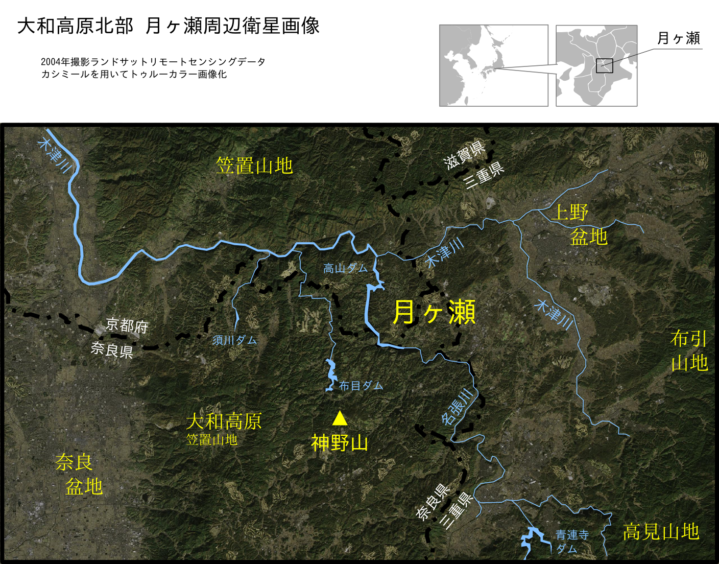
Satellite image of the area around Tsukigase on North Yamato Plateau in Japan 日本語: 大和高原北部月ヶ瀬周辺の衛星画像 |
|||
| Date | ||||
| Source |
Own work Satellite data is from NASA. |
|||
| Author | excl-zoo | |||
| Permission (Reusing this file) |
PD | |||
| Other versions |
|


Licensing
[edit]
| This file is in the public domain in the United States because it was solely created by NASA. NASA copyright policy states that "NASA material is not protected by copyright unless noted". (See Template:PD-USGov, NASA copyright policy page or JPL Image Use Policy.) | ||
 |
Warnings:
|
File history
Click on a date/time to view the file as it appeared at that time.
| Date/Time | Thumbnail | Dimensions | User | Comment | |
|---|---|---|---|---|---|
| current | 04:32, 30 September 2007 | | 1,408 × 1,104 (2.61 MB) | Excl-zoo (talk | contribs) | {{Information |Description= |Source= |Date= |Author= |Permission= |other_versions= }} |
| 15:04, 26 September 2007 |  | 1,408 × 1,256 (2.65 MB) | Excl-zoo (talk | contribs) | {{Information |Description=Satellite image of the area around Tsukigase on North Yamato Plateau in Japan<br />ja: <span lang="ja">大和高原北部月ヶ瀬周辺の衛星画像</span> |Source=Own work. Satellite data is from NASA. |Date=Sep, 2007 |Autho |
You cannot overwrite this file.
File usage on Commons
There are no pages that use this file.