File:Ynys Tysilio - Menai Staits near the Menai Suspension Bridge, Wales 04.jpg
Jump to navigation
Jump to search
Size of this preview: 800 × 317 pixels. Other resolutions: 320 × 127 pixels | 640 × 254 pixels | 1,024 × 406 pixels | 1,280 × 508 pixels | 2,560 × 1,015 pixels | 7,092 × 2,813 pixels.
Original file (7,092 × 2,813 pixels, file size: 7.4 MB, MIME type: image/jpeg)
Captions
Captions
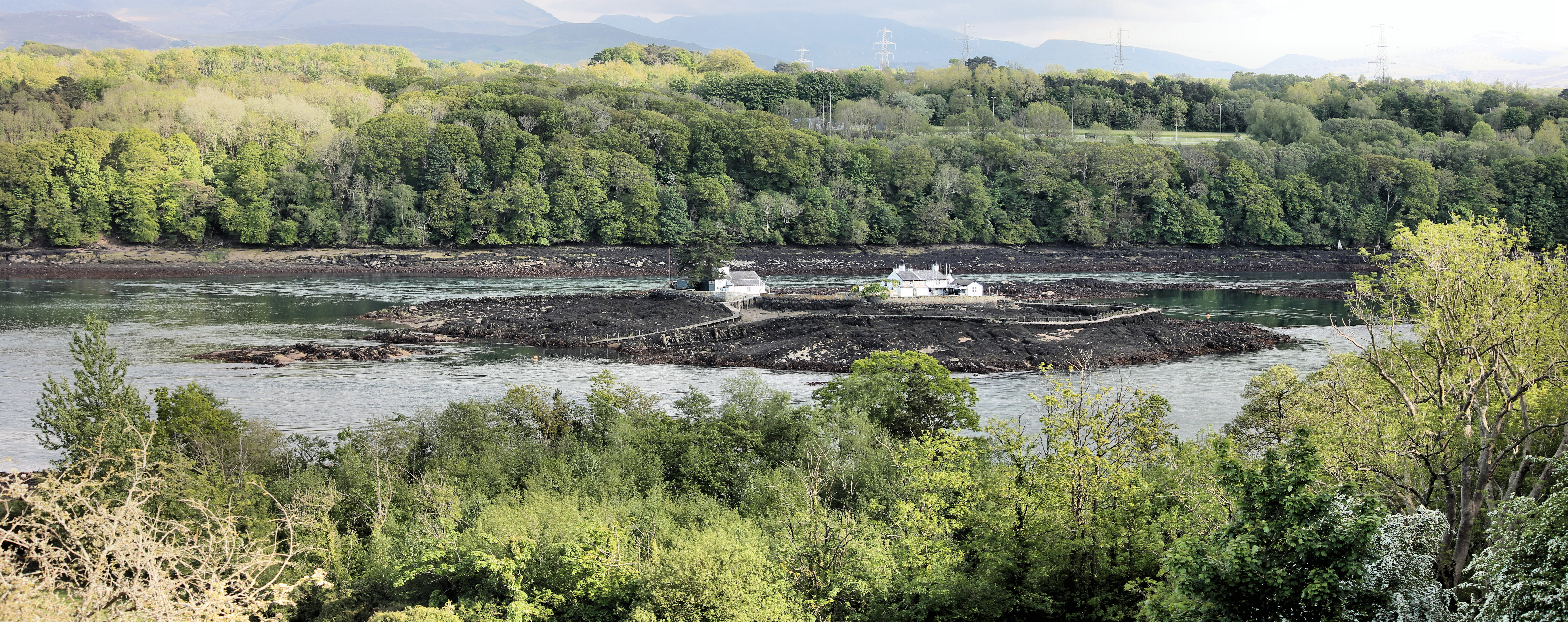
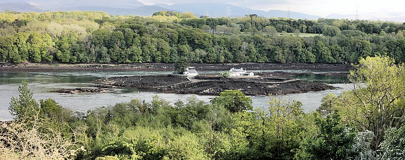
Menai Staits and the Menai Suspension Bridge, Wales
Summary[edit]
| Description |
Cymraeg: Y Fenai a Phont y Borth.
English: The strait is a special area of conservation with marine components. The waters are also a proposed Marine Nature Reserve. It has a number of designations of SSSIs along the strait including Glannau Porthaethwy, the ivy - oak - ash woodland on the southern shore (Coedydd Afon Menai) and much of the land on Anglesey at the eastern end of the strait is designated as an area of outstanding natural beauty. |
| Date | |
| Source | Own work |
| Author | Monsyn |
| Camera location | | View this and other nearby images on: OpenStreetMap |
|---|
Licensing[edit]
I, the copyright holder of this work, hereby publish it under the following license:
This file is licensed under the Creative Commons Attribution-Share Alike 4.0 International license.
- You are free:
- to share – to copy, distribute and transmit the work
- to remix – to adapt the work
- Under the following conditions:
- attribution – You must give appropriate credit, provide a link to the license, and indicate if changes were made. You may do so in any reasonable manner, but not in any way that suggests the licensor endorses you or your use.
- share alike – If you remix, transform, or build upon the material, you must distribute your contributions under the same or compatible license as the original.
This image was uploaded as part of Wiki Loves Earth 2021.
|
 |
File history
Click on a date/time to view the file as it appeared at that time.
| Date/Time | Thumbnail | Dimensions | User | Comment | |
|---|---|---|---|---|---|
| current | 11:22, 3 June 2021 | 7,092 × 2,813 (7.4 MB) | Monsyn (talk | contribs) | Uploaded own work with UploadWizard |
You cannot overwrite this file.
File usage on Commons
There are no pages that use this file.
File usage on other wikis
The following other wikis use this file:
- Usage on cy.wikipedia.org
- Usage on en.wikipedia.org