File:Zakrzówek (39343814235).jpg
Jump to navigation
Jump to search
Size of this preview: 600 × 600 pixels. Other resolutions: 240 × 240 pixels | 480 × 480 pixels | 768 × 768 pixels | 1,024 × 1,024 pixels | 2,048 × 2,048 pixels | 2,980 × 2,980 pixels.
Original file (2,980 × 2,980 pixels, file size: 2.74 MB, MIME type: image/jpeg)
Captions
Captions
Add a one-line explanation of what this file represents
Summary
[edit].jpg&action=edit§ion=1)
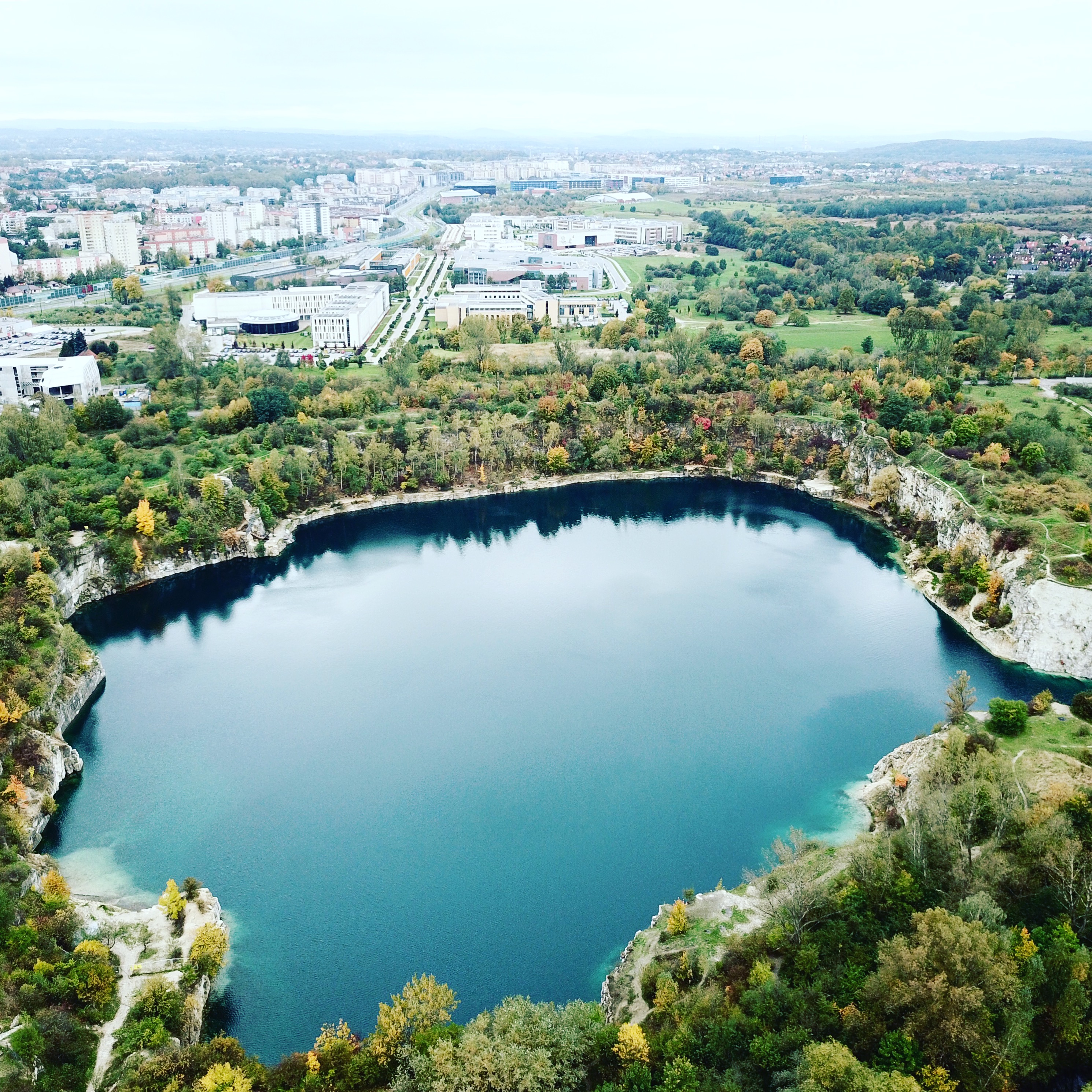
| Description | Zakrzówek |
| Date | |
| Source | Zakrzówek |
| Author | Paul Siarkowski from Poland |
| Camera location | | View this and other nearby images on: OpenStreetMap |
|---|
.jpg¶ms=050.025608_N_0019.904130_E_globe:Earth_type:camera_source:Flickr_&language=en)
Licensing
[edit].jpg&action=edit§ion=2)
This file is licensed under the Creative Commons Attribution 2.0 Generic license.
- You are free:
- to share – to copy, distribute and transmit the work
- to remix – to adapt the work
- Under the following conditions:
- attribution – You must give appropriate credit, provide a link to the license, and indicate if changes were made. You may do so in any reasonable manner, but not in any way that suggests the licensor endorses you or your use.
| This image was originally posted to Flickr by siarkowski at https://flickr.com/photos/65398334@N08/39343814235. It was reviewed on 4 May 2021 by FlickreviewR 2 and was confirmed to be licensed under the terms of the cc-by-2.0. |
| Annotations | This image is annotated: View the annotations at Commons |
.jpg)
File history
Click on a date/time to view the file as it appeared at that time.
| Date/Time | Thumbnail | Dimensions | User | Comment | |
|---|---|---|---|---|---|
| current | 10:09, 4 May 2021 | | 2,980 × 2,980 (2.74 MB) | English Roger (talk | contribs) | Transferred from Flickr via #flickr2commons |
You cannot overwrite this file.
File usage on Commons
The following page uses this file:
File usage on other wikis
The following other wikis use this file:
- Usage on www.wikidata.org
.jpg&oldid=883851620)