File:Zeichnung Ringwälle Gelbe Bürg (1877).jpg
Jump to navigation
Jump to search
Size of this preview: 695 × 599 pixels. Other resolutions: 278 × 240 pixels | 557 × 480 pixels | 891 × 768 pixels | 1,188 × 1,024 pixels | 2,375 × 2,048 pixels | 4,910 × 4,234 pixels.
Original file (4,910 × 4,234 pixels, file size: 3.49 MB, MIME type: image/jpeg)
Captions
Captions
Add a one-line explanation of what this file represents
Summary[edit]
.jpg&action=edit§ion=1)
| Description |
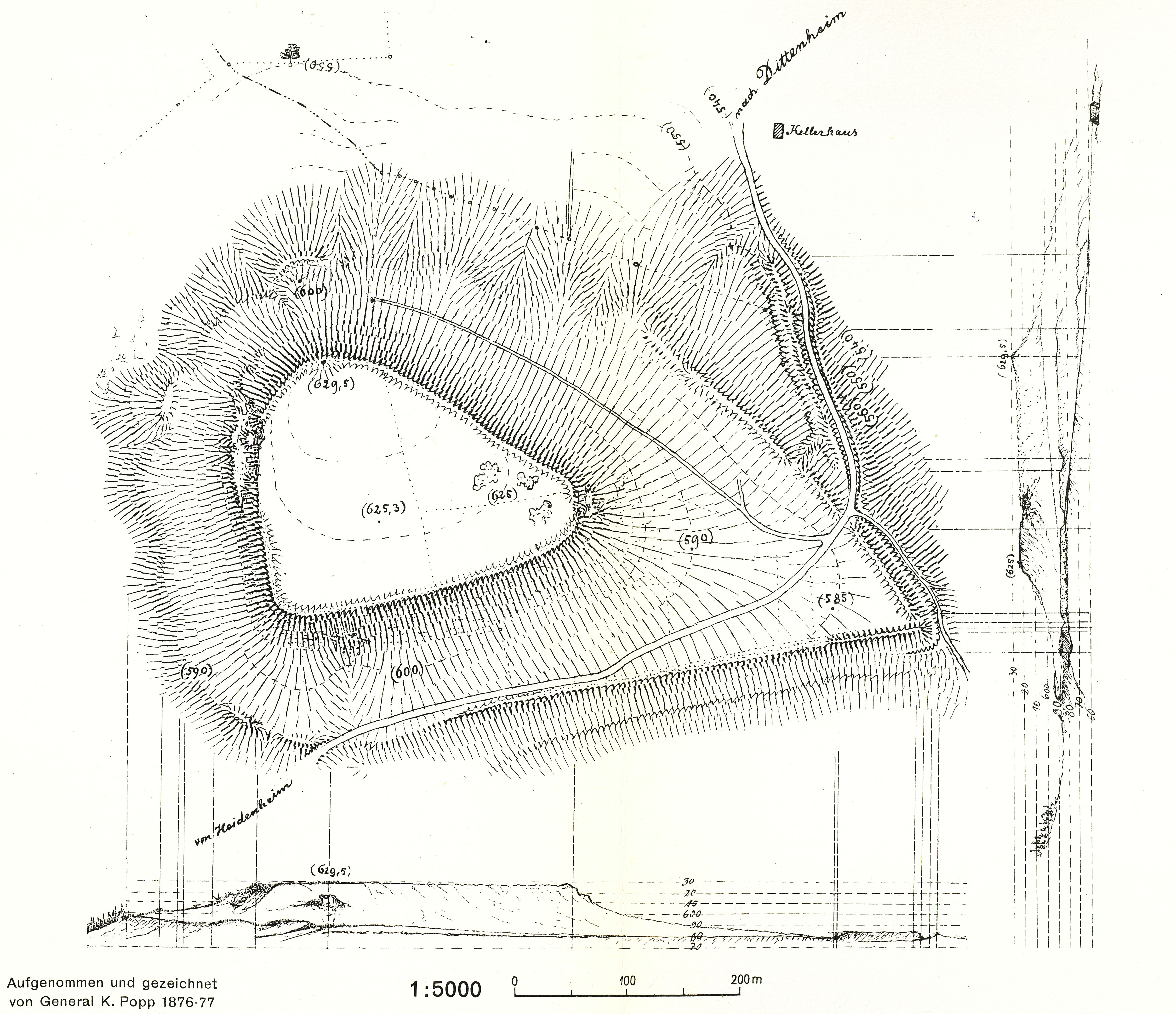
Deutsch: Zeichnung Ringwälle Gelbe Bürg (1877) |
| Date | |
| Source | Klaus Schwarz: Führer zu bayerischen Vorgeschichts-Exkursionen, Band 1: Limes - Karlsgraben - Gelbe Bürg - Hesselberg im Raum Ansbach - Weissenburg - Dinkelsbühl - Michael Lassleben Verlag - Kallmünz 1962, |
| Author | General K. Popp |
| Camera location | | View this and other nearby images on: OpenStreetMap |
|---|
.jpg¶ms=049.040200_N_0010.764500_E_globe:Earth_type:camera__&language=en)
Licensing[edit]
.jpg&action=edit§ion=2)
|
This work is in the public domain in its country of origin and other countries and areas where the copyright term is the author's life plus 70 years or fewer. This work is in the public domain in the United States because it was published (or registered with the U.S. Copyright Office) before January 1, 1929. | |
| This file has been identified as being free of known restrictions under copyright law, including all related and neighboring rights. | |
File history
Click on a date/time to view the file as it appeared at that time.
| Date/Time | Thumbnail | Dimensions | User | Comment | |
|---|---|---|---|---|---|
| current | 14:58, 10 October 2019 | | 4,910 × 4,234 (3.49 MB) | HaSe (talk | contribs) | User created page with UploadWizard |
You cannot overwrite this file.
File usage on Commons
The following page uses this file:
File usage on other wikis
The following other wikis use this file:
- Usage on de.wikipedia.org
.jpg&oldid=693577272)