File talk:Kurdish states 1835.png
跳转到导航
跳转到搜索
 | 这个file曾于2016年12月6日被提出存废讨论,讨论结果为保留。 如果您认为需要再度提出存废讨论,请先参阅该讨论页。 |
Bokan town[编辑]
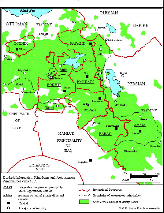
User Saman bokan72, please stop adding that town to this map. Yes, this town is relativelly large today, but map shows situation in 1835 and the question is was this town sizable in that time or not. Firstly, source used for this map does not show this town: http://www.institutkurde.org/images/cartes_and_maps/kurdish_independent_kingdom.jpg Secondly, this source says that town in the past was of "small size": http://www.iranicaonline.org/articles/bukan-kurd (quote: "Despite its small size"). However, if you want to have an locator map which will show position of this town in 1835, then you should upload that map under different filename. PANONIAN (留言) 09:41, 4 November 2014 (UTC)