File talk:Ladakh locator map.svg
 | This file was nominated for deletion on 31 December 2015 but was kept. If you are thinking about re-nominating it for deletion, please read that discussion first. |
Nice map, but "Xijang" appears to be a misspelling of "Xizang". Also, I don't really see why it needs a Chinese name listed. They speak Tibetan there.—Nat Krause 04:31, 12 May 2007 (UTC)
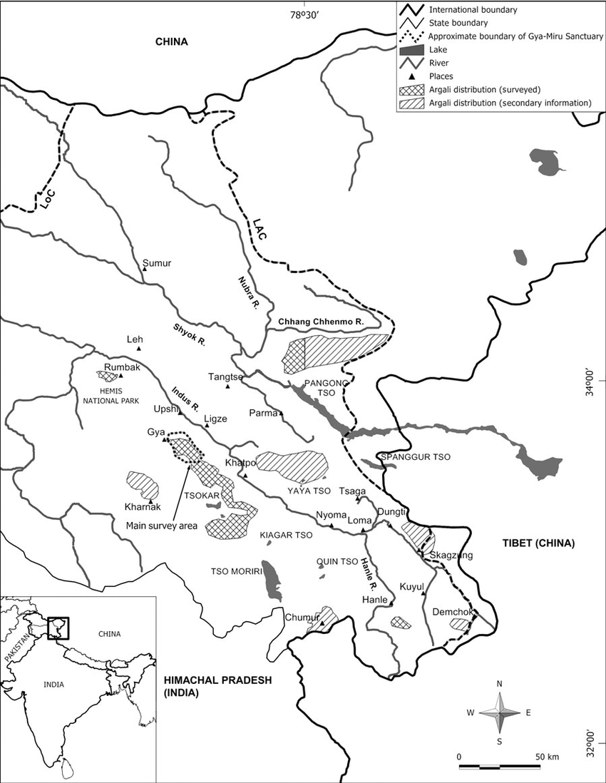
Demchok[edit]
Line of Actual Control near Demchok is wrong, 30% controled by India, other by China, map showed it. https://www.openstreetmap.org/#map=10/32.6648/79.3666 https://www.researchgate.net/profile/Tsewang_Namgail/publication/231786649/figure/fig1/AS:393405415870468@1470806568510/Current-distribution-of-the-Tibetan-argali-in-the-Ladakh-Trans-Himalaya-of-India-The.png — Preceding unsigned comment added by Бмхүн (talk • contribs) 08:26, 22 August 2019 (UTC)
names[edit]
Northern Area of Pakistan renamed to Gilgit-Baltistan after 2009,and India reorganise Jammu and Kashmir State into two union territories – Jammu and Kashmir and Ladakh. — Preceding unsigned comment added by Бмхүн (talk • contribs) 08:39, 22 August 2019 (UTC)