File talk:Portugal Império total.png
Talk retrieved from [1]
Banda Islands[edit]
Merbabu deleted the Banda Islands from the list, saying that "banda was never a portuguese possession. The portuguese were merely customers." I reverted him saying "Merbabu, that may be so, and I don't necessarily disagree with you, but could you provide some sources in the talk page and then del the link? Thanks!" And now I wait. The Ogre 12:59, 3 April 2007 (UTC)
- Hello there. Thanks for your interest. i replied on the article in question (and reverted sorry). By the way, i do love the map. Nice work indeed. But, there might be one dot that needs a change of colour. Pink i suggest, not read. he he. Some weeks ago i did a bit of work on Portuguese explorers, and their presence in Indonesia. I will pass the links on to you shortly. I have a question though, why was the Portuguese Empire article split? Ie, to the "Evolution of..." article. ciao for now. --Merbabu 13:32, 3 April 2007 (UTC)
- Firstly the fact is, wikipedia policy stipulates that the onus providing references is not on those that question unreferenced material, but those that want to keep it. see (Wikipedia:Verifiability#Burden_of_evidence). In theory, the whole article thus could be deleted But that is not my game, I just want to point out the nature of Portuguese involvement in the Bandas. My sources? Please read here, scroll down to the portuguese sub section. There is more that could go in there and more refs. I suggest the map will need changing to. And now I wait. ;) he he. kind regards --Merbabu 13:13, 3 April 2007 (UTC)
Hello Merbabu! Thanks for your reply. I was going to revert too to your version (I went and read the article on the Banda Islands and saw the references), but had to leave in a hurry. Thank you for you compliment on the map - I did loose some time with it! It is still a work in progress, though. I see that you are a member of WikiProject Indonesia, maybe you could help with more precise locations for the Portuguese presence in the area - actual possessions and for how long, areas of explorations, influence and commerce/trade. Exact locations are not easy to came by! As for the reason for the split into two articles, it was done by an user called The Red Hat of Pat Ferrick. You can check all the relevant discussions (and participate!) in Talk:Portuguese Empire#An exploration = Empire? and Talk:Portuguese Empire#Anachronous map of the Portuguese Empire (1415-1999). Please do! Cheers! The Ogre 14:58, 3 April 2007 (UTC)
- Corrected the map concerning the color (red to pink) for the Banda Islands. The Ogre 15:22, 3 April 2007 (UTC)
Indonesia[edit]
I do believe that the present version of the map does portray correctly the Portuguese presence in the whole of Indonesia - notice that in red are only marked the islands of Timor, Flores, Ambon, Ternate and Tidore. The pink areas are those of explorations, influence and commerce/trade. The Ogre 15:34, 3 April 2007 (UTC)
- Sounds correct. There was also Solor but it probably gets included as part of Flores. Merbabu 21:38, 3 April 2007 (UTC)
Anachronous map of the Portuguese Empire (1415-1999)[edit]
Hello everyone! I just did and added an anachronous map of the Portuguese Empire (1415-1999). Please feel free to comment. Thanks. The Ogre 17:50, 30 March 2007 (UTC)
- The map has been moved to Evolution of the Portuguese Empire, but I still think it should be present in this article, namely at the begining, what do you think. I'll wait for your reactions before adding it or not! The Ogre 15:19, 1 April 2007 (UTC)
- Sounds fair. But (continuing our discussion from Talk:Evolution of the Portuguese Empire) I think that the pink and blue areas are not necessary. Instead, showing the exploration routes of the "famous" explorers would be better, alongside the colonies where Portugal really had sovereignty beyond a short stop or an indefensible claim. The Red Hat of Pat Ferrick 15:30, 1 April 2007 (UTC)
Just re-added the map. The Ogre 15:35, 1 April 2007 (UTC)
- What you propose would provoke a loss of info. What I would really like is an interactive map showing the evolution dinamically - but that is out of my league. And some of the pink areas were areas of real influence (eg the Kingdom of the Kongo or Ethiopia), others were real areas of discovery/exploration (namely the African coastlines), and the blue sea areas do represent, even if they don't have the exact routes of specific famous explorations, maritime areas of exploration and influence (though not in all the period between 1415 and 1999, obviously!). The Ogre 15:40, 1 April 2007 (UTC)
- On the other hand, leaving that information in there without prominent disclaimers is misleading. The theory that Portuguese sailors discovered the eastern coast of Australia is just that, a theory. I don't think a question mark does this matter justice. Furthermore, showing the exploration routes covers both your blue and pink areas, because it shows (a) the navigational routes followed and (b) the coasts explored. The Red Hat of Pat Ferrick 15:48, 1 April 2007 (UTC)
I'll try to work on it, still have some objections, but will voice them latter (sorry, I'm in a hurry just now!). For now, can we leave at that? The Ogre 15:54, 1 April 2007 (UTC)
Thanks!! The Ogre 15:57, 1 April 2007 (UTC)
- Brazil was not in his borders of today part of Portuguese Empire. --J. Patrick Fischer 13:32, 6 April 2007 (UTC)
Incorrect Map - Canary Islands & Brazil?[edit]
Canarias Island never was included in the portugueses empire and part of the Brazilian territory was purchased after the independence, etc, etc. The map is only portuguese chauvinism. —the preceding unsigned comment is by 88.6.31.46 (talk • contribs)
- The map is not chauvinistic - my friend, assume good faith! And the map does not present the Canary Islands as part of the Portuguese Empire, they are in pink, that is to say, an area of "explorations, areas of influence and claims of sovereignty" - in this case a claim of sovereignty in the 15th century. The Canary Islands article states:
In 1402, the conquest of the islands began, with the expedition of Juan de Bethencourt and Gadifer de la Salle to the island of Lanzarote, Norman nobles who were vassals of Henry III of Castile. From there, they conquered Fuerteventura and Hierro. Béthencourt received the title King of the Canary Islands, but recognized King Henry III as his overlord. Béthencourt also established a base on the island of Gomera, but it would be many years before the island was truly conquered. The people of Gomera, as well as the Gran Canaria, Tenerife, and La Palma people, resisted the Spanish invaders for almost a century. Between 1448 and 1459, there was a crisis between Castile and Portugal over control of the islands, when Maciot de Bethencourt sold the lordship of Lanzarote to Portugal's Prince Henry the Navigator, an action that was not accepted by the natives or the Castilian residents of the island, who initiated a revolt and expelled the Portuguese. In 1479 Portugal recognised Castilian control of the Canary Islands in the Treaty of Alcaçovas.
- Regarding Brazil, the country's final frontiers would only be settled in the 20th century, but, grosso modo, it's modern configuration is largely the same as it was the day before the declaration of independence in 1822. If you can read Portuguese, check the article called Frontiers of Brazil in the Portuguese language Wikipedia (at Fronteiras do Brasil). Thank you. The Ogre 14:21, 6 April 2007 (UTC)
- Regarding Brazil, there are BIG differences. Large parts of Amazonia were not annected and 1874 was a war against Paraguay, where Brazil won a territory. --J. Patrick Fischer 17:15, 8 April 2007 (UTC)
Hello J. Patrick Fischer! I'll try to adress your objections some time soon (as well as other objections made by others), I promise. I just don't have the time right know. Thanks! The Ogre 18:44, 8 April 2007 (UTC)
- Hello again. I'll came back to the question of the Amazonian territory latter, but regarding the question with Paraguay, the Portuguese Wikipédia article on the Frontiers of Brazil states (my translation): "Regarding the frontiers with Paraguay the fixation of the frontier occured after the War of the Triple Alliance, when, in 1872, a peace treaty was signed with Paraguay in wich were specified the country's respective limites with Brazil, and that, according to historian Hélio Vianna (História da República e História diplomática do Brasil, São Paulo, Melhoramentos, 1957), respected the agreements of the colonial period and claimed for Brazil only the lands already occupied or explored by Portuguese and Brazilians." This reads to me as saying that the limits in 1822 were more a less the present ones indicated in the map. Wouldn't you say? See you soon! The Ogre 19:13, 8 April 2007 (UTC)
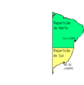
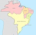
- However, going somewhat your way in this issue regarding the borders of Brazil and Paraguay (and also somewhat regarding the Amazonian issue) the present map of Brazil and that of 1822 do present some differences - see images bellow retrieved from States of Brazil. I'll try to correct the map of the Portuguese Empire accordingly. The Ogre 23:17, 8 April 2007 (UTC)
-

-
 1573
1573
Two states -
 1709
1709
São Paulo at its greatest -

-
 1823
1823
Imperial provinces -
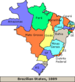 1889
1889
At the Start of Republic -
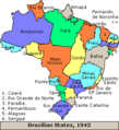 1943
1943
Border territories -
 1990
1990
Current


![[1]](https://en.wikipedia.org/wiki/Image_talk:Portugal_Imp%C3%A9rio_total.png)
)
)
)
)
Corrected the map regarding Brazil - basically some changes to the Amazonian region, the border with Paraguay and the inner part of modern Santa Catarina state. Those areas were fomerly in red and are now in pink, since they were areas claimed by the Portuguese. The Ogre 20:39, 9 April 2007 (UTC)
New Guinea[edit]
I think half of the north coast of New Guinea should be shown in pink, as with the Treaty of Saragoza it become in the Portuguese side.Câmara 19:06, 15 April 2007 (UTC)
- The question is not if some treaty said it belonged to Portugal or not. The question is if, in fact and not juridical fiction, the Portuguese did posses, explore or specifically claimed that area. In pink, however, and shall see to that, should be some islands and a small part of Formosa/Taywan. The Ogre 20:23, 15 April 2007 (UTC)
Anachronous[edit]
Adjective S: (adj) anachronic, anachronous, anachronistic (chronologically misplaced) "English public schools are anachronistic" source
. This can't be what you meant to write! FilipeS 22:24, 27 April 2007 (UTC)
- Well... it's what everyone writes in maps of the same time! I think it just means "not pertaining to a specific time period". The Ogre 15:42, 28 April 2007 (UTC)