Färbergasse (Ruhland)
Jump to navigation
Jump to search
| Object location | | View all coordinates using: OpenStreetMap |
|---|
vom Markt zur Gartenstraße
[edit]-
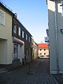
 in die Färbergasse Ostansicht
hinten links Gartenstraße südwärts -
 hinten die Gartenstraße
hinten rechts Gartenstraße nordwärts


von der Gartenstraße zum Markt
[edit]-
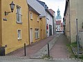
 Färbergasse 1, Ecke Gartenstraße
 -
 vor dem Markt
zum Marktplatz

