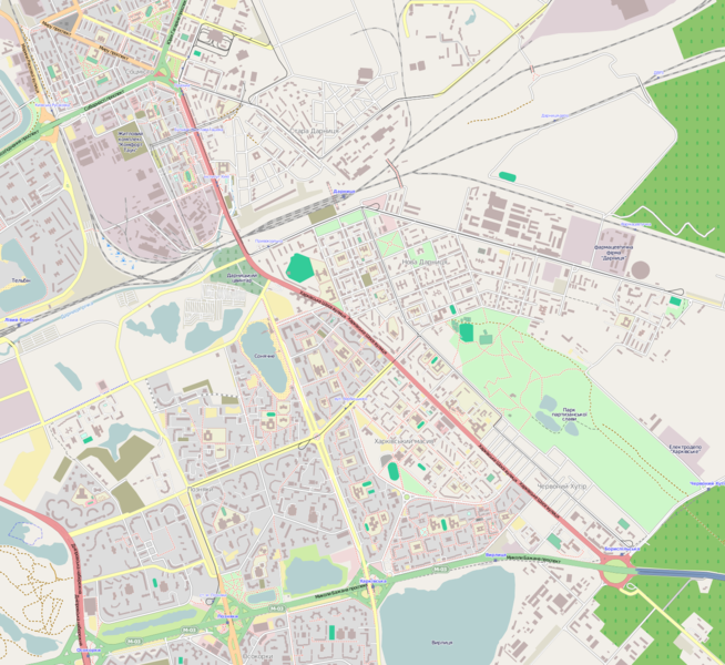
File:Харківське шосе карта.png
Jump to navigation
Jump to search

Size of this preview: 654 × 600 pixels. Other resolutions: 262 × 240 pixels | 524 × 480 pixels | 838 × 768 pixels | 1,117 × 1,024 pixels | 1,456 × 1,335 pixels.
Original file (1,456 × 1,335 pixels, file size: 1.22 MB, MIME type: image/png)
Captions
Captions
Add a one-line explanation of what this file represents
| Description |
This map of Харківське шосе у Києві was created from OpenStreetMap project data, collected by the community. This map may be incomplete, and may contain errors. Don't rely solely on it for navigation. |
|||||||||
| Date | (see file history) | |||||||||
| Source | openstreetmap.org | |||||||||
| Creator |
OpenStreetMap contributors |
|||||||||
| Permission (Reusing this file) |
OpenStreetMap data and maps are licensed under the Creative Commons Attribution-ShareAlike 2.0 license (CC-BY-SA 2.0). This file is licensed under the Creative Commons Attribution-Share Alike 2.0 Generic license.
|
|||||||||
| Geotemporal data | ||||||||||
| Bounding box |
|
|||||||||
| Georeferencing | If inappropriate please set warp_status = skip to hide. | |||||||||
File history
Click on a date/time to view the file as it appeared at that time.
| Date/Time | Thumbnail | Dimensions | User | Comment | |
|---|---|---|---|---|---|
| current | 23:23, 12 June 2011 | | 1,456 × 1,335 (1.22 MB) | NickK (talk | contribs) | {{OpenStreetMap |location=uk:Харківське шосе (Київ) у Києві |top=50.4482 |bottom=50.3947 |left=30.6054 |right=30.697 }} Category:Streets and squares of Kiev |
You cannot overwrite this file.
File usage on Commons
The following page uses this file:
File usage on other wikis
The following other wikis use this file:
- Usage on cs.wikipedia.org
- Usage on en.wikipedia.org
- Usage on ru.wikipedia.org
- Usage on uk.wikipedia.org
- Usage on www.wikidata.org