File:ארץ ישראל (FL33134524 2642746).jpg

לקובץ המקורי (11,219 × 15,944 פיקסלים, גודל הקובץ: 293.69 מ"ב, סוג MIME: image/jpeg)
כיתובים
כיתובים
תקציר
[עריכה]| ארץ ישראל
( |
||||||||||||||||||||||||
|---|---|---|---|---|---|---|---|---|---|---|---|---|---|---|---|---|---|---|---|---|---|---|---|---|
| כותרת |
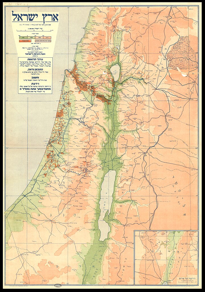
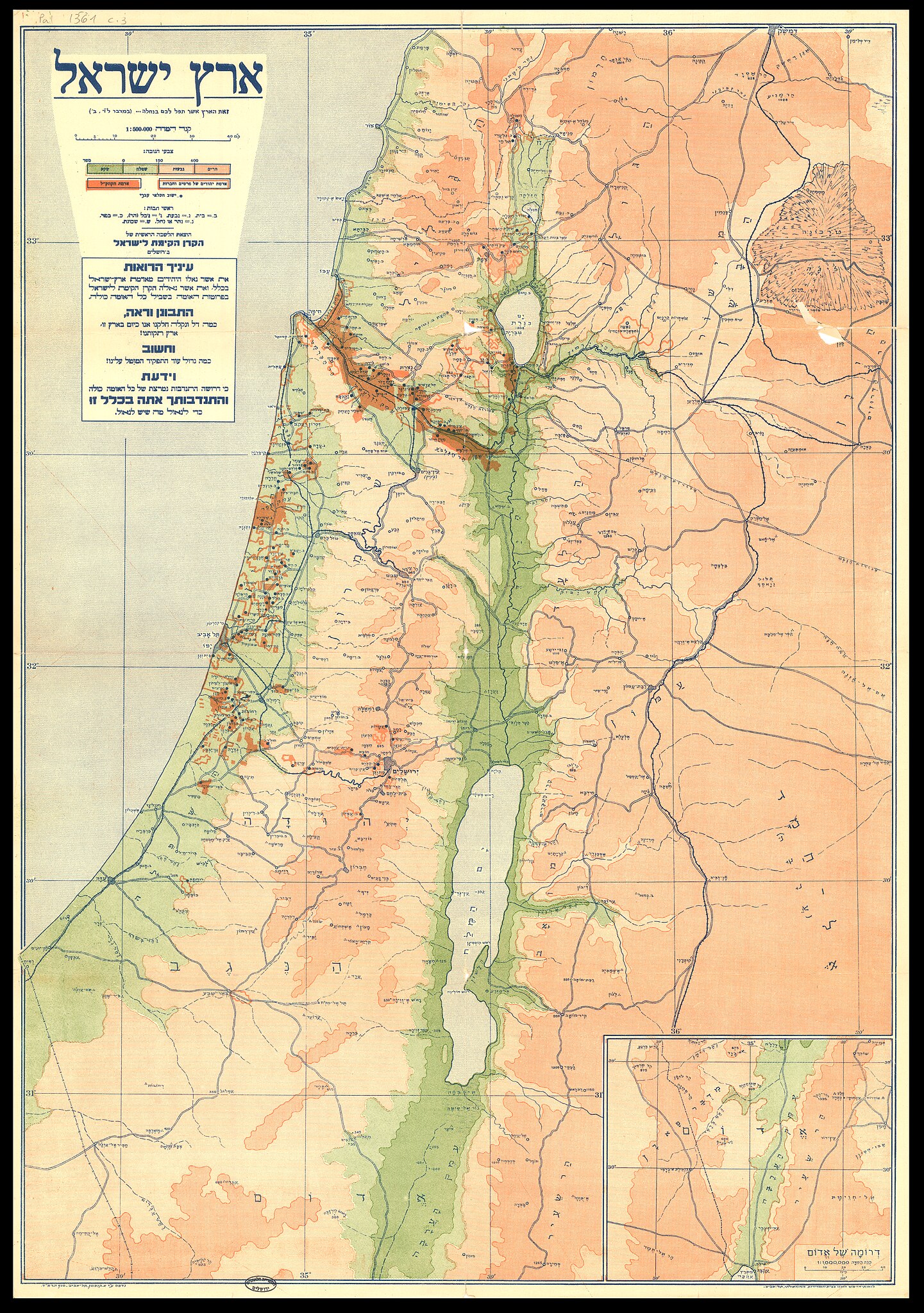
ארץ ישראל |
|||||||||||||||||||||||
| מפרסם |
קרן קימת לישראל - הלשכה הראשית |
|||||||||||||||||||||||
| תיאור |
ארץ ישראל. זאת הארץ אשר תפל לכם בנחלה.... |
|||||||||||||||||||||||
| שפה | עברית | |||||||||||||||||||||||
| תאריך הוצאה לאור | 1934 | |||||||||||||||||||||||
| טכניקה | 1 גליון : צבע ; | |||||||||||||||||||||||
| אוסף |
|
|||||||||||||||||||||||
| מיקום נוכחי |
|
|||||||||||||||||||||||
| מיקום הוצאה | ירושלים | |||||||||||||||||||||||
| חיפוש בקטלוג מרחב | ירושלים | |||||||||||||||||||||||
| הערות | כולל מפית: דרומה של אדום 1:1,000,000.; נדפס עי א. קופמן, תל אביב, סוף תרצד; ראה גם מהדורות באנגלית: pal 1361.1, pal 1361.2 ובגרמנית: pal 1361.3. | |||||||||||||||||||||||
| קנה מידה | 1:500,000 cm | |||||||||||||||||||||||
| IE PID | IE33134522 | |||||||||||||||||||||||
| רוזטה שם קובץ | FL33134524 | |||||||||||||||||||||||
| מזהה רשומה בספרייה הלאומית (P3959) | 990026427460205171 | |||||||||||||||||||||||
| חיפוש בקטלוג מרחב | עברית | |||||||||||||||||||||||
| חיפוש בקטלוג מרחב | Land tenureEretz IsraelMapsקרן קימת לישראל - הלשכה הראשית | |||||||||||||||||||||||
| מקור/צלם |
|
|||||||||||||||||||||||
| גרסאות אחרות | ||||||||||||||||||||||||
| Jpg / Tif version |
|
|||||||||||||||||||||||

.jpg)

.jpg&action=edit§ion=1)
רישיון
[עריכה].jpg&action=edit§ion=2)
The copyright of this image has expired in the European Union because it was published more than 70 years ago without a public claim of authorship (anonymous or pseudonymous), and no subsequent claim of authorship was made in the 70 years following its first publication.
|
 | |
To use this template, the image must meet both of the following two conditions:
Images that lack either of these two conditions should not use this template. Reasonable evidence must be presented that the author's name (e.g., the original photographer, portrait painter) was not published with a claim of copyright in conjunction with the image within 70 years of its original publication. Works which had not entered Public Domain in their country in 1996 that were uploaded before 1 March 2012 should be marked additionally with {{Not-PD-US-URAA}}. Note: In some countries anonymous works are copyrighted until 70 years after the death of the author if the author's identity became public in any way during the original term. In Germany this applies to certain works published before July 1, 1995; see Übergangsrecht.
|
היסטוריית הקובץ
ניתן ללחוץ על תאריך/שעה כדי לראות את הקובץ כפי שנראה באותו זמן.
| תאריך/שעה | תמונה ממוזערת | ממדים | משתמש | הערה | |
|---|---|---|---|---|---|
| נוכחית | 23:27, 11 באוגוסט 2023 | | 15,944 × 11,219 (293.69 מ"ב) | Geagea (שיחה | תרומות) | pattypan 22.03 |
אין באפשרותך לדרוס את הקובץ הזה.
שימוש בקובץ
הדף הבא משתמש בקובץ הזה:
.jpg&oldid=798792737)