Category:Public domain images no longer eligible for claim of authorship
Jump to navigation
Jump to search
English: The copyright of these images has expired in the European Union because they were published more than 70 years ago without a public claim of authorship (anonymous or pseudonymous), and no subsequent claim of authorship was made in the 70 years following first publication.
Wikimedia category | |||||
| Upload media | |||||
| Instance of | |||||
|---|---|---|---|---|---|
| |||||
Subcategories
This category has the following 2 subcategories, out of 2 total.
- PD-Art (PD-EU-no author disclosure) (1126 F)
Media in category "Public domain images no longer eligible for claim of authorship"
The following 200 files are in this category, out of 9,894 total.
(previous page) (next page)-
 ' 42 - ITALY - Vespa Caproni (1942) 02.JPG 606 × 382; 35 KB
-
 ' 43 - ITALY - As 42 metropolitana.jpg 550 × 305; 24 KB
-
 'Chateau de Luxembourg', TEKA0112604 (cropped)-101.jpg 1,557 × 1,570; 1.97 MB
-
 'Chateau de Luxembourg', TEKA0112604 (cropped)-102.jpg 1,588 × 1,594; 1.96 MB
-
 'Chateau de Luxembourg', TEKA0112604.jpg 3,543 × 1,778; 4.37 MB
-
 'Gare de Luxembourg', TEKA0112603 (cropped)-101.jpg 1,626 × 1,728; 2.03 MB
-
 'Gare de Luxembourg', TEKA0112603 (cropped)-102.jpg 1,598 × 1,761; 1.98 MB
-
 'Gare de Luxembourg', TEKA0112603.jpg 3,543 × 1,766; 4.5 MB
-
 'Le canal à Luxembourg', TEKA0112602 (cropped)-101.jpg 1,614 × 1,584; 1.87 MB
-
 'Le canal à Luxembourg', TEKA0112602 (cropped)-102.jpg 1,620 × 1,614; 1.9 MB
-
 'Le canal à Luxembourg', TEKA0112602.jpg 3,543 × 1,765; 4.4 MB
-
 'Place d'armes à Luxembourg', TEKA0112605 (cropped)-101.jpg 1,442 × 1,414; 1.68 MB
-
 'Place d'armes à Luxembourg', TEKA0112605 (cropped)-102.jpg 1,467 × 1,456; 1.65 MB
-
 'Place d'armes à Luxembourg', TEKA0112605.jpg 3,543 × 1,756; 4.36 MB
-
 't Zandt, Gemeenteatlas van Nederland.jpg 2,176 × 2,651; 1.7 MB
-
 'Vianden (Luxembourg)', TEKA0112601 (cropped)-101.jpg 1,620 × 1,734; 1.99 MB
-
 'Vianden (Luxembourg)', TEKA0112601 (cropped)-102.jpg 1,568 × 1,681; 1.89 MB
-
 'Vianden (Luxembourg)', TEKA0112601.jpg 3,543 × 1,771; 4.39 MB
-
 00000005.tif.original.png 1,876 × 2,755; 6.17 MB
-
 00000021.tif.original.png 2,089 × 1,255; 2.21 MB
-
 00000029.tif.original.png 2,092 × 1,253; 2.66 MB
-
 00000029u.tif.original.png 2,062 × 1,237; 2.71 MB
-
 00000031o.tif.original.png 2,085 × 1,253; 2.19 MB
-
 00000031u.tif.original.png 2,073 × 1,246; 3.61 MB
-
 00000033.tif.original.jpg 2,085 × 1,249; 435 KB
-
 00000035.tif.original.png 2,084 × 1,244; 2.58 MB
-
 001898 Das Wappen von Galizien.png 794 × 642; 905 KB
-

-
 004 - Basarab I.jpg 1,133 × 1,523; 395 KB
-
 0082.P.82.824.1140-1-.jpg 824 × 1,140; 103 KB
-
 01 MAG-02.jpg 538 × 205; 19 KB
-
 01- Hoechst MLB signet 1883.jpg 1,181 × 799; 222 KB
-
 010939 0668 (2) Gwiazdka Cieszyńska.jpg 2,091 × 2,977; 1.41 MB
-

-

-

-
 01769 Krillos, Europe in the XVIII century.png 685 × 448; 656 KB
-
 01769 Saint Stanislaw, Galicia, Europe in the XVIII.png 839 × 478; 705 KB
-
 01775 Europe in the XVIII. century, 1773-1775, Bielsko (Bielitz).png 1,034 × 662; 1.28 MB
-

-

-

-
 01804 Gródek, Westgalizien (1801–1804) , Josephinische Landesaufnahme (cropped).png 1,146 × 655; 1.13 MB
-
-
 01804 Kielce, West Gallicien (1801–1804) - First Military Survey.png 1,008 × 672; 1.31 MB
-

-
 01804 Lublin, Westgalizien (1801–1804) , Josephinische Landesaufnahme (cropped).png 1,208 × 683; 1.64 MB
-

-
 01804 Mokotow, Westgalizien (1801–1804) , Josephinische Landesaufnahme (cropped).png 1,066 × 666; 1.02 MB
-
-
-
-

-

-

-
 01804 Warschau, Westgalizien (1801–1804) , Josephinische Landesaufnahme.png 1,146 × 940; 2.15 MB
-
 01804 Westgalizien (1801–1804) , Josephinische Landesaufnahme (cropped).png 1,305 × 676; 1.77 MB
-
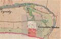
 0183 Ostra Górka, SGKP, t.4 S.306.jpg 736 × 721; 302 KB
-
 01841 Kreuzung Lisker-Gasse bei Spitals Gasse in Sanok.JPG 4,225 × 3,059; 1.25 MB
-
 01847 Mogiły na Pleśnisku, 1847, Stęczyński.png 846 × 602; 576 KB
-
 01849 Markt Narol in Galizien.jpg 1,119 × 806; 245 KB
-
 01849 Markt Radymno in Galizien.jpg 1,294 × 1,109; 565 KB
-
 01849 Stadt Dembica in Galizien Tarnower Kreis cropped.jpg 1,159 × 833; 397 KB
-
 01849 Stadt Kanczuga in Galizien.jpg 1,648 × 1,190; 617 KB
-
 01850 Stadt Brzostek in Galizien.jpg 1,826 × 1,322; 767 KB
-

-
-

-
-

-

-

-
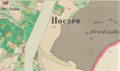 01852 2021-02-25 (20) Dorf Hoczew in Galizien Sanoker Kreis ( cropped ).png 949 × 564; 1.11 MB
-
 01852 2021-02-25 (21) Dorf Hoczew in Galizien Sanoker Kreis ( cropped ).png 880 × 567; 1.05 MB
-
-

-
 01852 2021-02-26 (11) Stadt Dubiecko in Galizien Sanoker Kreis.png 1,003 × 617; 1.76 MB
-

-
-
 01852 2021-02-26 (16) Stadt Brzozów in Galizien Sanoker Kreis.png 505 × 625; 821 KB
-
 01852 2021-02-26 (18) Dorf Plonna in Galizien Sanoker Kreis.png 984 × 618; 1.22 MB
-
 01852 2021-02-26 (19) Dorf Lalin in Galizien Sanoker Kreis (cropped).png 931 × 592; 1.18 MB
-
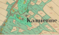
 01852 Dorf Czerteż sammt Enclave Zabłotce in Galizien Sanoker Kreis, 1852.png 1,053 × 617; 1.49 MB
-
 01852 Dorf Nadolany in Galizien Sanoker Kreis.jpg 918 × 557; 263 KB
-
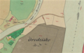
 01852 Dorf Olchowce in Galizien Sanoker Kreis (cropped).jpg 874 × 591; 264 KB
-
 01852 Dorf Zagórz in Galizien Sanoker Kreis (cropped).png 996 × 643; 1.34 MB
-
 01852 Markt Bukowsko in Galizien (cropped).jpg 864 × 602; 346 KB
-

-
 01852 Stadt Sanok in Galizien Sanoker Kreis (cropped).png 538 × 353; 418 KB
-
 01852 Stadt Sanok in Galizien Sanoker Kreis cropped.png 577 × 443; 653 KB
-
 01852 Stadt Sanok in Galizien Sanoker Kreis, Niwa ogrody (cropped).png 942 × 528; 1.12 MB
-

-
 01853 Katasterplan von Sanok, 1853, Galizien Cropped.jpg 558 × 385; 80 KB
-
 01853 Markt Lutowiska in Galizien Sanoker Kreis cropped.jpg 1,307 × 1,304; 488 KB
-
 01853 Nadolany (Nowotniec) - mapa katastralna (1853) cropped.jpg 783 × 500; 128 KB
-
 01854 2021-02-27 (11) Dorf Prusiek in Galizien Sanoker Kreis ( cropped ).png 873 × 594; 1.13 MB
-

-

-

-
-
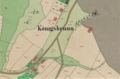
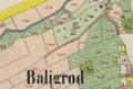 01854 2021-02-27 (9) Markt Baligrod in Galizien Sanoker Kreis (cropped).png 900 × 604; 1.01 MB
-
 01854 2021-03-12 (2) Stadt Rymanow in Galizien Sanoker Kreis (cropped).png 1,103 × 619; 1.66 MB
-
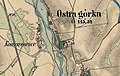 01864 Ostra górka, Komarowice.jpg 1,020 × 646; 365 KB
-

-
 01864 Solca village.jpg 1,128 × 686; 380 KB
-
 01869 Krylos, Europe in the XIX century.png 748 × 469; 671 KB
-
 01869 Swieti Stanislau, Galicia, Europe in the XIX century.png 730 × 471; 654 KB
-
 01872 Bodzia, Russia (1872) BXIa 39, Europe in the XIX century.png 774 × 474; 586 KB
-
 01877 (4) Fischerdorf Kamp bei Ostseebad Kolberg Deep.png 698 × 452; 656 KB
-
 01877 2021-06-17 (2) Fischerdorf Kamp bei Ostseebad Kolberg Deep.png 708 × 451; 640 KB
-
 01877 Berlinchen, Prussia, Europe in the XIX century.png 618 × 384; 459 KB
-
 01877 Denzin am Parsenta, Prussia, Europe in the XIX century.png 845 × 460; 815 KB
-
 01877 Fischerdorf Kamp bei Ostseebad Kolberg Deep.png 593 × 346; 483 KB
-
 01877 Kaldus, Prussia (1877).png 710 × 468; 724 KB
-
 01877 Lorenz-Berg am Chelmianka See, Kaldus, Prussia, 1877.png 721 × 461; 773 KB
-
 01877 Zehden, Prussia, Europe in the XIX century.png 749 × 472; 758 KB
-
 01883 (2) Map of Jewish cemetery in Bielsko-Biała.png 606 × 839; 839 KB
-
 01885 Katasterplan von Sanok, Sobieski-Strasse, Galizien.JPG 1,024 × 685; 641 KB
-
 01892 Siegel des Herzogs Bolesław Georg von Ruthenien (1335).png 760 × 728; 1.03 MB
-
 01892 Siegel des Herzogs Bolosław Georg von Ruthenien (1335).png 712 × 716; 1.08 MB
-

-

-

-
 01898 2021-02-14 (53) Altpolnischer Bauernpflug, Kronprinzenwerk.png 1,062 × 431; 878 KB
-

-
 01898 2021-02-14 (53) Brauerei in Okocim bei Bochnia.png 1,029 × 603; 1.1 MB
-
 01898 2021-02-14 (53) Kamieniec Castle, Kronprinzenwerk.png 826 × 551; 844 KB
-

-

-

-
 01898 Vorgeschichte Galiziens, Funde .. Skythisch, La Tène und römisch.png 1,116 × 580; 1.19 MB
-

-
 01900 Brunnen im Schloss Sanok in Sanok, Österreich-Ungarn.png 724 × 1,036; 1.2 MB
-
 01900 Sanoks der ältesten Gebäude.jpeg 800 × 593; 114 KB
-

-
 01904 0673 (2) Orientierungsplan von Bielitz-Biala, Ausgabe 1904 (cropped).jpg 2,719 × 1,922; 1.63 MB
-
-
-

-

-

-

-

-

-

-

-

-

-

-

-

-
-

-
-
-

-

-

-

-
-

-

-
-
 01911 Sanok, Bild, Postkarte.png 1,208 × 747; 1.18 MB
-
 01912 BIELITZ und BIALA, Batzdorf, Komorowice.jpg 1,495 × 1,042; 717 KB
-
 01912 BIELITZ und BIALA, Kamitz (cropped).jpg 1,141 × 782; 504 KB
-

-
 01913 Kataster-Flurkarte von Sanok, Dąbrówka, Galizien.JPG 1,020 × 676; 504 KB
-

-

-
 01914 Der Bahnhof Kowel in 1914.jpg 851 × 567; 175 KB
-
 01914 Der Bahnhof Sokal in 1914.jpg 800 × 503; 175 KB
-
-

-
 01914 K.u.K Kappenabzeichen der 2. Armee.jpg 651 × 384; 95 KB
-
 01914 K.u.K Kappenabzeichen der 3. Armee.jpg 483 × 677; 69 KB
-
 01914 K.u.K Kappenabzeichen der 4. Armee.JPG 500 × 769; 113 KB
-
 01914 Katasterplan von Sanok, Galizien.JPG 1,920 × 1,285; 2.24 MB
-
-

-
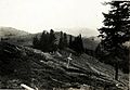 01915 Am Grat des Zwinin-Gebirgskamms..jpg 800 × 551; 83 KB
-
 01915 Auf der Strecke Jaroslau - Rzeszow.jpg 750 × 530; 149 KB
-
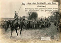 01915 Aus der Schlacht am San.jpg 750 × 537; 143 KB
-
 01915 Aus der Schlacht von Gorlice.jpg 750 × 538; 142 KB
-
 01915 Bad eines Feldspitals in Ostrozec am 28. 09. 1915..jpg 789 × 527; 47 KB
-
 01915 Barackenbau in Stryj - Küche.jpg 786 × 525; 75 KB
-
 01915 Barackenbau in Stryj. Heim für Pflegeschwestern..jpg 798 × 532; 64 KB
-
 01915 Bauer mit Sohn aus Sokal.jpg 611 × 800; 78 KB
-
 01915 Brandruinen des nordöstlichen Stadtteiles in Buczacz.jpg 800 × 579; 75 KB
-
 01915 Cerkiewna Str. um 1915.jpg 748 × 541; 91 KB
-
 01915 Czartoryski-Palast in Zurawno.jpg 800 × 562; 98 KB
-
 01915 Dekorierung am 27. 6. 1915 in Kuryłówka.jpg 1,651 × 1,101; 202 KB
-
 01915 Dekorierung bei Zabia Wola Żabia Wola (powiat grodziski).jpg 1,806 × 1,203; 270 KB
-
-

-

-
 01915 Deutscher Flugplatz in Stanislau.jpg 800 × 534; 61 KB
-
 01915 Die Schlacht bei Grodek am 19. Juni 1915.jpg 800 × 659; 113 KB
-
 01915 Ehrung beim Rainergrab in der Totenallee bei Poturzyn.jpg 1,560 × 1,039; 337 KB
-
 01915 Eisenbahnbrucke bei Grybów.jpg 1,768 × 1,178; 272 KB
_02.JPG)

-101.jpg)
-102.jpg)

-101.jpg)
-102.jpg)

-101.jpg)
-102.jpg)

-101.jpg)
-102.jpg)


%27,_TEKA0112601_(cropped)-101.jpg)
%27,_TEKA0112601_(cropped)-102.jpg)
%27,_TEKA0112601.jpg)


_Die_%C3%96sterreichisch-ungarische_Monarchie_in_Wort_und_Bild,_Galizien.png)


_Gwiazdka_Cieszy%C5%84ska.jpg)

_Talerf%C3%B6rmige_Medaille_des_Bischofs_Johann_V._Turzo_vom_Jahre_1508.png)
_%22Das_betr%C3%BCbte_Thorn%22,_oder_die_Geschichte_so_sich_zu_Thorn_dem_11._Julii_1724,_Jab%C5%82o%C5%84ski,_Daniel_Ernest_(1660%E2%80%931741).jpg)


.png)
_Sadole%C5%9B_am_Bug,_Westgalizien_(1801%E2%80%931804)_,_Josephinische_Landesaufnahme_(cropped).png)
_,_Josephinische_Landesaufnahme_(cropped).png)
_,_Josephinische_Landesaufnahme_(cropped).png)
_,_Josephinische_Landesaufnahme_(cropped).png)
_,_Josephinische_Landesaufnahme_(cropped).png)
_-_First_Military_Survey.png)
_,_Josephinische_Landesaufnahme_(cropped).png)
_,_Josephinische_Landesaufnahme_(cropped).png)
_,_Josephinische_Landesaufnahme_(cropped).png)
_,_Josephinische_Landesaufnahme_(cropped).png)
_,_Josephinische_Landesaufnahme_(cropped).png)
_,_Josephinische_Landesaufnahme_(cropped).png)
_,_Josephinische_Landesaufnahme_(cropped).png)
_,_Josephinische_Landesaufnahme_(cropped).png)
_,_Josephinische_Landesaufnahme.png)
_,_Josephinische_Landesaufnahme_(cropped).png)
_,_Josephinische_Landesaufnahme.png)
_,_Josephinische_Landesaufnahme_(cropped).png)


_Markt_Czudec_sammt_Ortschaft_Przedmie%C5%9Bcie_in_Galizien_(Jas%C5%82oer_Kreis)_,_cropped.png)
_Dorf_Besko_sammt_den_Ortschaften_Mymo%C5%84_und_Por%C4%99by_in_Galizien_Sanoker_Kreis_(cropped).png)
_Dorf_D%C4%85br%C3%B3wka_Polska_in_Galizien_Sanoker_Kreis_(cropped).png)
_Stadt_Sanok_in_Galizien_Sanoker_Kreis_(cropped).png)
_Stadt_Sanok_in_Galizien_Sanoker_Kreis_(cropped).png)
_Stadt_Sanok_in_Galizien_Sanoker_Kreis_(cropped).png)
_Dorf_Hoczew_in_Galizien_Sanoker_Kreis_(_cropped_).png)
_Dorf_Hoczew_in_Galizien_Sanoker_Kreis_(_cropped_).png)
_Dorf_Hoczew_in_Galizien_Sanoker_Kreis_(_cropped_).png)
_01852_Stadt_Sanok_in_Galizien_Sanoker_Kreis_(cropped).png)
_01852_Stadt_Sanok_in_Galizien_Sanoker_Kreis_(cropped).png)
_Stadt_Dubiecko_in_Galizien_Sanoker_Kreis.png)
_Dorf_Kamienne_in_Galizien_Sanoker_Kreis_(_cropped_).png)
_Dorf_Kamienne_in_Galizien_Sanoker_Kreis_(_cropped_).png)
_Stadt_Brzoz%C3%B3w_in_Galizien_Sanoker_Kreis.png)
_Dorf_Plonna_in_Galizien_Sanoker_Kreis.png)
_Dorf_Lalin_in_Galizien_Sanoker_Kreis_(cropped).png)


.jpg)
.png)
.jpg)
.png)
.png)

.png)
.png)


_-_mapa_katastralna_(1853)_cropped.jpg)
_Dorf_Prusiek_in_Galizien_Sanoker_Kreis_(_cropped_).png)
.png)
_Dorf_Prusiek_in_Galizien_Sanoker_Kreis_(_cropped_).png)
_Markt_Baligrod_in_Galizien_Sanoker_Kreis_(cropped).png)
_Markt_Baligrod_in_Galizien_Sanoker_Kreis_(cropped).png)
_Markt_Baligrod_in_Galizien_Sanoker_Kreis_(cropped).png)
_Stadt_Rymanow_in_Galizien_Sanoker_Kreis_(cropped).png)


_BXIa_39,_Europe_in_the_XIX_century.png)
_Fischerdorf_Kamp_bei_Ostseebad_Kolberg_Deep.png)
_Fischerdorf_Kamp_bei_Ostseebad_Kolberg_Deep.png)


.png)


_Map_of_Jewish_cemetery_in_Bielsko-Bia%C5%82a.png)

.png)
.png)
,_Hallstatter_und_La_T%C3%A8ne_-Zeit_.._Opferwagen,_Schwerter,_Gef%C3%A4%C3%9Fe,_Fibeln,_Armringe_u.s.w._aus_Bronze.png)
_Kronprinzenwerk,_Vorgeschichte_Galiziens,_Die_H%C3%B6hlen_von_Mnik%C3%B3w_und_Funde_der_Steinzeit.png)
_Nordic_crown-shaped_chokers,_Kronprinzenwerk,_Vorgeschichte_Galiziens,_Waffen,_Schmuck,_Ger%C3%A4te_aus_der_Bronzezeit_cropped.png)
_Altpolnischer_Oberhof_zu_Szymbark_bei_Gryb%C3%B3w,_XVI._Jahrhunder.png)
_Brauerei_in_Okocim_bei_Bochnia.png)
_Kamieniec_Castle,_Kronprinzenwerk.png)
_Petrolumgruben_von_Potok_bei_Krosno,_Westgalizien.png)


_Orientierungsplan_von_Bielitz-Biala,_Ausgabe_1904_(cropped).jpg)
_Portal_von_Schloss_Sanok_in_Sanok,_%C3%96sterreich-Ungarn_(cropped).png)
_Portal_von_Schloss_Sanok_in_Sanok,_%C3%96sterreich-Ungarn_(cropped).png)
_Ovation_im_Schloss_Sanok_in_Sanok,_%C3%96sterreich-Ungarn.png)
_Portal_von_Schloss_Sanok_in_Sanok,_%C3%96sterreich-Ungarn.png)


_Posada_sanocka_in_der_Gemeinde_Sanok,_%C3%96sterreich-Ungarn.png)
_Posada_sanocka_in_der_Gemeinde_Sanok,_%C3%96sterreich-Ungarn_(cropped).png)
_Kriminalgeb%C3%A4ude_in_Sanok,_Posada_sanocka_in_der_Gemeinde_Sanok,_%C3%96sterreich-Ungarn_(cropped).png)

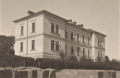
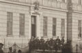
_Kaiser-Jubil%C3%A4ums-B%C3%BCrgerschule_in_Sanok,_%C3%96sterreich-Ungarn_(cropped).png)
_Kaiser-Jubil%C3%A4ums-B%C3%BCrgerschule_in_Sanok,_%C3%96sterreich-Ungarn_(cropped).png)
_Speisesaal_im_Schloss_Sanok_in_Sanok,_%C3%96sterreich-Ungarn_(cropped).png)
_Speisesaal_im_Schloss_Sanok_in_Sanok,_%C3%96sterreich-Ungarn.png)
_Post-_und_Telegraphen-Amt_in_Sanok,_%C3%96sterreich-Ungarn_(cropped).png)
_Empfangssaal_im_Schloss_Sanok_in_Sanok,_%C3%96sterreich-Ungarn.png)
_Post-_und_Telegraphen-Amt_in_Sanok,_%C3%96sterreich-Ungarn_(cropped).png)
_Post-_und_Telegraphen-Amt_in_Sanok,_%C3%96sterreich-Ungarn_(cropped).png)
_Empfangssaal_im_Schloss_Sanok_in_Sanok,_%C3%96sterreich-Ungarn_(cropped).png)
_Empfangssaal_im_Schloss_Sanok_in_Sanok,_%C3%96sterreich-Ungarn.png)

_Kaiser-Jubil%C3%A4ums-Internat_in_Sanok,_%C3%96sterreich-Ungarn.png)
_Kaiser-Jubil%C3%A4ums-Internat_in_Sanok,_%C3%96sterreich-Ungarn_(cropped).png)
_Gymnasium_in_Sanok,_%C3%96sterreich-Ungarn_(cropped).png)
_Gymnasium_in_Sanok,_%C3%96sterreich-Ungarn_(cropped).png)


.jpg)
.png)


_Post-_und_Telegraphen-Amt_in_Sanok,_%C3%96sterreich-Ungarn.png)


.jpg)

_steht_zusammen_mit_dem_polnischen_Legion%C3%A4r.jpg)


_Altpolnischer_Bauernpflug,_Kronprinzenwerk.png)