File:012 035 Ile Mingan Niapiscau.jpg
원본 파일 (2,698 × 4,149 픽셀, 파일 크기: 3.98 MB, MIME 종류: image/jpeg)
캡션
설명
파일 설명
[편집]
| 설명 |
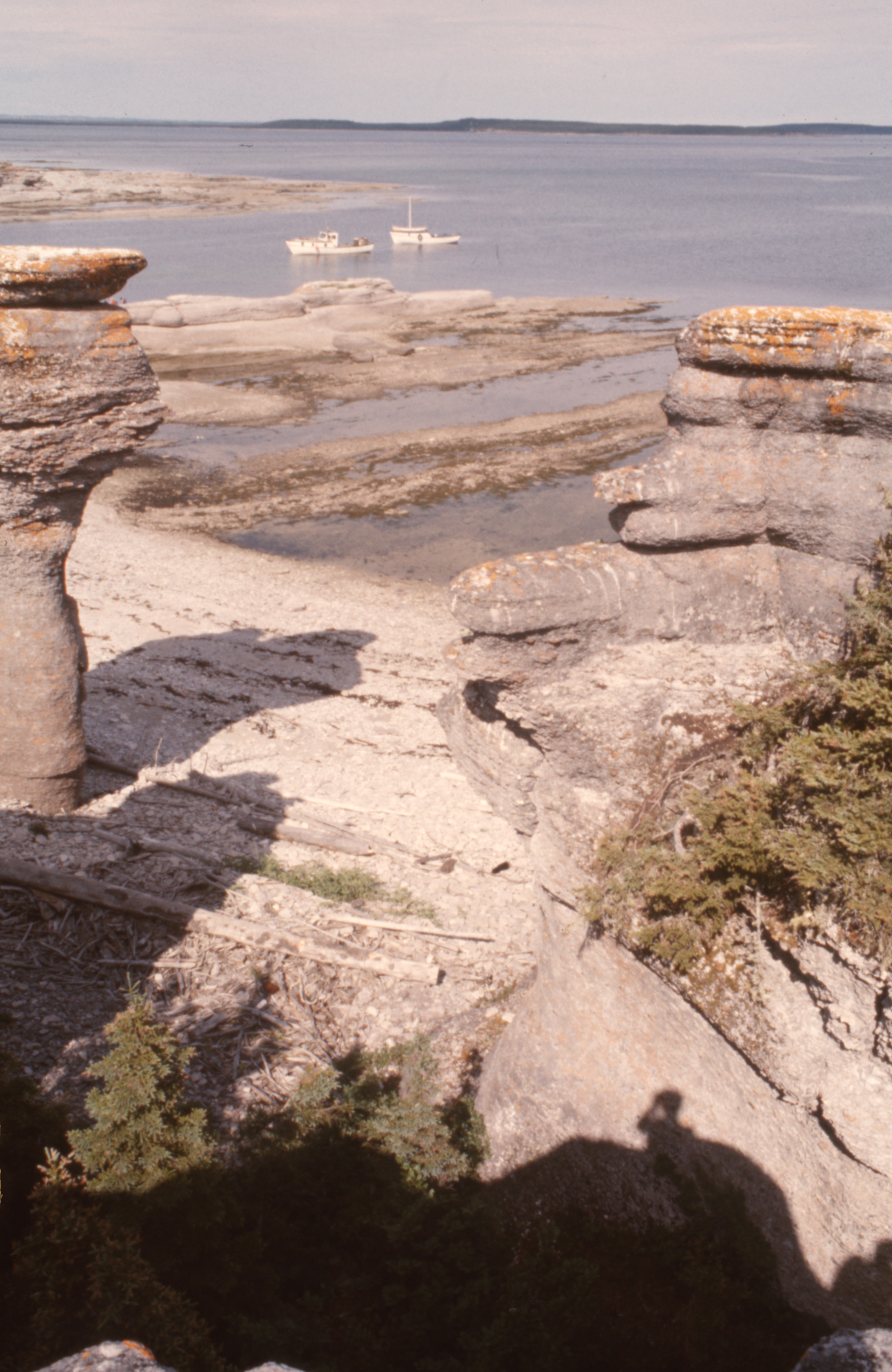
English: 50° 12' 10.0"N - -63° 28' 47.0"W, MRC Minganie, islands of the Mingan archipelago, limestone formations, boreal forest, Gulf of St. Lawrence, aboard the boat of Patrice Lebrun, guide and captain of the excursion, resident of Havre-Saint-Pierre and his family, Tuesday, July 20, 1976.
Français : 50° 12' 10.0"N - -63° 28' 47.0"O, MRC Minganie, îles de l'archipel de Mingan, formations calcaires, forêt boréale, golfe Saint-Laurent, à bord de la chaloupe de Patrice Lebrun, guide et capitaine de l’excursion, résident de Havre-Saint-Pierre et sa famille, le mardi 20 juillet 1976. |
| 날짜 | |
| 출처 | 자작 |
| 저자 | Nichole Ouellette |
| 카메라 위치 | | 이 지역의 다른 사진을 보기: OpenStreetMap |
|---|
- More infos/photos, same author: ouellette001.com/
- Québec en photos – Réserve de parc national de l'Archipel-de-Mingan juillet 1976
- Golfe du Saint-Laurent, À bord de la chaloupe, bateau de plaisance
- Îles - îlots - rochers - cayes – récifs
- Îles - îlots - rochers - cayes – récifs
- Quarry, la mer, des îles
Excursion to the heritage site of the Mingan Archipelago, in a rowboat by Patrice Lebrun with his wife Hélène Turbis, his daughter Marilyne, his son Yvan, Guy Lapointe, our sons Jean-Bruno and Jean-Frédéric and me Nichole Ouellette The section of route 138 from Sept-Îles to Havre-Saint-Pierre opened in the spring of 1976. In July, we were among the first tourists to arrive by road, family, car and tent-trailer, the welcome was exceptional, a mixture of curiosity, hospitality, benevolence combined with a touch of incredulous distrust. We were amazed and won over by our contributor to this article
라이선스
[편집]
- 이용자는 다음의 권리를 갖습니다:
- 공유 및 이용 – 저작물의 복제, 배포, 전시, 공연 및 공중송신
- 재창작 – 저작물의 개작, 수정, 2차적저작물 창작
- 다음과 같은 조건을 따라야 합니다:
- 저작자표시 – 적절한 저작자 표시를 제공하고, 라이센스에 대한 링크를 제공하고, 변경사항이 있는지를 표시해야 합니다. 당신은 합리적인 방식으로 표시할 수 있지만, 어떤 방식으로든 사용권 허가자가 당신 또는 당신의 사용을 지지하는 방식으로 표시할 수 없습니다.
파일 역사
날짜/시간 링크를 클릭하면 해당 시간의 파일을 볼 수 있습니다.
| 날짜/시간 | 섬네일 | 크기 | 사용자 | 설명 | |
|---|---|---|---|---|---|
| 현재 | 2024년 1월 13일 (토) 12:40 | | 2,698 × 4,149 (3.98 MB) | Nichole Ouellette (토론 | 기여) | Uploaded own work with UploadWizard |
이 파일을 덮어쓸 수 없습니다.
이 파일을 사용하는 문서
이 파일을 사용하는 문서가 없습니다.
이 파일을 사용하고 있는 모든 위키의 문서 목록
다음 위키에서 이 파일을 사용하고 있습니다:
- en.wikipedia.org에서 이 파일을 사용하고 있는 문서 목록
- fr.wikipedia.org에서 이 파일을 사용하고 있는 문서 목록
- ko.wikipedia.org에서 이 파일을 사용하고 있는 문서 목록