File:1850 Mitchell Map of Persia, Arabia and Afghanistan - Geographicus - Arabia-m-50.jpg
קפיצה לניווט
קפיצה לחיפוש
גודל התצוגה המקדימה הזאת: 730 × 599 פיקסלים. רזולוציות אחרות: 292 × 240 פיקסלים | 585 × 480 פיקסלים | 936 × 768 פיקסלים | 1,247 × 1,024 פיקסלים | 2,495 × 2,048 פיקסלים | 4,000 × 3,284 פיקסלים.
לקובץ המקורי (4,000 × 3,284 פיקסלים, גודל הקובץ: 3.01 מ"ב, סוג MIME: image/jpeg)
כיתובים
כיתובים
נא להוסיף משפט שמסביר מה הקובץ מייצג
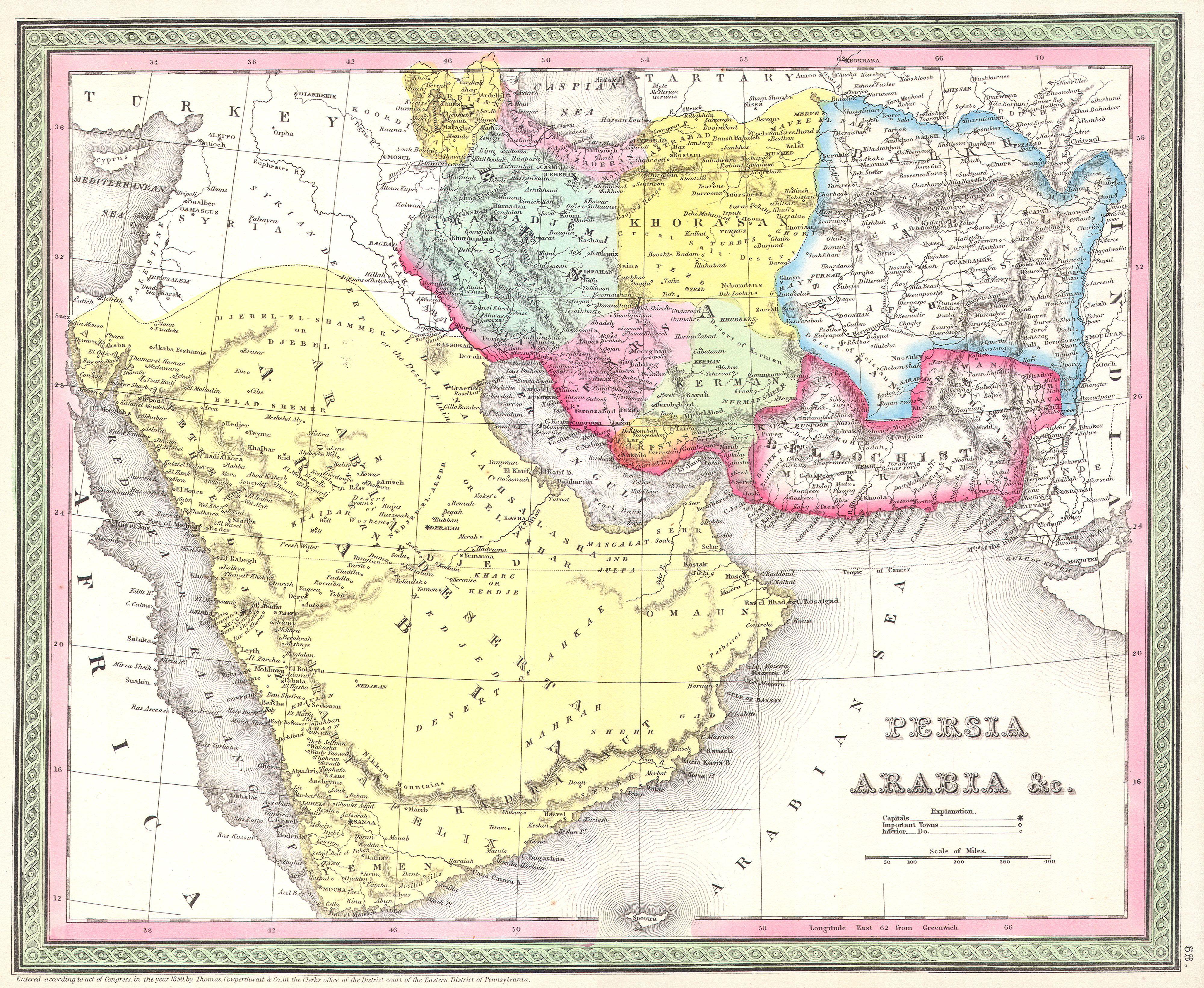
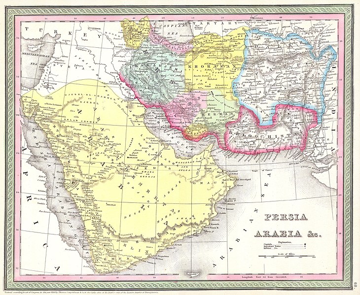
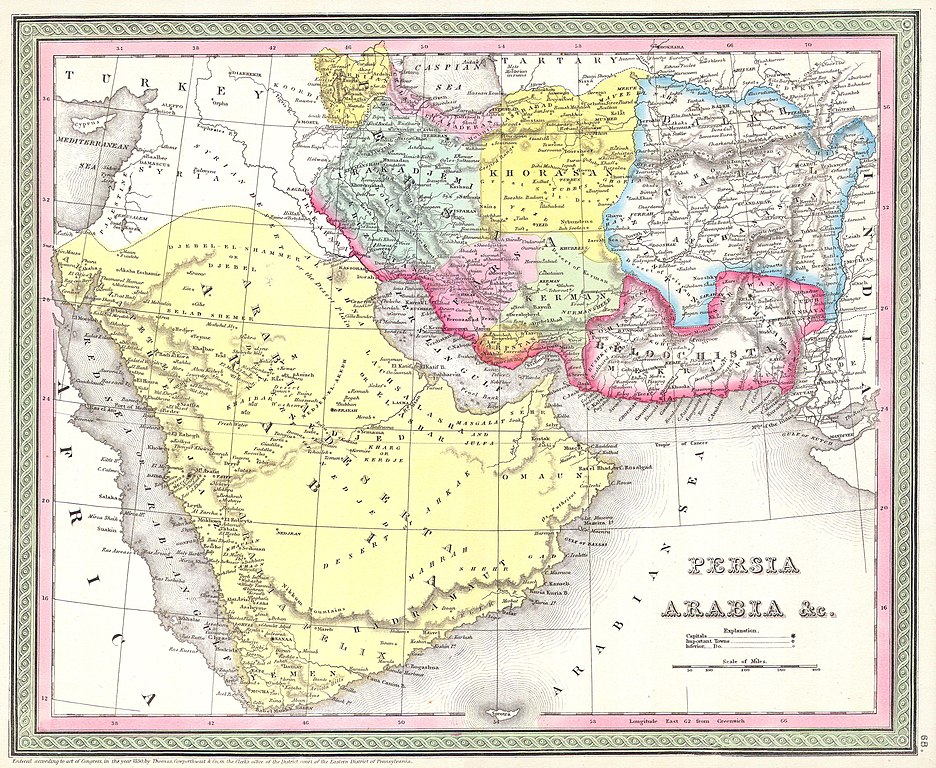
| Samuel Augustus Mitchell: Persia, Arabia, and Afghanistan.
( |
||||||||||||||||||||
|---|---|---|---|---|---|---|---|---|---|---|---|---|---|---|---|---|---|---|---|---|
| אומן |
|
|||||||||||||||||||
| כותרת |
Persia, Arabia, and Afghanistan. |
|||||||||||||||||||
| תיאור |
English: This beautiful hand colored map is a lithographic engraving of Persian and Arabia, dating to 1850, by the legendary American map publisher S.A. Mitchell, the elder. Includes what is today Saudi Arabia, Israel, Syria, Jordan, Iran, Iraq and Afghanistan. Many fascinating features including desert oases, caravan routes, and camps, as well as both political and geographical information. Dated and copyrighted: “1850 by Thomas Cowperthwait & co. in the Clerk’s office of the District Court of the Eastern District of Pennsylvania.”. |
|||||||||||||||||||
| תאריך יצירה | 1850 | |||||||||||||||||||
| ממדים | גובה: 12.5 in (31.7 ס"מ); רוחב: 15.5 in (39.3 ס"מ) | |||||||||||||||||||
| מספר גישה |
Geographicus link: Arabia-m-50 |
|||||||||||||||||||
| מקור/צלם |
|
|||||||||||||||||||
| אישורים והיתרים (שימוש חוזר בקובץ זה) |
|
|||||||||||||||||||
היסטוריית הקובץ
ניתן ללחוץ על תאריך/שעה כדי לראות את הקובץ כפי שנראה באותו זמן.
| תאריך/שעה | תמונה ממוזערת | ממדים | משתמש | הערה | |
|---|---|---|---|---|---|
| נוכחית | 21:22, 15 במרץ 2011 | | 3,284 × 4,000 (3.01 מ"ב) | BotMultichill (שיחה | תרומות) | {{subst:User:Multichill/Geographicus |link=http://www.geographicus.com/P/AntiqueMap/Arabia-m-50 |product_name=1850 Mitchell Map of Persia, Arabia and Afghanistan |map_title=Persia, Arabia, and Afghanistan. |description=This beautiful hand colored map is a |
אין באפשרותך לדרוס את הקובץ הזה.
שימוש בקובץ
הדפים הבאים משתמשים בקובץ הזה: