File:Abaco Islands 15ft 4p572 shaded.png
Jump to navigation
Jump to search
Size of this preview: 474 × 599 pixels. Other resolutions: 190 × 240 pixels | 380 × 480 pixels | 608 × 768 pixels | 810 × 1,024 pixels | 1,651 × 2,086 pixels.
Original file (1,651 × 2,086 pixels, file size: 610 KB, MIME type: image/png)
Captions
Captions
Add a one-line explanation of what this file represents
Summary[edit]
| Description |
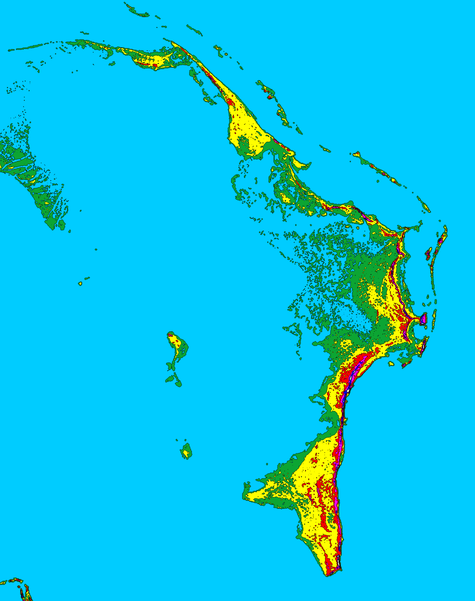
English: Topographic map of the Abaco Islands, Bahamas shaded at 15 foot (4.572 meter) contour intervals. MAP KEY |
| Date | |
| Source | Own work |
| Author | Lithium6ion |
Licensing[edit]
| I, the copyright holder of this work, release this work into the public domain. This applies worldwide. In some countries this may not be legally possible; if so: I grant anyone the right to use this work for any purpose, without any conditions, unless such conditions are required by law. |
File history
Click on a date/time to view the file as it appeared at that time.
| Date/Time | Thumbnail | Dimensions | User | Comment | |
|---|---|---|---|---|---|
| current | 06:49, 22 February 2012 | | 1,651 × 2,086 (610 KB) | Lithium6ion (talk | contribs) | {{Information |Description ={{en|1=Topographic map of the Abaco Islands, Bahamas shaded at 15 foot (4.572 meter) contour intervals.<br><br> MAP KEY<br> Light Blue: 0 ft (0.0 m)<br> Green: 0-15 ft (0.0-4.6 m)<br> Yellow: 15-30 ft (4 |
You cannot overwrite this file.
File usage on Commons
There are no pages that use this file.
File usage on other wikis
The following other wikis use this file:
- Usage on cs.wikipedia.org
- Usage on en.wikipedia.org
- Usage on et.wikipedia.org
- Usage on fr.wikipedia.org
- Usage on it.wikipedia.org
- Usage on ka.wikipedia.org
- Usage on pt.wikipedia.org
- Usage on ru.wikipedia.org
- Usage on uk.wikipedia.org