File:Aerial photograph of Helmand River at Gereshk in 2011.jpg
Jump to navigation
Jump to search
ഈ പ്രിവ്യൂവിന്റെ വലിപ്പം: 800 × 531 പിക്സലുകൾ. മറ്റ് റെസലൂഷനുകൾ: 320 × 212 പിക്സലുകൾ | 640 × 425 പിക്സലുകൾ | 1,024 × 680 പിക്സലുകൾ | 1,280 × 850 പിക്സലുകൾ | 2,784 × 1,848 പിക്സലുകൾ.
പൂർണ്ണ വലിപ്പം (2,784 × 1,848 പിക്സൽ, പ്രമാണത്തിന്റെ വലിപ്പം: 3.95 എം.ബി., മൈം തരം: image/jpeg)
തലവാചകം
തലവാചകങ്ങൾ
ഈ പ്രമാണം എന്തിനെ പ്രതിനിധീകരിക്കുന്നുവെന്ന ഒറ്റവരി വിശദീകരണം ചേർക്കുക
ചുരുക്കം[തിരുത്തുക]
| വിവരണം |
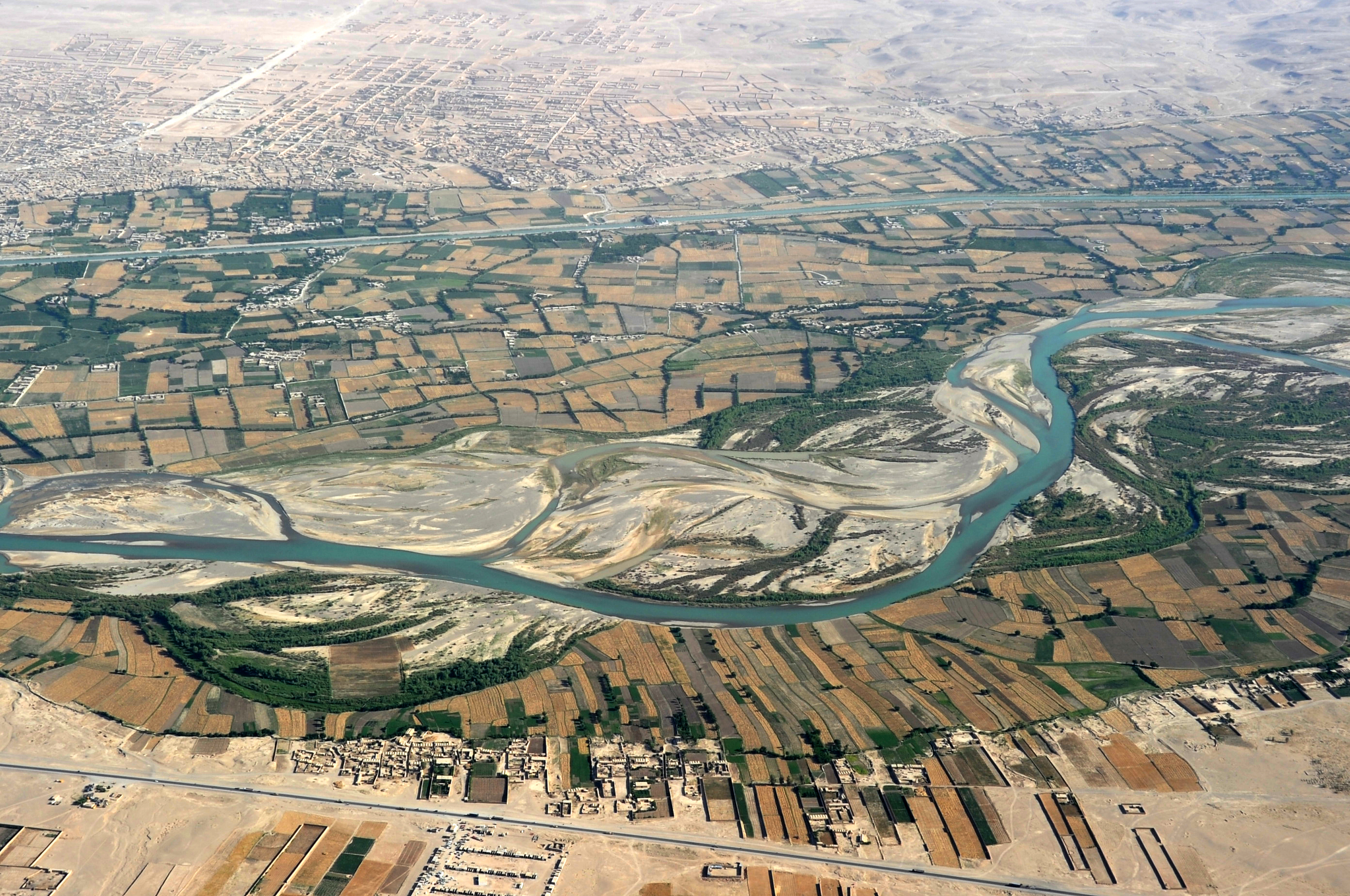
English: Traveling by helicopter enables us to see the beauty of Helmand River with the Boghra Irrigation Canal (Nahr-e Bughra) in the middle distance and the town of Gereshk (Grishk) in the far distance, Helmand Province. |
| തീയതി | |
| സ്രോതസ്സ് | https://www.flickr.com/photos/usace-tas/8713418682/in/photostream/ |
| സ്രഷ്ടാവ് | Karla Marshall |
| ഛായാഗ്രാഹിയുടെ സ്ഥാനം | | സ്ഥാനമനുസരിച്ച് ഇതും മറ്റു ചിത്രങ്ങളും: ഓപ്പൺസ്ട്രീറ്റ്മാപ്പ് |
|---|
അനുമതി[തിരുത്തുക]
This image or file is a work of a U.S. Army Corps of Engineers soldier or employee, taken or made as part of that person's official duties. As a work of the U.S. federal government, the image is in the public domain.
|
പ്രമാണ നാൾവഴി
ഏതെങ്കിലും തീയതി/സമയ കണ്ണിയിൽ ഞെക്കിയാൽ പ്രസ്തുതസമയത്ത് ഈ പ്രമാണം എങ്ങനെയായിരുന്നു എന്നു കാണാം.
| തീയതി/സമയം | ലഘുചിത്രം | അളവുകൾ | ഉപയോക്താവ് | അഭിപ്രായം | |
|---|---|---|---|---|---|
| നിലവിലുള്ളത് | 14:14, 21 മേയ് 2013 | | 2,784 × 1,848 (3.95 എം.ബി.) | Officer (സംവാദം | സംഭാവനകൾ) | {{Information |Description={{en|Traveling by helicopter enables us to see the beauty of Kandahar province from the air. (USACE Photo by Karla Marshall)}} |Source=http://www.flickr.com/photos/usace-tas/8713418682/in/photostream/ |Date=2011-05-30 |Author... |
ഈ പ്രമാണത്തിനു മുകളിൽ മറ്റൊരു പ്രമാണം ചേർക്കാൻ താങ്കൾക്ക് കഴിയില്ല.
പ്രമാണത്തിന്റെ ഉപയോഗം
താഴെ കാണുന്ന 5 താളുകളിൽ ഈ ചിത്രം ഉപയോഗിക്കുന്നു:
പ്രമാണത്തിന്റെ ആഗോള ഉപയോഗം
താഴെ കൊടുത്തിരിക്കുന്ന മറ്റ് വിക്കികൾ ഈ പ്രമാണം ഉപയോഗിക്കുന്നു:
- ar.wikipedia.org സംരംഭത്തിലെ ഉപയോഗം
- azb.wikipedia.org സംരംഭത്തിലെ ഉപയോഗം
- bn.wikipedia.org സംരംഭത്തിലെ ഉപയോഗം
- bs.wikipedia.org സംരംഭത്തിലെ ഉപയോഗം
- ca.wikipedia.org സംരംഭത്തിലെ ഉപയോഗം
- ceb.wikipedia.org സംരംഭത്തിലെ ഉപയോഗം
- cs.wikipedia.org സംരംഭത്തിലെ ഉപയോഗം
- cy.wikipedia.org സംരംഭത്തിലെ ഉപയോഗം
- da.wikipedia.org സംരംഭത്തിലെ ഉപയോഗം
- el.wikipedia.org സംരംഭത്തിലെ ഉപയോഗം
- en.wikipedia.org സംരംഭത്തിലെ ഉപയോഗം
- en.wikivoyage.org സംരംഭത്തിലെ ഉപയോഗം
- en.wiktionary.org സംരംഭത്തിലെ ഉപയോഗം
- eo.wikipedia.org സംരംഭത്തിലെ ഉപയോഗം
- es.wikipedia.org സംരംഭത്തിലെ ഉപയോഗം
- eu.wikipedia.org സംരംഭത്തിലെ ഉപയോഗം
- fa.wikipedia.org സംരംഭത്തിലെ ഉപയോഗം
- fi.wikipedia.org സംരംഭത്തിലെ ഉപയോഗം
- fr.wikipedia.org സംരംഭത്തിലെ ഉപയോഗം
- gu.wikipedia.org സംരംഭത്തിലെ ഉപയോഗം
- he.wikipedia.org സംരംഭത്തിലെ ഉപയോഗം
- hu.wikipedia.org സംരംഭത്തിലെ ഉപയോഗം
- hy.wikipedia.org സംരംഭത്തിലെ ഉപയോഗം
- id.wikipedia.org സംരംഭത്തിലെ ഉപയോഗം
- incubator.wikimedia.org സംരംഭത്തിലെ ഉപയോഗം
- it.wikipedia.org സംരംഭത്തിലെ ഉപയോഗം
ഈ പ്രമാണത്തിന്റെ കൂടുതൽ ആഗോള ഉപയോഗം കാണുക.