File:Allegheny Islands State Park, C.W. Bill Young Lock and Dam.jpg
Pereiti į navigaciją
Jump to search
Geresnė raiška negalima.
Allegheny_Islands_State_Park,_C.W._Bill_Young_Lock_and_Dam.jpg (720 × 480 taškų, rinkmenos dydis: 113 KiB, MIME tipas: image/jpeg)
Captions
Captions
Add a one-line explanation of what this file represents
|
This is an image of a place or building that is listed on the National Register of Historic Places in the United States of America. Its reference number is 397. |
| Aprašymas |
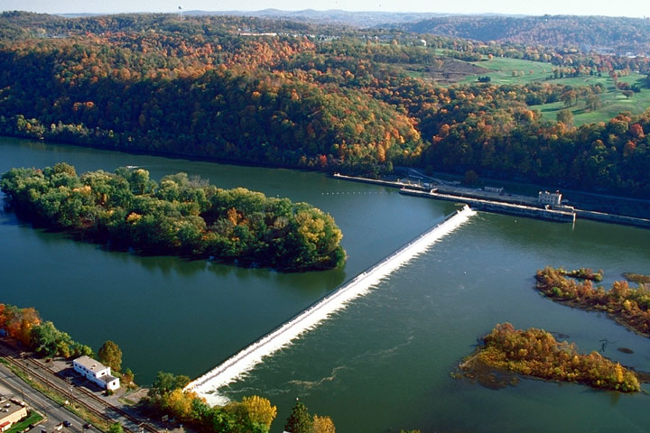
English: Part of Allegheny Islands State Park and the C.W. Bill Young Lock and Dam (Lock and Dam #3) on the Allegheny River, Allegheny County, Pennsylvania, United States. |
|||
| Data | Uploaded August 2007 | |||
| Šaltinis | U.S. Army Corps of Engineers website for the C.W. Bill Young Lock and Dam [1] | |||
| Autorius | U.S. Army Corps of Engineers | |||
| Leidimas (Šios rinkmenos panaudojimas kitur) |
|
|||
| Vieta | near Pittsburgh in Harmar Township, Allegheny County, Pennsylvania, USA |
| Objekto koordinatės | | Šis ir kiti paveikslėliai: OpenStreetMap |
|---|
Rinkmenos istorija
Paspauskite ant datos/laiko, kad pamatytumėte rinkmeną tokią, kokia ji buvo tuo metu.
| Data/Laikas | Miniatiūra | Matmenys | Naudotojas | Paaiškinimas | |
|---|---|---|---|---|---|
| dabartinis | 17:55, 29 rugpjūčio 2007 | | 720 × 480 (113 KiB) | Ruhrfisch (aptarimas | indėlis) | {{Information | Description = {{en|Part of Allegheny Islands State Park and the C.W. Bill Young Lock and Dam (Lock and Dam #3) on the Allegheny River, Allegheny County, Pennsylvania, United States.}} | Source |
Jūs negalite perrašyti šios rinkmenos.
Rinkmenos naudojimas
Šis puslapis naudoja šią rinkmeną:
Visuotinis rinkmenos naudojimas
Ši rinkmena naudojama šiose viki svetainėse:
- Naudojama ar.wikipedia.org
- Naudojama bg.wikipedia.org
- Naudojama ceb.wikipedia.org
- Naudojama en.wikipedia.org
- Naudojama fa.wikipedia.org
- Naudojama fr.wikipedia.org
- Naudojama he.wikipedia.org
- Naudojama lt.wikipedia.org
- Naudojama pl.wikipedia.org
- Naudojama tl.wikipedia.org
- Naudojama vi.wikipedia.org
- Naudojama www.wikidata.org
Metaduomenys
Kategorijos:
- Aerial photographs of Pennsylvania
- Harmar Township, Allegheny County, Pennsylvania
- Dams in Pennsylvania
- Islands of Pennsylvania
- River islands of the United States
- Allegheny Islands State Park
- Geomorphology of Pennsylvania
- Locks on the Allegheny River
- Dams of the Allegheny River
- United States Army Corps of Engineers, Pittsburgh District