File:Angling in troubled waters – a serio-comic map of Europe - Kungliga Biblioteket - 2818247-thumb.png

Original file (12,010 × 9,183 pixels, file size: 517.45 MB, MIME type: image/png)
Captions
Captions
Summary
[edit]| Warning | The original file is very high-resolution. It might not load properly or could cause your browser to freeze when opened at full size. |
|---|
| Title |
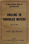
Angling in troubled waters – a serio-comic map of Europe |
||||||||||||||||||||||||||
| Description |
Svenska: Politisk karikatyrkarta över Europa. - Sverige och Norge framställs som två hundar, där den norska hunden biter den svenska i tassen. - Med beskrivning |
||||||||||||||||||||||||||
| Source |
|
||||||||||||||||||||||||||
| Creator |
|
||||||||||||||||||||||||||
| Permission (Reusing this file) |
Per the source the digitisations are under
|
||||||||||||||||||||||||||
| Geotemporal data | |||||||||||||||||||||||||||
| Date depicted | turn of the 19/20th century | ||||||||||||||||||||||||||
| Map location |
Svenska: Europa |
||||||||||||||||||||||||||
| Scale | 1:8,700,000 | ||||||||||||||||||||||||||
| Bounding box |
|
||||||||||||||||||||||||||
| Georeferencing | If inappropriate please set warp_status = skip to hide. | ||||||||||||||||||||||||||
| Bibliographic data | |||||||||||||||||||||||||||
| Map sheet | 1 karta | ||||||||||||||||||||||||||
| Language | English | ||||||||||||||||||||||||||
| Publisher |
G.W. Bacon & Co., London, United Kingdom |
||||||||||||||||||||||||||
| Archival data | |||||||||||||||||||||||||||
| Collection |
|
||||||||||||||||||||||||||
| Accession number |
2818247 |
||||||||||||||||||||||||||
| Dimensions | 49 x 71 cm vikt till 20 x 14 cm | ||||||||||||||||||||||||||
| Medium | färglitografi | ||||||||||||||||||||||||||
| Notes |
by Fred W. Rose
|
||||||||||||||||||||||||||
| Other versions |
|
||||||||||||||||||||||||||


.jpg)

|
The author died in 1915, so this work is in the public domain in its country of origin and other countries and areas where the copyright term is the author's life plus 100 years or fewer. This work is in the public domain in the United States because it was published (or registered with the U.S. Copyright Office) before January 1, 1929. | |
| This file has been identified as being free of known restrictions under copyright law, including all related and neighboring rights. | |
File history
Click on a date/time to view the file as it appeared at that time.
| Date/Time | Thumbnail | Dimensions | User | Comment | |
|---|---|---|---|---|---|
| current | 22:09, 20 January 2015 | | 12,010 × 9,183 (517.45 MB) | L PBot (talk | contribs) | {{subst:User:André_Costa_(WMSE)/KB-map |title = Angling in troubled waters – a serio-comic map of Europe |description = {{sv|Politisk karikatyrkarta över Europa. - Sverige och Norge framställs som två hundar, där den norska hunde... |
You cannot overwrite this file.
File usage on Commons
The following 13 pages use this file:
- User:Josve05a/Sweden/2015 January 11-20
- Commons:Kungliga biblioteket/Reports
- Commons:Kungliga biblioteket/Reports/improvement
- Commons:Kungliga biblioteket/Reports/largest
- Commons:Kungliga biblioteket/Reports/most edited
- Commons:Kungliga biblioteket/Reports/wikimedia usage
- Commons:Wikimedia Sverige/recent uploads/2015 January
- File:1899 satirical map of Europe - Angling in troubled waters - by Fred W. rose.tiff
- File:Angling in Troubled Waters A Serio-Comic Map of Europe.jpg
- File:Angling in troubled waters- a serio-comic map of Europe. (IA bp 14539).pdf
- File:Angling in troubled waters = der fischfang im truben = la peche en eau trouble = la pesca nelle acque turbes - a serio-comic map of Europe (14028135563).jpg
- File:Angling in troubled waters – a serio-comic map of Europe - Kungliga Biblioteket - 2818247.tif
- File:Fred W Rose Angling in troubled waters.jpg
File usage on other wikis
The following other wikis use this file:
- Usage on az.wikipedia.org
- Usage on en.wikipedia.org
- 19th-century satirical maps
- 1899 maps of Europe
- 1899 political cartoons
- Political maps of Europe
- English-language maps of Europe
- Multilingual maps
- Quadrilingual English-French-German-Italian signs
- Fred. W. Rose
- Figurative maps
- Personifications of nations
- Caricatures of Abdül Hamid II
- Alfonso XIII of Spain (caricatures)
- Caricatures of Carlos de Borbón
- Carlos I of Portugal in art
- Caricatures of Franz Joseph I of Austria
- Danish Royal Family in 1899
- Caricatures of George I of Greece
- John Bull
- Leopold II of Belgium in cartoons
- Caricatures of Nicholas II of Russia
- Caricatures of Umberto I of Italy
- Caricatures of Pierre Waldeck-Rousseau
- Caricatures of Wilhelm II of Germany
- Wilhelmina of the Netherlands in art