File:Antarctica relief location map.jpg
둘러보기로 이동
검색으로 이동

미리 보기 크기: 600 × 600 픽셀 다른 해상도: 240 × 240 픽셀 | 480 × 480 픽셀 | 768 × 768 픽셀 | 1,024 × 1,024 픽셀 | 1,493 × 1,493 픽셀
원본 파일 (1,493 × 1,493 픽셀, 파일 크기: 459 KB, MIME 종류: image/jpeg)
캡션
설명
이 파일이 나타내는 바에 대한 한 줄 설명을 추가합니다
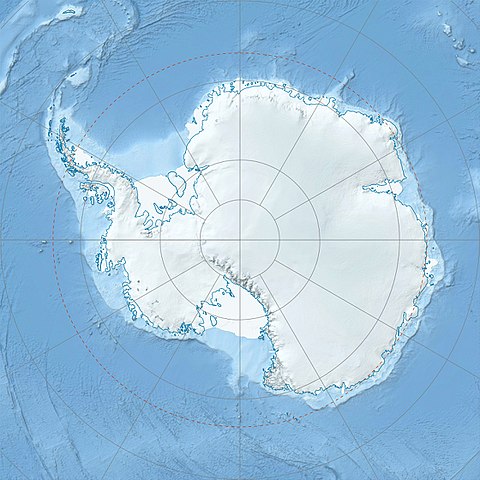
Physical Location map Antarctica, Azimuthal equidistant projection
파일 설명[편집]
| 설명 |
Deutsch: Physische Positionskarte Antarktis, Mittabstandstreue Azimutalprojektion
English: Physical Location map Antarctica, Azimuthal equidistant projection
|
| 날짜 | |
| 출처 |
자작
|
| 저자 | Alexrk2 |
| 다른 버전 |
|

Derivative works[편집]


|
This map has been made or improved in the German Kartenwerkstatt (Map Lab). You can propose maps to improve as well.
|
라이선스[편집]
나는 아래 작품의 저작권자로서, 이 저작물을 다음과 같은 라이선스로 배포합니다:
이 파일은 크리에이티브 커먼즈 저작자표시-동일조건변경허락 3.0 Unported 라이선스로 배포됩니다.
- 이용자는 다음의 권리를 갖습니다:
- 공유 및 이용 – 저작물의 복제, 배포, 전시, 공연 및 공중송신
- 재창작 – 저작물의 개작, 수정, 2차적저작물 창작
- 다음과 같은 조건을 따라야 합니다:
- 저작자표시 – 적절한 저작자 표시를 제공하고, 라이센스에 대한 링크를 제공하고, 변경사항이 있는지를 표시해야 합니다. 당신은 합리적인 방식으로 표시할 수 있지만, 어떤 방식으로든 사용권 허가자가 당신 또는 당신의 사용을 지지하는 방식으로 표시할 수 없습니다.
- 동일조건변경허락 – 만약 당신이 이 저작물을 리믹스 또는 변형하거나 이 저작물을 기반으로 제작하는 경우, 당신은 당신의 기여물을 원저작물과 동일하거나 호환 가능한 라이선스에 따라 배포하여야 합니다.
파일 역사
날짜/시간 링크를 클릭하면 해당 시간의 파일을 볼 수 있습니다.
| 날짜/시간 | 섬네일 | 크기 | 사용자 | 설명 | |
|---|---|---|---|---|---|
| 현재 | 2017년 7월 26일 (수) 07:52 | | 1,493 × 1,493 (459 KB) | Amga (토론 | 기여) | Reverted to version as of 16:03, 3 May 2011 (UTC). This is used in location maps, so don't rotate it! |
| 2017년 7월 26일 (수) 00:00 |  | 1,488 × 1,493 (458 KB) | SteinsplitterBot (토론 | 기여) | Bot: Image rotated by 90° | |
| 2011년 5월 3일 (화) 16:03 |  | 1,493 × 1,493 (459 KB) | Alexrk2 (토론 | 기여) | light blue hypso colors | |
| 2010년 2월 21일 (일) 21:24 |  | 1,500 × 1,500 (818 KB) | Alexrk2 (토론 | 기여) | == Summary == {{Information |Description= {{de|Physische Positionskarte Antarktis, Mittabstandstreue Azimutalprojektion}} {{en|Physical Location map Antarctica, Azimuthal equidistant projection}} * Longitude of central |
이 파일을 덮어쓸 수 없습니다.
이 파일을 사용하는 문서
다음 문서 47개가 이 파일을 사용하고 있습니다:
- User:4ing/Antarctica/2017-07
- File:90 Degrees East lake Wikipedia.png
- File:Adelie Land in Antarctica.svg
- File:Adelie Land in Antarctica (Relief).svg
- File:Antarctic-east-ru.jpg
- File:Antarctic-seas-ru.jpg
- File:Antarctica location map.svg
- File:Antarctica relief location map ua.jpg
- File:Antartica (Antartica Chilena Province) in Antarctica (Relief).svg
- File:Argentine Antarctica in Antarctica.svg
- File:Argentine Antarctica in Antarctica (Relief).svg
- File:Auckland Islands in Antarctica (extended).svg
- File:Australian Antarctic Territory in Antarctica.svg
- File:Australian Antarctic Territory in Antarctica (Relief).svg
- File:Bouvet Island in Antarctica (extended).svg
- File:Brazilian Antarctica in Antarctica.svg
- File:British Antarctic Territory in Antarctica.svg
- File:British Antarctic Territory in Antarctica (Relief).svg
- File:British Antarctic Territory in Antarctica (extended).svg
- File:Campbell Island in Antarctica (extended).svg
- File:Chilean Antarctica in Antarctica.svg
- File:Ellsworth-Mountains-location-map.png
- File:Falkland-islands-dependencies-map-rus.jpg
- File:Falkland Islands in Antarctica (extended).svg
- File:French Southern Territories in Antarctica (extended).svg
- File:Heard Island and McDonald Islands in Antarctica (extended).svg
- File:Heritage-Range-location-map.png
- File:Macquarie Island in Antarctica (extended).svg
- File:Marie Byrd Land in Antarctica.svg
- File:Marie Byrd Land in Antarctica (Relief).svg
- File:Peter I Island in Antarctica.svg
- File:Peter I Island in Antarctica (Relief).svg
- File:Prince Edward Islands in Antarctica (extended).svg
- File:Queen Maud Land in Antarctica (Relief).svg
- File:Queen Maud Land in Antarctica (no south borders).svg
- File:Ross Dependency in Antarctica.svg
- File:Ross Dependency in Antarctica (Relief).svg
- File:Ross Dependency in Antarctica (Relief white scheme).svg
- File:Sentinel-Range-location-map.png
- File:South Georgia and the South Sandwich Islands in Antarctica.svg
- File:South Georgia and the South Sandwich Islands in Antarctica (extended).svg
- File:South Georgia and the South Sandwich Islands in Antarctica (special marker).svg
- File talk:Ross Island (orthographic projection).svg
- Category:Antarctic
- Category:Antarctica
- Category:Category navigational templates for Antarctica
- Category:Culture of Antarctica
.svg)
_in_Antarctica_(Relief).svg)
.svg)
.svg)
.svg)
.svg)
.svg)
.svg)
.svg)
.svg)
.svg)
.svg)
.svg)
.svg)
.svg)
.svg)
.svg)
.svg)
.svg)
.svg)
.svg)
.svg)
.svg)
이 파일을 사용하고 있는 모든 위키의 문서 목록
다음 위키에서 이 파일을 사용하고 있습니다:
- af.wikipedia.org에서 이 파일을 사용하고 있는 문서 목록
- ar.wikipedia.org에서 이 파일을 사용하고 있는 문서 목록
- arz.wikipedia.org에서 이 파일을 사용하고 있는 문서 목록
- ast.wikipedia.org에서 이 파일을 사용하고 있는 문서 목록
- az.wikipedia.org에서 이 파일을 사용하고 있는 문서 목록
- Şablon:Yer xəritəsi Antarktida
- Antarktik yarımadası
- Şablon:Yer xəritəsi Antarktida (fiziki)
- Antarktik boğazı
- Jerlaş boğazı
- Bransfild boğazı
- Lemeir boğazı
- Vostok gölü
- Friksel gölü
- Mak-Medro boğazı
- Veddell dənizi
- Birlik dənizi
- Riser-Larsen dənizi
- Kosmonavtlar dənizi
- Mouson dənizi
- Dürvil dənizi
- Somov dənizi
- Kral VII Haakon dənizi
- Deyvis dənizi
- Lazarev dənizi
- Bellinshauzen dənizi
- Amundsen dənizi
- Ross dənizi
- Skotia dənizi
- Mouson yarımadası
- Hat Point yarımadası
- I Aleksandr Torpağı
- Berkner
- Ross adası
- Erebus vulkanı
- Saypl
- Terston
- Karney
- Ruzvelt adası (Antarktida)
- Sifre burnu
- Cənubi Şetland adaları
- Cənubi Orkney adaları
- Koroneyşen
이 파일의 더 많은 사용 내역을 봅니다.