File:Autoroute 19.png
Jump to navigation
Jump to search

Size of this preview: 625 × 599 pixels. Other resolutions: 250 × 240 pixels | 501 × 480 pixels | 706 × 677 pixels.
Original file (706 × 677 pixels, file size: 104 KB, MIME type: image/png)
Captions
Captions
Add a one-line explanation of what this file represents
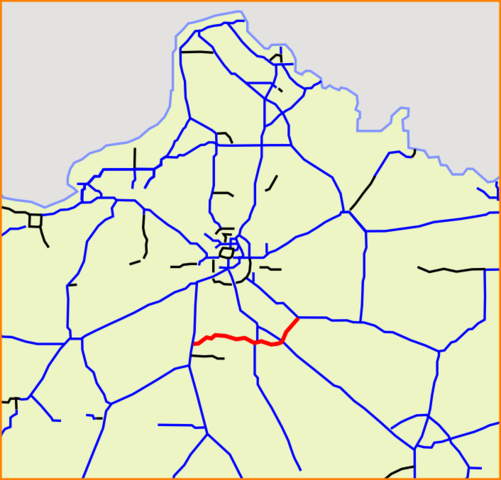
| Description | French A19 highway, as in 2009-06 with the opening of the new section between A6 and A10. |
| Source | based on Image:Carte Autoroute A1.svg |
| Author | from user:Madcap, modified by user:Sting |
| This work has been released into the public domain by its author, Madcap. This applies worldwide. In some countries this may not be legally possible; if so: |
File history
Click on a date/time to view the file as it appeared at that time.
| Date/Time | Thumbnail | Dimensions | User | Comment | |
|---|---|---|---|---|---|
| current | 16:13, 6 July 2009 | | 706 × 677 (104 KB) | Sting (talk | contribs) | Complementary section of the highway, as in 2009-06 after the opening of the part between A6 and A10 |
| 16:09, 11 November 2007 |  | 706 × 677 (99 KB) | Michiel1972 (talk | contribs) | {{Information |Description=A19 |Source=based on Image:Carte Autoroute A1.svg |Date= |Author= from user:Madcap |Permission= |other_versions= }} {{PD-user|Madcap}} Category:Detailed autoroute maps of France |
You cannot overwrite this file.
File usage on Commons
The following page uses this file:
File usage on other wikis
The following other wikis use this file:
- Usage on de.wikipedia.org
- Usage on fr.wikipedia.org
- Usage on it.wikipedia.org
- Usage on lmo.wikipedia.org
- Usage on nl.wikipedia.org
- Usage on uk.wikipedia.org
- Usage on www.wikidata.org
- Usage on zh.wikipedia.org