File:BSicon RP2sRP2.svg
둘러보기로 이동
검색으로 이동

SVG 파일의 PNG 형식의 미리보기 크기: 500 × 500 픽셀. 다른 해상도: 240 × 240 픽셀 | 480 × 480 픽셀 | 768 × 768 픽셀 | 1,024 × 1,024 픽셀 | 2,048 × 2,048 픽셀
원본 파일 (SVG 파일, 실제 크기 500 × 500 픽셀, 파일 크기: 638 바이트)
캡션
설명
이 파일이 나타내는 바에 대한 한 줄 설명을 추가합니다
파일 설명
[편집]
| 설명 |
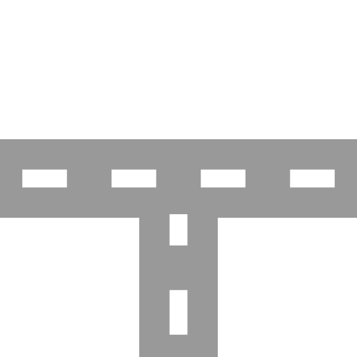
English: two-lane road with two-lane road joining from south Esperanto: Dualea ŝoseo kun kuniĝo de dualea ŝoseo el sudo Português: Estrada de duas faixas com junção de estrada de duas faixas vinda de sul |
| 날짜 | |
| 출처 | |
| 저자 |
|
| 다른 버전 | 이 파일은 다음으로 파생됨: BSicon RP2nRP2.svg |
| SVG 발전 |
라이선스
[편집]
나는 아래 작품의 저작권자로서, 이 저작물을 다음과 같은 라이선스로 배포합니다:
| 이 파일은 크리에이티브 커먼즈 CC0 1.0 보편적 퍼블릭 도메인 귀속에 따라 이용할 수 있습니다. | |
| 저작물에 본 권리증서를 첨부한 자는 법률에서 허용하는 범위 내에서 저작인접권 및 관련된 모든 권리들을 포함하여 저작권법에 따라 전 세계적으로 해당 저작물에 대해 자신이 갖는 일체의 권리를 포기함으로써 저작물을 퍼블릭 도메인으로 양도하였습니다. 저작권자의 허락을 구하지 않아도 이 저작물을 상업적인 목적을 포함하여 모든 목적으로 복제, 수정·변경, 배포, 공연·실연할 수 있습니다.
|
기존 올리기 기록
[편집]
This image is a derivative work of the following images:
- BSicon RP2wRP2.svg licensed with Cc-zero
- 2011-01-28T12:04:58Z Tuvalkin 500x500 (913 Bytes) {{Information |Description={{en|1= two-lane road with two-lane road joining from west}} {{eo|1= Dualea ŝoseo kun kuniĝo de kun dualea ŝoseo el okcidento}} {{pt|1= Estrada de duas com junção de estrada de duas faixas vind
Uploaded with derivativeFX
파일 역사
날짜/시간 링크를 클릭하면 해당 시간의 파일을 볼 수 있습니다.
| 날짜/시간 | 섬네일 | 크기 | 사용자 | 설명 | |
|---|---|---|---|---|---|
| 현재 | 2011년 10월 21일 (금) 06:04 | | 500 × 500 (638 바이트) | Tuvalkin (토론 | 기여) | 4 dashes |
| 2011년 1월 30일 (일) 02:05 |  | 500 × 500 (913 바이트) | Tuvalkin (토론 | 기여) | {{Information |Description={{en|1= two-lane road with two-lane road joining from south}} {{eo|1= Dualea ŝoseo kun kuniĝo de dualea ŝoseo el sudo}} {{pt|1= Estrada de duas faixas com junção de estrada de duas faixas vinda de sul}} |Source=*[[:File:BSi |
이 파일을 덮어쓸 수 없습니다.
이 파일을 사용하는 문서
다음 문서 9개가 이 파일을 사용하고 있습니다:
- BSicon/Catalogue/generic roads
- Talk:BSicon/Categorization/Archive 1
- User:Circeus/BSicon renaming/Generic
- User:JJMC89 bot/report/BSicons/changes/2017-04 (02)
- User:JJMC89 bot/report/BSicons/changes/2022-03
- User:JJMC89 bot/report/BSicons/changes/2022-09
- User:JJMC89 bot/report/BSicons/logs/upload/2011-01
- User:JJMC89 bot/report/BSicons/logs/upload/2011-10
- Category talk:Icons for motorway descriptions/generic/descriptions
이 파일을 사용하고 있는 모든 위키의 문서 목록
다음 위키에서 이 파일을 사용하고 있습니다:
- cs.wikipedia.org에서 이 파일을 사용하고 있는 문서 목록
- de.wikipedia.org에서 이 파일을 사용하고 있는 문서 목록
- el.wikipedia.org에서 이 파일을 사용하고 있는 문서 목록
- en.wikipedia.org에서 이 파일을 사용하고 있는 문서 목록
- Historic Columbia River Highway
- Gympie Arterial Road
- Sunshine Motorway
- North East railway line
- Ravenswood station
- Elmhurst station (Illinois)
- Bartlett station
- Iron Horse Trail, Ontario
- Triyuga Municipality
- Martin Luther King Jr. East Busway
- Lombard station
- Prairie Crossing station
- Lake Villa station
- Mont Clare station (Illinois)
- Bensenville station
- Hudson Lake station
- Des Plaines station
- State Street station (Illinois)
- Sandgate Road
- Template:HCRH map
- VIP Road, Kolkata
- West Santa Ana Branch
- Trams in Graz
- User:Etp01/sandbox
- Talk:Riverline (Hobart)
- Template talk:Northern Suburbs Light Rail
- Vulture Street, Brisbane
- Keele Yard
- User:Dr. British12/Gallery: Fictional Metro Maps made using MediaWiki
- Template:Vincent Yard
- Tongpo Line
- Maroochydore Road
- Template:VIP Road
- Template:Iron Horse Trail (Ontario)
- User:ArnabSaha/sandbox/map
- Template:Martin Luther King Jr. East Busway
- Template:West Santa Ana Branch
- Caboolture–Bribie Island Road
- Beerburrum Road
- Caloundra Road
- Brisbane–Woodford Road
- User:ThylacineHunter/Lines/NESG railway line
- Hill Street Tunnel
- Template:Hill Street Tunnel
- South Pine Road
이 파일의 더 많은 사용 내역을 봅니다.