File:Bethel Alaska aerial view.jpg
Jump to navigation
Jump to search

Size of this preview: 641 × 599 pixels. Other resolutions: 257 × 240 pixels | 513 × 480 pixels | 821 × 768 pixels | 1,095 × 1,024 pixels | 1,493 × 1,396 pixels.
Original file (1,493 × 1,396 pixels, file size: 843 KB, MIME type: image/jpeg)
Captions
Captions
Add a one-line explanation of what this file represents
Summary[edit]
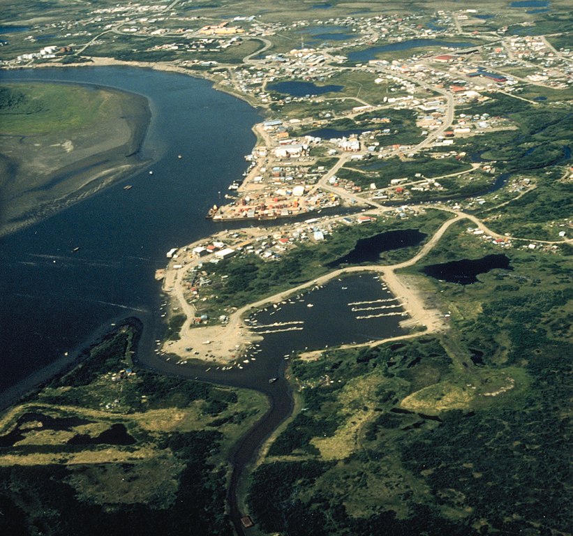
| Description | Aerial view of Bethel, Alaska. |
| Date | not specified or unknown |
| Source |
U.S. Army Corps of Engineers Digital Visual Library
|
| Author | U.S. Army Corps of Engineers, photographer not specified or unknown |
| Permission (Reusing this file) |
Public Domain |
| Object location | | View this and other nearby images on: OpenStreetMap |
|---|
Licensing[edit]
This image or file is a work of a U.S. Army Corps of Engineers soldier or employee, taken or made as part of that person's official duties. As a work of the U.S. federal government, the image is in the public domain.
|
File history
Click on a date/time to view the file as it appeared at that time.
| Date/Time | Thumbnail | Dimensions | User | Comment | |
|---|---|---|---|---|---|
| current | 22:13, 10 June 2017 | | 1,493 × 1,396 (843 KB) | Kingofthedead (talk | contribs) | Cropped < 1 % horizontally using CropTool with precise mode. |
| 01:53, 20 March 2007 |  | 1,500 × 1,396 (798 KB) | DanMS (talk | contribs) | {{Information | Description = Aerial view of Bethel, Alaska. | Source = U.S. Army Corps of Engineers Digital Visual Library<br />[http://images.usace.army.mil/images/Hires/4414-21.Jpg Image page]<br />[http://images.usace.army.mil/scripts/PortW |
You cannot overwrite this file.
File usage on Commons
The following 3 pages use this file:
File usage on other wikis
The following other wikis use this file:
- Usage on af.wikipedia.org
- Usage on ar.wikipedia.org
- Usage on arz.wikipedia.org
- Usage on azb.wikipedia.org
- Usage on az.wikipedia.org
- Usage on ceb.wikipedia.org
- Usage on de.wikipedia.org
- Usage on en.wikipedia.org
- Usage on en.wikivoyage.org
- Usage on fa.wikipedia.org
- Usage on fr.wikipedia.org
- Usage on ga.wikipedia.org
- Usage on he.wikipedia.org
- Usage on incubator.wikimedia.org
- Usage on io.wikipedia.org
- Usage on it.wikipedia.org
- Usage on ja.wikipedia.org
- Usage on ko.wikipedia.org
- Usage on mdf.wikipedia.org
- Usage on ml.wikipedia.org
- Usage on mrj.wikipedia.org
- Usage on nl.wikipedia.org
- Usage on pl.wikipedia.org
- Usage on pt.wikipedia.org
- Usage on ru.wikipedia.org
- Usage on sd.wikipedia.org
- Usage on sh.wikipedia.org
- Usage on simple.wikipedia.org
- Usage on sr.wikipedia.org
- Usage on tly.wikipedia.org
- Usage on tr.wikipedia.org
- Usage on tum.wikipedia.org
- Usage on uk.wikipedia.org
- Usage on uz.wikipedia.org
- Usage on vo.wikipedia.org
- Usage on www.wikidata.org
- Usage on zh-min-nan.wikipedia.org
- Usage on zh.wikipedia.org
- Usage on zh.wikivoyage.org