File:1880 Boston horse railroads map.jpg
(Redirected from File:Boston horse rails 1880.jpg)

Size of this preview: 604 × 599 pixels. Other resolutions: 242 × 240 pixels | 484 × 480 pixels | 774 × 768 pixels | 1,032 × 1,024 pixels | 1,588 × 1,575 pixels.
Original file (1,588 × 1,575 pixels, file size: 661 KB, MIME type: image/jpeg)
Captions
Captions
Add a one-line explanation of what this file represents
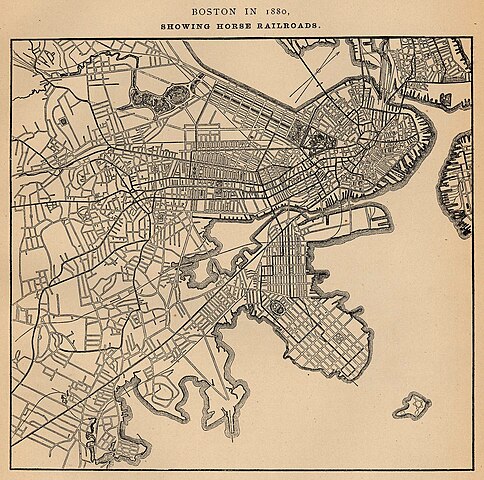
| Description | "Boston in 1880. Showing Horse Railroads." |
| Date | |
| Source |
Report on the Social Statistics of Cities, United States Census Office, Part I Via University of Texas Library (file page) |
| Author | George E. Waring, Jr. |
This image or file is a work of a United States Census Bureau employee, taken or made as part of that person's official duties. As a work of the U.S. federal government, the image is in the public domain.
|
 |
File history
Click on a date/time to view the file as it appeared at that time.
| Date/Time | Thumbnail | Dimensions | User | Comment | |
|---|---|---|---|---|---|
| current | 01:37, 12 March 2007 | | 1,588 × 1,575 (661 KB) | Beland (talk | contribs) | "Boston in 1880. Showing Horse Railroads." From Report on the Social Statistics of Cities, Compiled by George E. Waring, Jr., United States. Census Office, Part I, 1886. {{PD-USGov-DOC-Census}} Source: http://www.lib.utexas.edu/maps/historical/boston_hor |
You cannot overwrite this file.
File usage on Commons
The following page uses this file:
- File:Boston horse rails 1880.jpg (file redirect)
File usage on other wikis
The following other wikis use this file:
- Usage on en.wikipedia.org
- Usage on fr.wikipedia.org