File:Bruneian Empire.png
Jump to navigation
Jump to search

Size of this preview: 603 × 600 pixels. Other resolutions: 241 × 240 pixels | 482 × 480 pixels | 772 × 768 pixels | 1,029 × 1,024 pixels | 2,059 × 2,048 pixels | 2,732 × 2,718 pixels.
Original file (2,732 × 2,718 pixels, file size: 2.91 MB, MIME type: image/png)
Captions
Captions
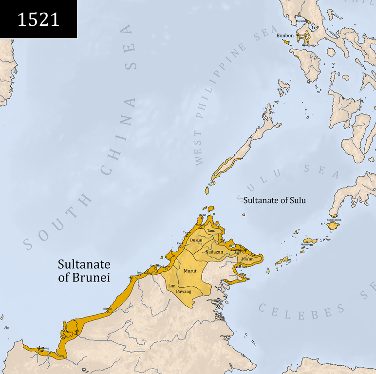
This is the map of Brunei at its greatest extent in year 1521.
Summary[edit]
| Description |
English: This is the map of Brunei at its greatest extent in year 1521.
العربية: هذه خريطة بروناي في أقصى مدى لها في عام ١٥٢١.
اردو: یہ ۱۵۲۱ء میں برونائی کا سب سے بڑا نقشہ ہے۔ |
| Date | |
| Source | Wikipedia, The Early Brunei Conquests by Rozan Yunos, A History of Brunei by Graham Saunders |
| Author | Delirium333 |
Licensing[edit]
I, the copyright holder of this work, hereby publish it under the following license:
This file is licensed under the Creative Commons Attribution-Share Alike 4.0 International license.
- You are free:
- to share – to copy, distribute and transmit the work
- to remix – to adapt the work
- Under the following conditions:
- attribution – You must give appropriate credit, provide a link to the license, and indicate if changes were made. You may do so in any reasonable manner, but not in any way that suggests the licensor endorses you or your use.
- share alike – If you remix, transform, or build upon the material, you must distribute your contributions under the same or compatible license as the original.
File history
Click on a date/time to view the file as it appeared at that time.
| Date/Time | Thumbnail | Dimensions | User | Comment | |
|---|---|---|---|---|---|
| current | 04:02, 6 September 2022 | | 2,732 × 2,718 (2.91 MB) | Delirium333 (talk | contribs) | accuracy changes |
| 04:22, 27 August 2022 |  | 2,732 × 2,718 (2.91 MB) | Delirium333 (talk | contribs) | Uploaded own work with UploadWizard |
You cannot overwrite this file.
File usage on Commons
There are no pages that use this file.
File usage on other wikis
The following other wikis use this file:
- Usage on cs.wikipedia.org
- Usage on en.wikipedia.org
- Usage on es.wikipedia.org
- Usage on he.wikipedia.org
- Usage on id.wikibooks.org
- Usage on km.wikipedia.org
- Usage on mk.wikipedia.org
- Usage on ms.wikipedia.org
- Usage on mt.wikipedia.org
- Usage on th.wikipedia.org
- Usage on tl.wikipedia.org