File:Bruxelles Brussels-Capital Belgium Map.svg
Jump to navigation
Jump to search

Size of this PNG preview of this SVG file: 603 × 600 pixels. Other resolutions: 241 × 240 pixels | 483 × 480 pixels | 772 × 768 pixels | 1,030 × 1,024 pixels | 2,059 × 2,048 pixels | 745 × 741 pixels.
Original file (SVG file, nominally 745 × 741 pixels, file size: 425 KB)
Captions
Captions
Add a one-line explanation of what this file represents
Summary
[edit]
| Description |
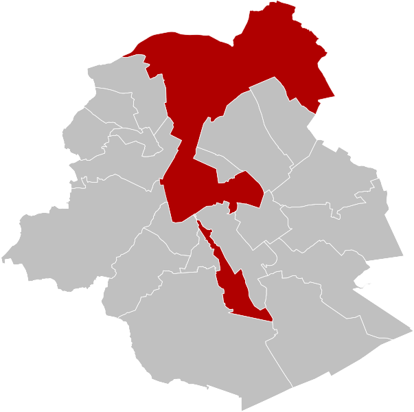
Français : Carte indiquant la localisation de la commune de Bruxelles en rouge dans la région de Bruxelles-Capitale.
English: Map of Brussels in region of Brussels-Capital, Belgium. |
| Date | |
| Source | Own work |
| Author | OD02fr |
Licensing
[edit]
I, the copyright holder of this work, hereby publish it under the following license:
This file is licensed under the Creative Commons Attribution-Share Alike 4.0 International license.
- You are free:
- to share – to copy, distribute and transmit the work
- to remix – to adapt the work
- Under the following conditions:
- attribution – You must give appropriate credit, provide a link to the license, and indicate if changes were made. You may do so in any reasonable manner, but not in any way that suggests the licensor endorses you or your use.
- share alike – If you remix, transform, or build upon the material, you must distribute your contributions under the same or compatible license as the original.
File history
Click on a date/time to view the file as it appeared at that time.
| Date/Time | Thumbnail | Dimensions | User | Comment | |
|---|---|---|---|---|---|
| current | 18:22, 28 September 2019 | | 745 × 741 (425 KB) | OD02fr (talk | contribs) | User created page with UploadWizard |
You cannot overwrite this file.
File usage on Commons
The following 16 pages use this file:
- File:BrusselLocatie.png
- Category:2024 in Brussels
- Category:Breweries in the City of Brussels
- Category:Brussels (municipality)
- Category:Brussels in the 17th century
- Category:Brussels in the 18th century
- Category:Brussels in the 1940s
- Category:Brussels in the 19th century
- Category:Brussels in the 20th century
- Category:Brussels in the 21st century
- Category:Churches in Brussels
- Category:Music events in Brussels
- Category:Organizations based in Brussels
- Category:Parks in Brussels-Capital Region
- Category:Sports venues in Brussels
- Category:Visitor attractions in Brussels
File usage on other wikis
The following other wikis use this file:
- Usage on ang.wikipedia.org
- Usage on arz.wikipedia.org
- Usage on ast.wikipedia.org
- Usage on avk.wikipedia.org
- Usage on br.wikipedia.org
- Usage on ca.wikipedia.org
- Usage on ceb.wikipedia.org
- Usage on cv.wikipedia.org
- Usage on cy.wikipedia.org
- Usage on da.wikipedia.org
- Usage on de.wikipedia.org
- Usage on diq.wikipedia.org
- Usage on el.wikipedia.org
- Usage on en.wikipedia.org
- Usage on es.wikipedia.org
- Usage on eu.wikipedia.org
- Usage on ext.wikipedia.org
- Usage on fi.wikipedia.org
- Usage on fr.wikipedia.org
- Usage on fr.wikinews.org
- Usage on gl.wikipedia.org
- Usage on he.wikipedia.org
- Usage on hr.wikipedia.org
- Usage on ht.wikipedia.org
- Usage on hy.wikipedia.org
- Usage on ia.wikipedia.org
- Usage on ie.wikipedia.org
- Usage on it.wikipedia.org
- Usage on kab.wikipedia.org
- Usage on la.wikipedia.org
- Usage on lb.wikipedia.org
- Usage on lij.wikipedia.org
- Usage on mdf.wikipedia.org
- Usage on mt.wikipedia.org
- Usage on nds.wikipedia.org
- Usage on nl.wikipedia.org
- Usage on no.wikipedia.org
View more global usage of this file.