File:C77141s1 Ant.Map Boyd Glacier.jpg
קפיצה לניווט
קפיצה לחיפוש

גודל התצוגה המקדימה הזאת: 800 × 503 פיקסלים. רזולוציות אחרות: 320 × 201 פיקסלים | 640 × 403 פיקסלים | 1,024 × 644 פיקסלים | 1,280 × 806 פיקסלים | 2,560 × 1,611 פיקסלים | 5,164 × 3,250 פיקסלים.
לקובץ המקורי (5,164 × 3,250 פיקסלים, גודל הקובץ: 1.96 מ"ב, סוג MIME: image/jpeg)
כיתובים
כיתובים
נא להוסיף משפט שמסביר מה הקובץ מייצג
| תיאור |
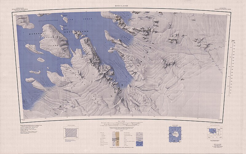
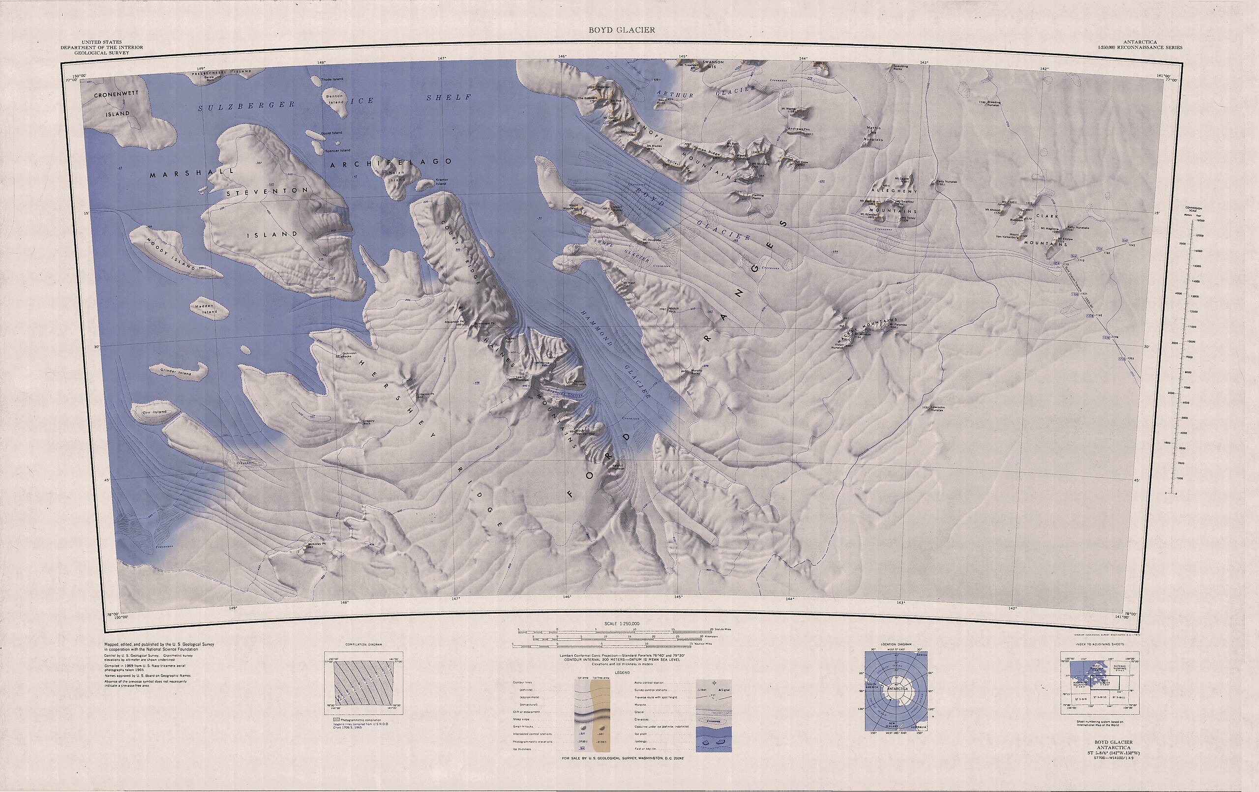
English: Map of Antarctica by the United States Antarctic Resource Center of the US Geological Society. |
| מקור | USGS |
| יוצר | USGS |
This image is in the public domain in the United States because it only contains materials that originally came from the United States Geological Survey, an agency of the United States Department of the Interior. For more information, see the official USGS copyright policy.
|
היסטוריית הקובץ
ניתן ללחוץ על תאריך/שעה כדי לראות את הקובץ כפי שנראה באותו זמן.
| תאריך/שעה | תמונה ממוזערת | ממדים | משתמש | הערה | |
|---|---|---|---|---|---|
| נוכחית | 16:23, 3 באפריל 2005 | | 3,250 × 5,164 (1.96 מ"ב) | Achim Raschka (שיחה | תרומות) | Map of Antarctica by the United States Antarctic Ressource Center of the US Geological Society. {{PD-US}} Copyrights and Trademarks USGS-authored or produced data and information are in the public domain. While the content of most USGS web pages is in th |
אין באפשרותך לדרוס את הקובץ הזה.
שימוש בקובץ
הדף הבא משתמש בקובץ הזה:
- File:C77141s1 Ant.Map Boyd Glacier.jpg.jpg (הפניה של קובץ)
שימוש גלובלי בקובץ
אתרי הוויקי השונים הבאים משתמשים בקובץ זה:
- שימוש באתר bg.wikipedia.org
- שימוש באתר ceb.wikipedia.org
- שימוש באתר de.wikipedia.org
- Ford Ranges
- Cronenwett-Insel
- Steventon-Insel
- Marshall-Archipel
- Court Ridge
- Haines Mountains
- Hammond-Gletscher
- Clark Mountains
- Allegheny Mountains (Antarktika)
- Grinder-Insel
- Alexander Peak
- Arthur-Gletscher (Antarktika)
- Swanson Mountains
- Boyd-Gletscher
- Asman Ridge
- Sarnoff Mountains
- Bailey Ridge
- Fleming Peaks
- Benton-Insel
- Nolan-Insel
- Buennagel Peak
- Mount Darling
- Dickinson Rocks
- Linwood Peak
- Hershey Ridge
- Mount Ronne
- McKinley Peak
- Gould Island (Antarktika)
- Spencer Island (Antarktika)
- Gregory Rock
- Kelly-Nunatakker
- Keyser-Nunatak
- Reynolds-Gletscher
- Kramer Island
- Leach-Nunatak
- Madden Island
- Moody Island
- Midkiff Rock
- Mount West
- Swope-Gletscher
- Orr Island
- Rucker Spur
- Mount Spencer
צפייה בשימושים גלובליים נוספים של קובץ זה.