File:C77190s1 Ant.Map Ross Island.jpg
קפיצה לניווט
קפיצה לחיפוש
גודל התצוגה המקדימה הזאת: 800 × 508 פיקסלים. רזולוציות אחרות: 320 × 203 פיקסלים | 640 × 406 פיקסלים | 1,024 × 650 פיקסלים | 1,280 × 813 פיקסלים | 2,560 × 1,625 פיקסלים | 5,118 × 3,249 פיקסלים.
לקובץ המקורי (5,118 × 3,249 פיקסלים, גודל הקובץ: 1.95 מ"ב, סוג MIME: image/jpeg)
כיתובים
כיתובים
נא להוסיף משפט שמסביר מה הקובץ מייצג
| תיאור |
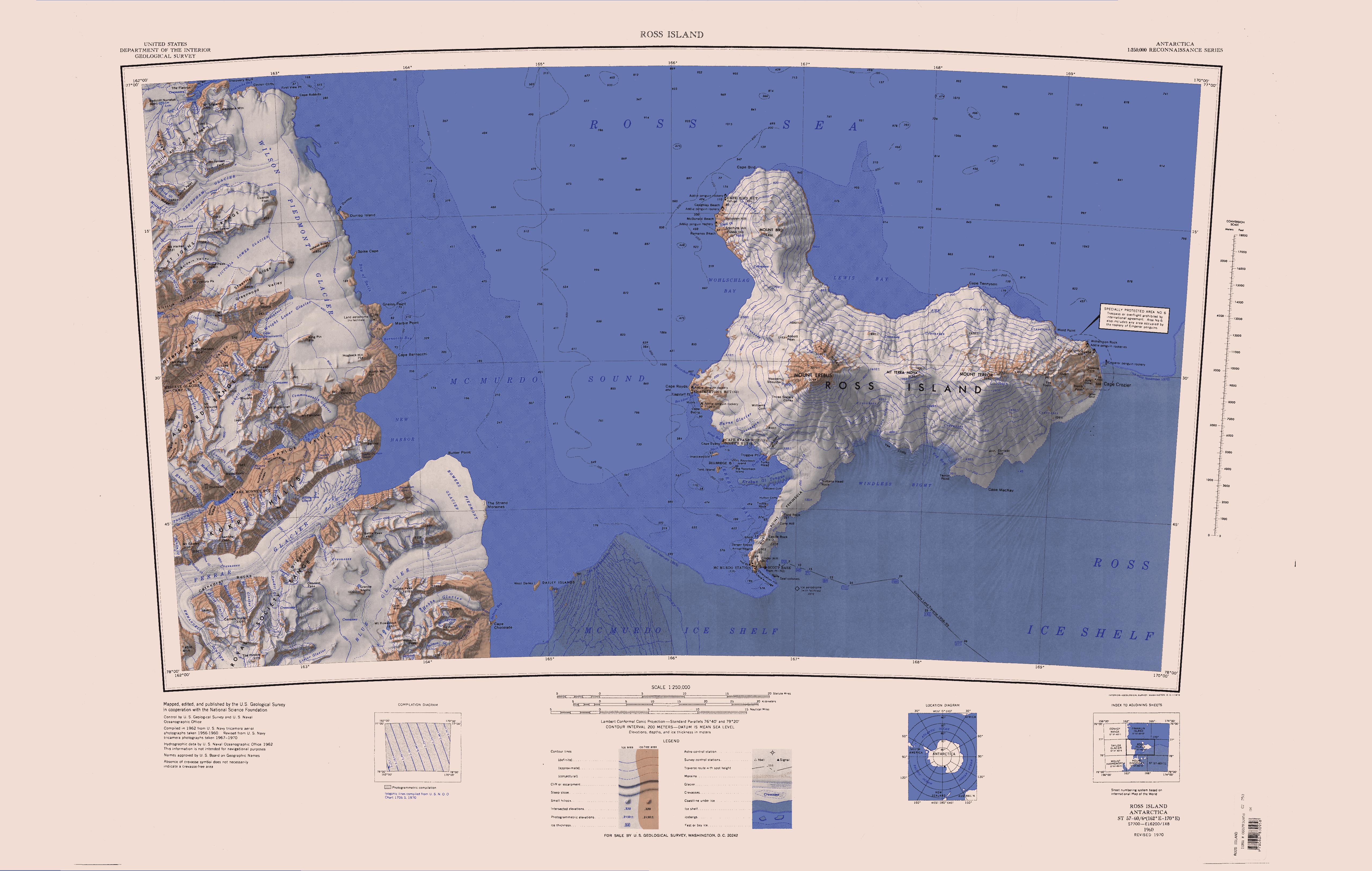
English: Map of Antarctica by the United States Antarctic Resource Center of the US Geological Society. |
| מקור | USGS |
| יוצר | USGS |
| גרסאות אחרות | File:Ross Island Topographic Map USGS.png : Higher quality PNG version |
This image is in the public domain in the United States because it only contains materials that originally came from the United States Geological Survey, an agency of the United States Department of the Interior. For more information, see the official USGS copyright policy.
|
היסטוריית הקובץ
ניתן ללחוץ על תאריך/שעה כדי לראות את הקובץ כפי שנראה באותו זמן.
| תאריך/שעה | תמונה ממוזערת | ממדים | משתמש | הערה | |
|---|---|---|---|---|---|
| נוכחית | 12:01, 15 באפריל 2005 | | 3,249 × 5,118 (1.95 מ"ב) | Achim Raschka (שיחה | תרומות) | Map of Antarctica by the United States Antarctic Ressource Center of the US Geological Society. {{PD-US}} Copyrights and Trademarks USGS-authored or produced data and information are in the public domain. While the content of most USGS web pages is in th |
אין באפשרותך לדרוס את הקובץ הזה.
שימוש בקובץ
הדף הבא משתמש בקובץ הזה:
שימוש גלובלי בקובץ
אתרי הוויקי השונים הבאים משתמשים בקובץ זה:
- שימוש באתר ceb.wikipedia.org
- שימוש באתר de.wikipedia.org
- Meserve-Gletscher
- Antarktische Trockentäler
- Tschadsee (Antarktika)
- Dailey Islands
- Marble Point
- Kap Roberts
- Wilson-Piedmont-Gletscher
- Kap Bernacchi
- Bernacchi-Bucht
- Bowers-Piedmont-Gletscher
- Blue Glacier
- Denton Hills
- Staeffler Ridge
- Matterhorn (Viktorialand)
- Lacroix-Gletscher
- Matterhorn-Gletscher
- Debenham-Gletscher
- Gonville and Caius Range
- Arnold Cove
- Gneiss Point
- Redcliff-Nunatak
- Borns-Gletscher
- Mount Coates (Viktorialand)
- Briggs Hill
- Descent-Pass
- Brodie Ponds
- Kuechle Island
- West Dailey Island
- שימוש באתר en.wikipedia.org
צפייה בשימושים גלובליים נוספים של קובץ זה.