File:Cantabria-loc.svg
Jump to navigation
Jump to search

Size of this PNG preview of this SVG file: 512 × 365 pixels. Other resolutions: 320 × 228 pixels | 640 × 456 pixels | 1,024 × 730 pixels | 1,280 × 913 pixels | 2,560 × 1,825 pixels.
Original file (SVG file, nominally 512 × 365 pixels, file size: 190 KB)
Captions
Captions
Add a one-line explanation of what this file represents
Summary[edit]
| Description |
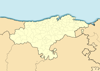
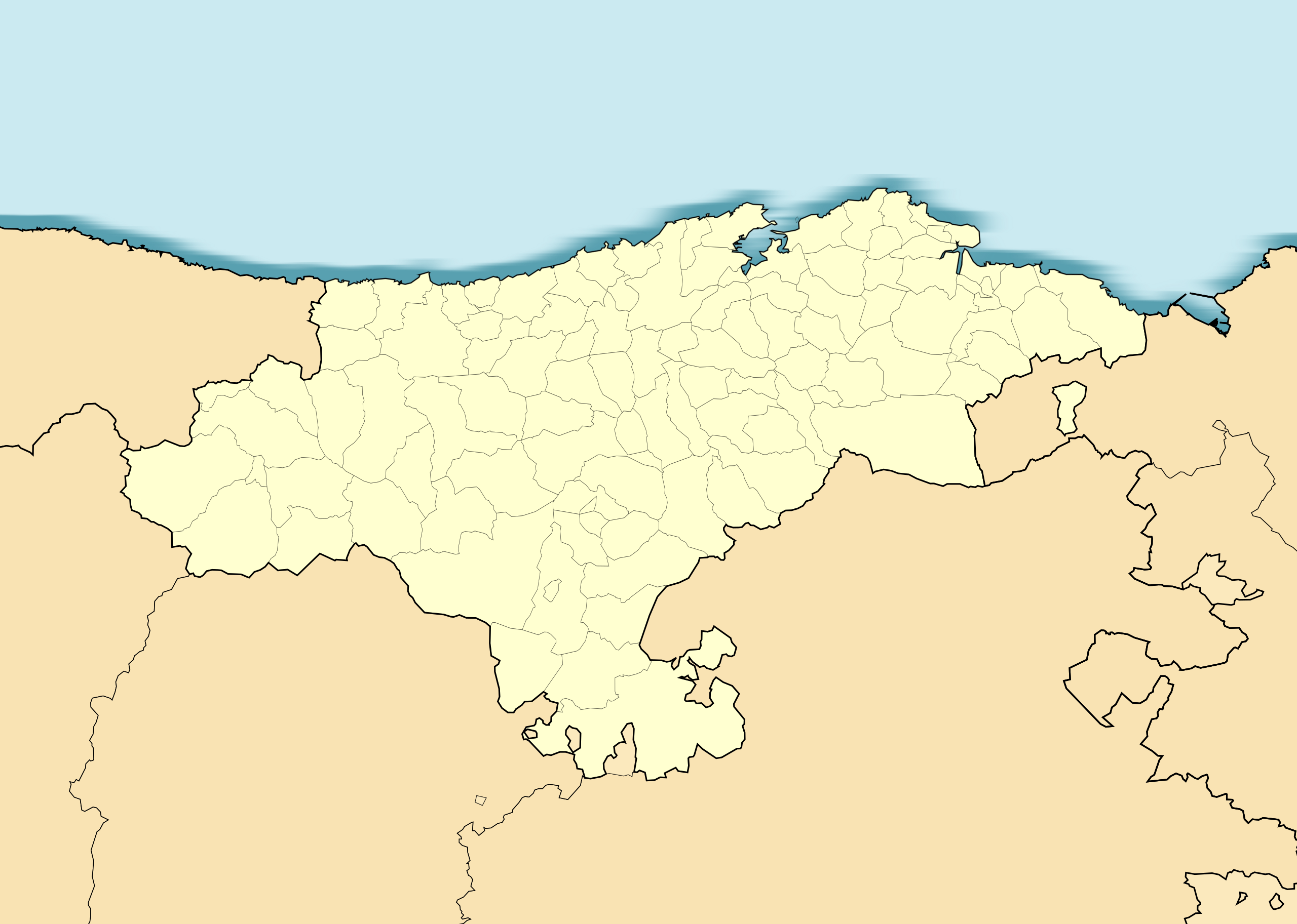
English: Location map of Cantabria
Equirectangular projection, N/S stretching 130 %. Geographic limits of the map:
Español: Mapa de localización de Cantabria
Proyección equirrectangular, N/S estirada 130 %. Límites geográficos del mapa:
|
|
| Date | ||
| Source |
Own work based on: ✦ EspañaLoc.svg by HansenBCN ✦ Spain location map.svg by NNW |
|
| Author | Miguillen | |
| SVG development | This locator map was created with Inkscape.
|
Licensing[edit]
This file is licensed under the Creative Commons Attribution-Share Alike 1.0 Generic license.
- You are free:
- to share – to copy, distribute and transmit the work
- to remix – to adapt the work
- Under the following conditions:
- attribution – You must give appropriate credit, provide a link to the license, and indicate if changes were made. You may do so in any reasonable manner, but not in any way that suggests the licensor endorses you or your use.
- share alike – If you alter, transform, or build upon this work, you must distribute the resulting work under the same license as the original.
File history
Click on a date/time to view the file as it appeared at that time.
| Date/Time | Thumbnail | Dimensions | User | Comment | |
|---|---|---|---|---|---|
| current | 19:26, 9 December 2010 | | 512 × 365 (190 KB) | Miguillen (talk | contribs) | colores según convención |
| 21:24, 2 June 2010 |  | 512 × 365 (223 KB) | Miguillen (talk | contribs) | lepongo el enclave | |
| 21:22, 2 June 2010 |  | 512 × 365 (223 KB) | Miguillen (talk | contribs) | Reverted to version as of 11:29, 22 May 2010 | |
| 06:45, 2 June 2010 |  | 512 × 365 (224 KB) | Uhanu (talk | contribs) | Adding the exclave Valle de Villaverde | |
| 11:29, 22 May 2010 |  | 512 × 365 (223 KB) | Miguillen (talk | contribs) | == {{int:filedesc}} == {{Information |Description= {{en|Location map of Cantabria}} Equirectangular projection, N/S stretching 130 %. Geographic limits of the map: * N: 43.749772° N * S: 42.578655° N * W: 5.049921° O * E: 2.90242 |
You cannot overwrite this file.
File usage on Commons
There are no pages that use this file.
File usage on other wikis
The following other wikis use this file:
- Usage on an.wikipedia.org
- Santander
- Fontibre
- Reinosa
- Hermandad de Campoo de Suso
- Pesquera
- Las Rozas de Valdearroyo
- Campoo de Yuso
- Campoo de Enmedio
- Alfoz de Lloredo
- Ampuero
- Anievas
- Arenas de Iguña
- Argoños
- Arnuero
- Arredondo
- Bareyo
- Bárcena de Pie de Concha
- Cabezón de Liébana
- Cabezón de la Sal
- Cabuérniga
- Camaleño
- Santiurde de Reinosa
- San Miguel de Aguayo
- Valdeolea
- Valdeprado del Río
- Valderredible
- Santillana del Mar
- Camargo (Cantabria)
- Cartes
- Castañeda
- Castro Urdiales
- Cieza (Cantabria)
- Cillorigo de Liébana
- Comillas
- Corvera de Toranzo
- El Astillero
- Entrambasaguas (Cantabria)
- Escalante (Cantabria)
- Guriezo
- Hazas de Cesto
- Herrerías
- Lamasón
- Liendo
- Limpias
- Liérganes
- Los Corrales de Buelna
- Los Tojos
- Luena
- Mancomunidat Campoo-Cabuérniga
- Marina de Cudeyo
View more global usage of this file.