File:CardiganBay.svg
Jump to navigation
Jump to search

Size of this PNG preview of this SVG file: 390 × 599 pixels. Other resolutions: 156 × 240 pixels | 312 × 480 pixels | 500 × 768 pixels | 666 × 1,024 pixels | 1,332 × 2,048 pixels | 2,030 × 3,120 pixels.
Original file (SVG file, nominally 2,030 × 3,120 pixels, file size: 66 KB)
Captions
Captions
Add a one-line explanation of what this file represents
Summary[edit]
| Description |
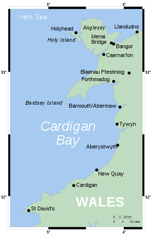
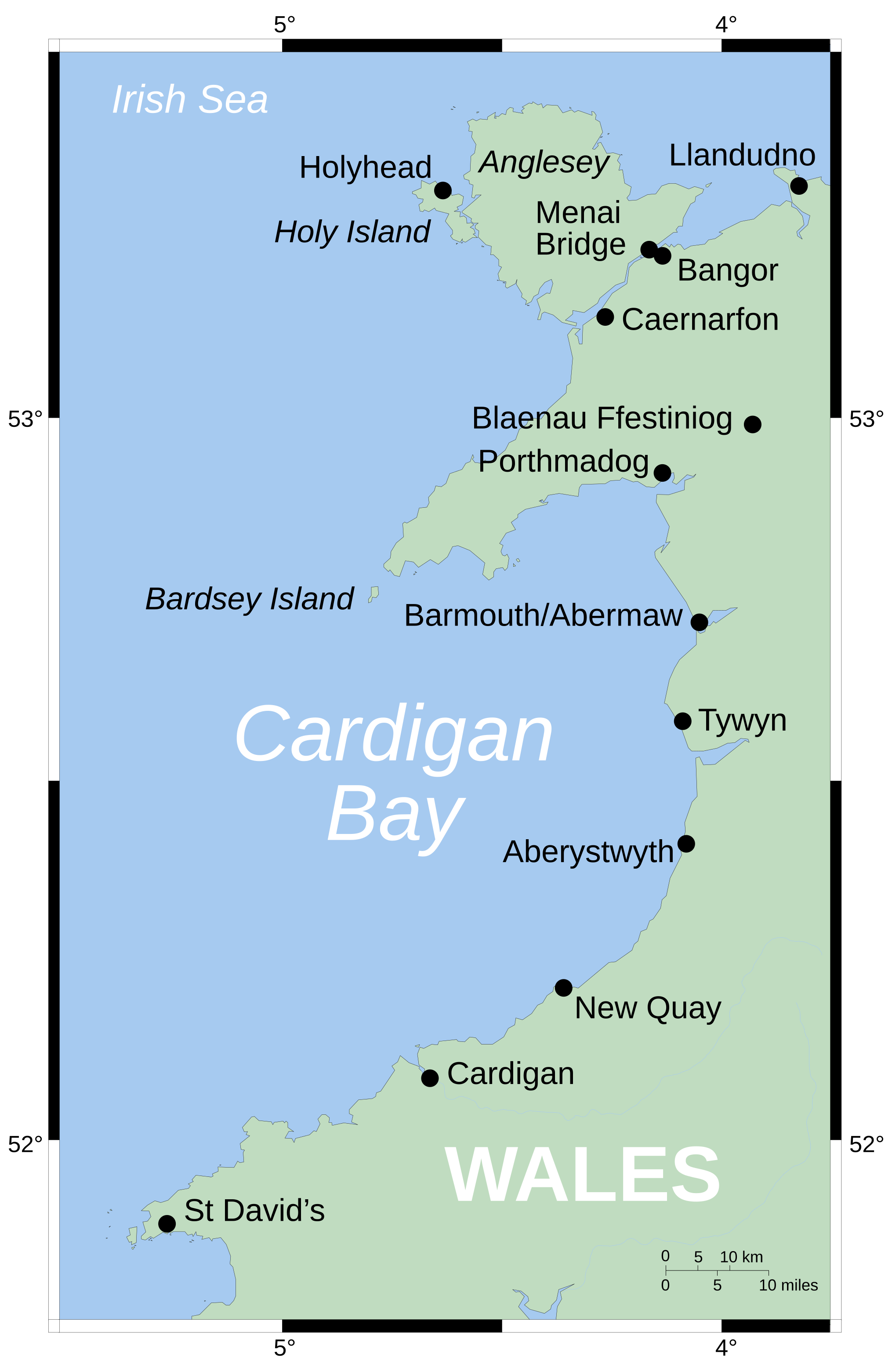
English: Map showing position of Cardigan Bay off Wales' west coast. Vector version of Image:CardiganBay.png on the English Wikipedia.
Mercator projection. Shore-line derived from GSHHS, rivers from the CIA World DataBank, both public-domain data sources. |
| Source | Own work |
| Author | Wereon |
Licensing[edit]
| I, the copyright holder of this work, release this work into the public domain. This applies worldwide. In some countries this may not be legally possible; if so: I grant anyone the right to use this work for any purpose, without any conditions, unless such conditions are required by law. |
derivative works[edit]
Derivative works of this file:
-
 Cymraeg
 -
 македонски


File history
Click on a date/time to view the file as it appeared at that time.
| Date/Time | Thumbnail | Dimensions | User | Comment | |
|---|---|---|---|---|---|
| current | 16:43, 9 August 2006 | | 2,030 × 3,120 (66 KB) | Wereon (talk | contribs) | oops, left the image in |
| 16:41, 9 August 2006 |  | 2,030 × 3,120 (66 KB) | Wereon (talk | contribs) | MediaWiki's acting a bit funny... | |
| 16:33, 9 August 2006 |  | 203 × 312 (62 KB) | Wereon (talk | contribs) | Map showing position of Cardigan Bay off Wales' west coast. Vector version of Image:CardiganBay.png on the English Wikipedia. Mercator projection. Shore-line derived from GSHHS, rivers from VMAP0, both public-domain data sources. |
You cannot overwrite this file.
File usage on Commons
The following 3 pages use this file:
File usage on other wikis
The following other wikis use this file:
- Usage on da.wikipedia.org
- Usage on de.wikipedia.org
- Usage on en.wikipedia.org
- Usage on eu.wikipedia.org
- Usage on fr.wikipedia.org
- Usage on it.wikipedia.org
- Usage on la.wikipedia.org
- Usage on lt.wikipedia.org
- Usage on nl.wikipedia.org
- Usage on nn.wikipedia.org
- Usage on pl.wikipedia.org
- Usage on pt.wikipedia.org
- Usage on ru.wikipedia.org
- Usage on sv.wikipedia.org
- Usage on tt.wikipedia.org
- Usage on zh.wikipedia.org