File:Central African Republic location map.svg

원본 파일 (SVG 파일, 실제 크기 1,606 × 1,109 픽셀, 파일 크기: 339 KB)
캡션
설명
파일 설명[편집]
| 설명 |
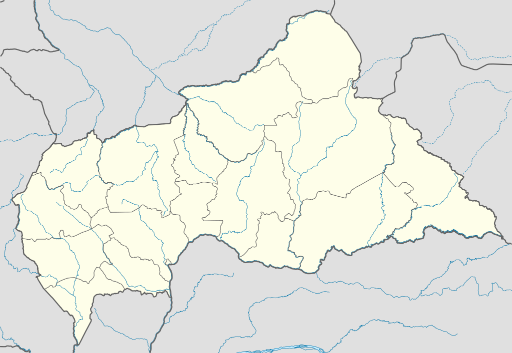
Deutsch: Positionskarte der Zentralafrikanischen Republik
Quadratische Plattkarte, N-S-Streckung 101 %. Geographische Begrenzung der Karte:
English: Location map of the Central African Republic
Equirectangular projection, N/S stretching 101 %. Geographic limits of the map:
|
|
| 날짜 | ||
| 출처 |
자작, using
|
|
| 저자 | NordNordWest | |
| 저작권 (이 파일을 인용하기) |
이 파일은 크리에이티브 커먼즈 저작자표시-동일조건변경허락 3.0 독일 라이선스로 배포됩니다.
 이 파일은 크리에이티브 커먼즈 저작자표시-동일조건변경허락 3.0 독일 라이선스로 배포됩니다.
|
|
| 다른 버전 |
이 파일은 다음으로 파생됨:
|


.svg)
.svg)
.svg)
.svg)
.svg)
.svg)
.svg)
.svg)
.svg)
.svg)
.svg)
.svg)
.svg)
.svg)
.svg)
.svg)

|
This map has been made or improved in the German Kartenwerkstatt (Map Lab). You can propose maps to improve as well.
|
파일 역사
날짜/시간 링크를 클릭하면 해당 시간의 파일을 볼 수 있습니다.
| 날짜/시간 | 섬네일 | 크기 | 사용자 | 설명 | |
|---|---|---|---|---|---|
| 현재 | 2011년 7월 10일 (일) 17:59 | | 1,606 × 1,109 (339 KB) | NordNordWest (토론 | 기여) | upd |
| 2009년 12월 5일 (토) 20:47 |  | 1,606 × 1,110 (556 KB) | NordNordWest (토론 | 기여) | =={{int:filedesc}}== {{Information |Description= {{de|Positionskarte der Zentralafrikanischen Republik}} Quadratische Plattkarte, N-S-Streckung 101 %. Geographische Begrenzung der Karte: * N: 11.3° N * S: 2.0° N * W: |
이 파일을 덮어쓸 수 없습니다.
이 파일을 사용하는 문서
다음 문서 36개가 이 파일을 사용하고 있습니다:
- User:NordNordWest/Gallery/Location maps
- File:Bambingui-Bangoran (Central African Republic).svg
- File:Basse-Kotto (Central African Republic).svg
- File:Central African Republic - Bamingui-Bangoran.svg
- File:Central African Republic - Bangui.svg
- File:Central African Republic - Bangui (+special marker).svg
- File:Central African Republic - Basse-Kotto.svg
- File:Central African Republic - Haut-Mbomou.svg
- File:Central African Republic - Haute-Kotto.svg
- File:Central African Republic - Kémo.svg
- File:Central African Republic - Lobaye.svg
- File:Central African Republic - Mambéré-Kadéï.svg
- File:Central African Republic - Mbomou.svg
- File:Central African Republic - Nana-Grébizi.svg
- File:Central African Republic - Nana-Mambéré.svg
- File:Central African Republic - Ombella-M'Poko.svg
- File:Central African Republic - Ouaka.svg
- File:Central African Republic - Ouham-Pendé.svg
- File:Central African Republic - Ouham.svg
- File:Central African Republic - Sangha-Mbaéré.svg
- File:Central African Republic - Vakaga.svg
- File:Central African Republic relief location map.jpg
- File:Haut-Mbomou (Central African Republic).svg
- File:Haute-Kotto (Central African Republic).svg
- File:Kémo (Central African Republic).svg
- File:Lobaye (Central African Republic).svg
- File:Mambere-Kadei (Central African Republic).svg
- File:Mbomou (Central African Republic).svg
- File:Nana-Grebizi (Central African Republic).svg
- File:Nana-Mambéré (Central African Republic).svg
- File:Ombella-Mpoko (Central African Republic).svg
- File:Ouaka (Central African Republic).svg
- File:Ouham-Pendé (Central African Republic).svg
- File:Ouham (Central African Republic).svg
- File:Sangha-Mbaéré (Central African Republic).svg
- File:Vakaga (Central African Republic).svg
.svg)
이 파일을 사용하고 있는 모든 위키의 문서 목록
다음 위키에서 이 파일을 사용하고 있습니다:
- af.wikipedia.org에서 이 파일을 사용하고 있는 문서 목록
- am.wikipedia.org에서 이 파일을 사용하고 있는 문서 목록
- an.wikipedia.org에서 이 파일을 사용하고 있는 문서 목록
- ar.wikipedia.org에서 이 파일을 사용하고 있는 문서 목록
- ast.wikipedia.org에서 이 파일을 사용하고 있는 문서 목록
- azb.wikipedia.org에서 이 파일을 사용하고 있는 문서 목록
- az.wikipedia.org에서 이 파일을 사용하고 있는 문서 목록
- be.wikipedia.org에서 이 파일을 사용하고 있는 문서 목록
- bg.wikipedia.org에서 이 파일을 사용하고 있는 문서 목록
- bn.wikipedia.org에서 이 파일을 사용하고 있는 문서 목록
- bs.wikipedia.org에서 이 파일을 사용하고 있는 문서 목록
- ceb.wikipedia.org에서 이 파일을 사용하고 있는 문서 목록
이 파일의 더 많은 사용 내역을 봅니다.