File:Chad adm location map after 2012.png
Jump to navigation
Jump to search
Size of this preview: 399 × 599 pixels. Other resolutions: 160 × 240 pixels | 320 × 480 pixels | 512 × 768 pixels | 682 × 1,024 pixels | 2,000 × 3,001 pixels.
Original file (2,000 × 3,001 pixels, file size: 524 KB, MIME type: image/png)
Captions
Captions
Add a one-line explanation of what this file represents
Summary[edit]
| Camera location | | View this and other nearby images on: OpenStreetMap |
|---|
| Description |
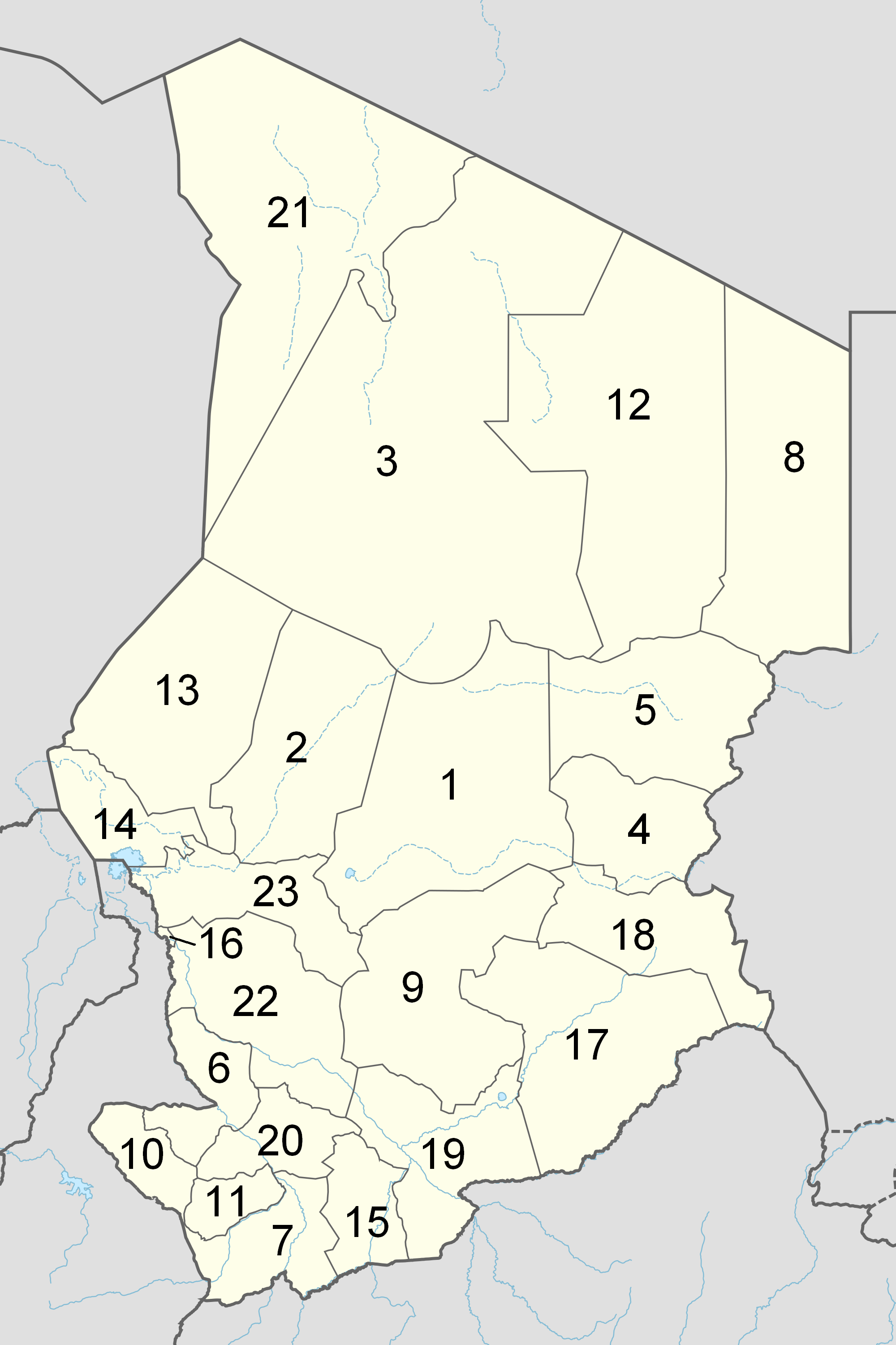
Русский: Департаменты Чада после 2012 года.
English: Numbered map of the administrative regions in Chad as after the 2012 reform.
Français : Carte numérotée des régions administratives du Tchad telles qu'après la réforme des Régions de février 2012. |
| Date | |
| Source | Own work (ed. File:Chad departments.png) |
| Author | Siver-Snom |
Licensing[edit]
| I, the copyright holder of this work, release this work into the public domain. This applies worldwide. In some countries this may not be legally possible; if so: I grant anyone the right to use this work for any purpose, without any conditions, unless such conditions are required by law. |
File history
Click on a date/time to view the file as it appeared at that time.
| Date/Time | Thumbnail | Dimensions | User | Comment | |
|---|---|---|---|---|---|
| current | 11:00, 18 August 2018 | | 2,000 × 3,001 (524 KB) | Siver-Snom (talk | contribs) | User created page with UploadWizard |
You cannot overwrite this file.
File usage on Commons
The following page uses this file:
- File:Chad adm location map after 2012.svg.png (file redirect)
File usage on other wikis
The following other wikis use this file:
- Usage on ab.wikipedia.org
- Usage on an.wikipedia.org
- Usage on bn.wikipedia.org
- Usage on en.wikipedia.org
- Usage on fa.wikipedia.org
- Usage on fr.wikipedia.org
- Usage on incubator.wikimedia.org
- Usage on ja.wikipedia.org
- Usage on ru.wikipedia.org
- Usage on simple.wikipedia.org
- Usage on so.wikipedia.org
- Usage on zh.wikipedia.org