File:CharonFeatureMap Annotated.png
Jump to navigation
Jump to search
Size of this preview: 800 × 355 pixels. Other resolutions: 320 × 142 pixels | 640 × 284 pixels | 1,024 × 454 pixels | 1,280 × 568 pixels | 2,380 × 1,056 pixels.
Original file (2,380 × 1,056 pixels, file size: 3.22 MB, MIME type: image/png)
Captions
Captions
Add a one-line explanation of what this file represents
Summary
[edit]
| Description |
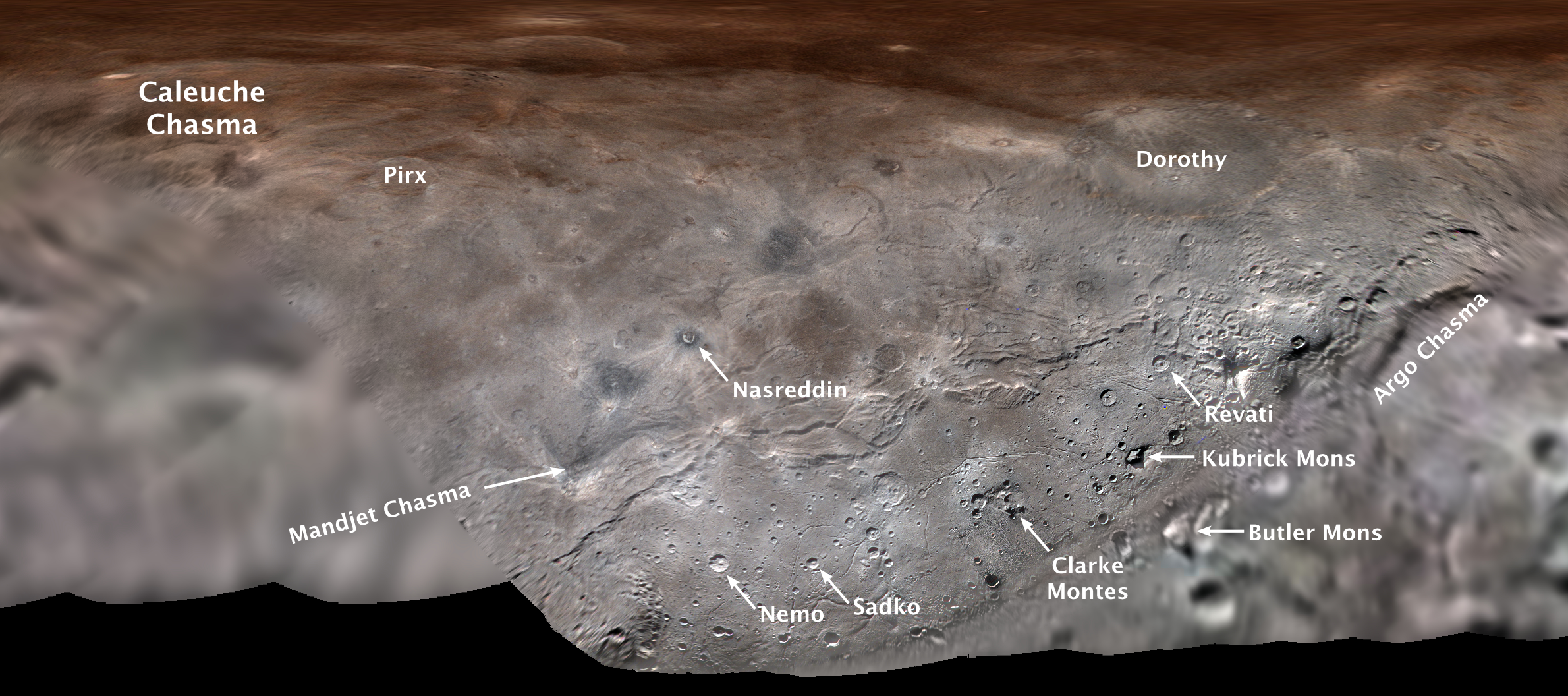
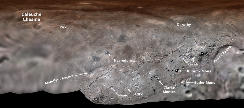
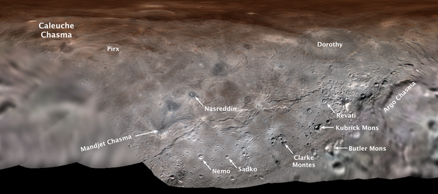
English: Map projection of Charon, the largest of Pluto's five moons, annotated with its first set of official feature names. With a diameter of about 755 miles, the Texas-sized moon is one of largest known objects in the Kuiper Belt, the region of icy, rocky bodies beyond Neptune. |
| Date | |
| Source | http://pluto.jhuapl.edu/Multimedia/Science-Photos/image.php?page=1&gallery_id=2&image_id=536 |
| Author | NASA/Johns Hopkins University Applied Physics Laboratory/Southwest Research Institute |
Licensing
[edit]
| This file is in the public domain in the United States because it was solely created by NASA. NASA copyright policy states that "NASA material is not protected by copyright unless noted". (See Template:PD-USGov, NASA copyright policy page or JPL Image Use Policy.) | ||
 |
Warnings:
|
File history
Click on a date/time to view the file as it appeared at that time.
| Date/Time | Thumbnail | Dimensions | User | Comment | |
|---|---|---|---|---|---|
| current | 19:20, 3 August 2018 | | 2,380 × 1,056 (3.22 MB) | Michael 2M (talk | contribs) | User created page with UploadWizard |
You cannot overwrite this file.
File usage on Commons
There are no pages that use this file.
File usage on other wikis
The following other wikis use this file:
- Usage on arz.wikipedia.org
- Usage on bs.wikipedia.org
- Usage on de.wikipedia.org
- Usage on en.wikipedia.org
- Usage on fr.wikipedia.org
- Usage on nl.wikipedia.org
- Usage on uk.wikipedia.org