File:Congo regions named Ua.PNG
Jump to navigation
Jump to search
No higher resolution available.
Congo_regions_named_Ua.PNG (300 × 370 pixels, file size: 21 KB, MIME type: image/png)
Captions
Captions
Add a one-line explanation of what this file represents
| Description |
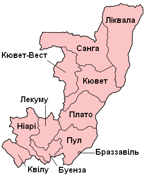
Українська: Адмінітрастивний поділ Республіки Конго. Мапа регіонів Республіки Конго |
| Date | |
| Source |
Українська: Congo regions named.png |
| Author | Вальдимар |
| Permission (Reusing this file) |
Українська: I, the copyright holder of this work, hereby publish it under the following license: This file is licensed under the Creative Commons Attribution-Share Alike 1.0 Generic license.
|
File history
Click on a date/time to view the file as it appeared at that time.
| Date/Time | Thumbnail | Dimensions | User | Comment | |
|---|---|---|---|---|---|
| current | 22:53, 25 September 2008 | | 300 × 370 (21 KB) | Вальдимар (talk | contribs) | {{Зображення |Назва=Адмінітрастивний поділ Республіки Конго |Опис=Мапа регіонів Республіки Конго |Автор=Вальдимар |Джерело=Congo regions named.png |Ча |
You cannot overwrite this file.
File usage on Commons
There are no pages that use this file.