File:Duitstalige GemeenschapLocatie.svg
Jump to navigation
Jump to search

Size of this PNG preview of this SVG file: 319 × 261 pixels. Other resolutions: 293 × 240 pixels | 587 × 480 pixels | 939 × 768 pixels | 1,252 × 1,024 pixels | 2,503 × 2,048 pixels.
Original file (SVG file, nominally 319 × 261 pixels, file size: 76 KB)
Captions
Captions
Add a one-line explanation of what this file represents
Summary[edit]
| Description |
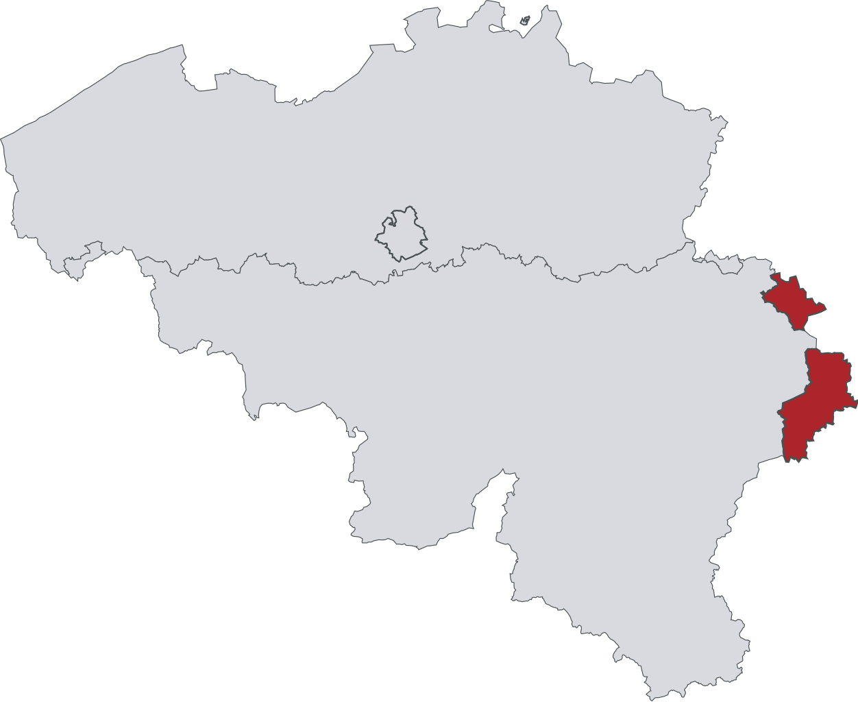
Français : Plan des cantons de l'Est formés par les 2 communes de Malmedy et Waimes (Communauté française de Belgique) et par les 9 communes de la Communauté Germanophone de Belgique.
Deutsch: Die neun Gemeinden der Deutschsprachigen Gemeinschaft und die zwei francophone Gemeinden Malmedy und Waimes bilden die belgischen Ostkantone.
Português: As nove comunidades germanófonas e as duas comunidades francófonas de Malmedy e Waimes formam os cantões do leste da Bélgica.
English: Map of the Eastern Cantons in Belgium which are formed by the 9 municipalities of the German-Speaking Community and the 2 municipalities of Malmedy and Waimes (part of the French-Speaking Community) |
| Source | Own work |
| Author | Vascer |
Licensing[edit]
I, the copyright holder of this work, hereby publish it under the following license:
This file is licensed under the Creative Commons Attribution-Share Alike 3.0 Unported license.
- You are free:
- to share – to copy, distribute and transmit the work
- to remix – to adapt the work
- Under the following conditions:
- attribution – You must give appropriate credit, provide a link to the license, and indicate if changes were made. You may do so in any reasonable manner, but not in any way that suggests the licensor endorses you or your use.
- share alike – If you remix, transform, or build upon the material, you must distribute your contributions under the same or compatible license as the original.
File history
Click on a date/time to view the file as it appeared at that time.
| Date/Time | Thumbnail | Dimensions | User | Comment | |
|---|---|---|---|---|---|
| current | 14:46, 24 May 2009 | | 319 × 261 (76 KB) | Knorck (talk | contribs) | borders of German-speaking Community rectified |
| 08:00, 11 October 2008 |  | 307 × 251 (86 KB) | Vascer (talk | contribs) | {{Information |Description={{fr|1=Plan de la Belgique avec la communauté germanophone en rouge plein}} |Source=Moi |Author=Moi |Date= |Permission= |other_versions= }} <!--{{ImageUpload|full}}--> [[Category:Maps of the German-speaking Community of Belgiu |
You cannot overwrite this file.
File usage on Commons
The following page uses this file:
File usage on other wikis
The following other wikis use this file:
- Usage on an.wikipedia.org
- Usage on de.wikipedia.org
- Usage on en.wikipedia.org
- Usage on fr.wikipedia.org
- Usage on ja.wikipedia.org
- Usage on ko.wikipedia.org
- Usage on no.wikipedia.org
- Usage on ro.wikipedia.org
- Usage on ru.wikipedia.org
- Usage on th.wikipedia.org
- Usage on uk.wikipedia.org
- Usage on zea.wikipedia.org