File:Elysium Planitia (MOLA).jpg
Jump to navigation
Jump to search

Size of this preview: 722 × 599 pixels. Other resolutions: 289 × 240 pixels | 578 × 480 pixels | 925 × 768 pixels | 1,233 × 1,024 pixels | 2,467 × 2,048 pixels | 3,900 × 3,238 pixels.
Original file (3,900 × 3,238 pixels, file size: 5.09 MB, MIME type: image/jpeg)
Captions
Captions
Add a one-line explanation of what this file represents
Summary[edit]
.jpg&action=edit§ion=1)
| Description |
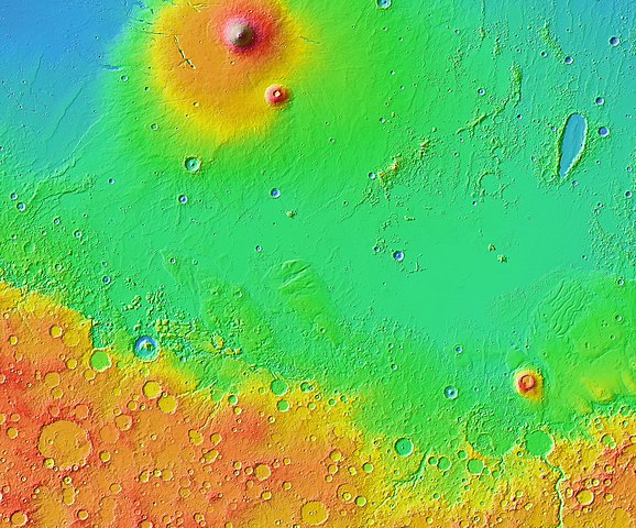
Українська: Рівнина Елізій з околицями на Марсі. Карта висот, складена за даними альтиметра Mars Orbiter Laser Altimeter на супутнику Mars Global Surveyor. Розмір зображення — 3600×3000 км, північ угорі.
English: Elysium Planitia with surroundings on Mars. Elevation map (color shaded relief), based on data from Mars Orbiter Laser Altimeter onboard Mars Global Surveyor satellite. Size of the image is 3600×3000 km, north is up. |
| Date | |
| Source | JMARS |
| Author | NASA (colorized shaded relief data by Mars Orbiter Laser Altimeter) |
Licensing[edit]
.jpg&action=edit§ion=2)
| This file is in the public domain in the United States because it was solely created by NASA. NASA copyright policy states that "NASA material is not protected by copyright unless noted". (See Template:PD-USGov, NASA copyright policy page or JPL Image Use Policy.) | ||
 |
Warnings:
|
File history
Click on a date/time to view the file as it appeared at that time.
| Date/Time | Thumbnail | Dimensions | User | Comment | |
|---|---|---|---|---|---|
| current | 05:04, 30 November 2018 | | 3,900 × 3,238 (5.09 MB) | Sneeuwschaap (talk | contribs) | User created page with UploadWizard |
You cannot overwrite this file.
File usage on Commons
The following 2 pages use this file:
File usage on other wikis
The following other wikis use this file:
- Usage on ca.wikipedia.org
- Usage on el.wikipedia.org
- Usage on es.wikipedia.org
- Usage on hu.wikipedia.org
- Usage on id.wikipedia.org
- Usage on it.wikipedia.org
- Usage on ru.wikipedia.org
- Usage on uk.wikipedia.org
- Usage on www.wikidata.org
.jpg&oldid=510816098)