File:Enewetak Atoll 2005-09-01, EO-1 bands 10-8-2-1, 15m resolution, no annotations.png
Jump to navigation
Jump to search

Size of this preview: 597 × 599 pixels. Other resolutions: 239 × 240 pixels | 478 × 480 pixels | 765 × 768 pixels | 1,020 × 1,024 pixels | 2,040 × 2,048 pixels | 3,126 × 3,138 pixels.
Original file (3,126 × 3,138 pixels, file size: 11.72 MB, MIME type: image/png)
Captions
Captions
Add a one-line explanation of what this file represents
Summary[edit]
| Description |
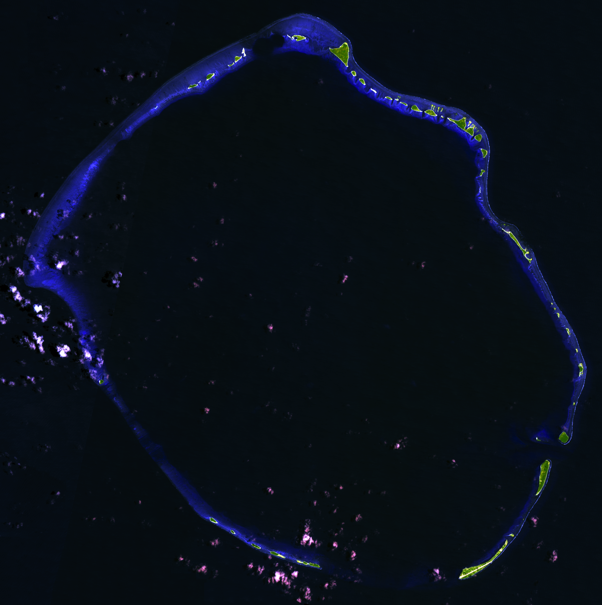
English: Composite "false color" multispectral satellite image of Enewetak Atoll, Marshall Islands.
NASA EO-1 ALI bands used were 10 (SWIR), 8 (SWIR) and 2 (blue). The image was pan-sharpened and resampled to 15m resolution. Imagery courtesy of NASA/USGS. |
| Date | |
| Source | NASA EO-1 satellite image GeoTIFF archive, http://glovis.usgs.gov |
| Author | NASA |
| Camera location | | View this and other nearby images on: OpenStreetMap |
|---|
Revision of earlier image to correctly align to true north and remove annotations.
This image is a composite of two different satellite images; a visible seam is present due to this. Unfortunately the freely available alternatives from NASA included lower resolution, greater cloud cover, and scanline artifacts. (EO-1, Landsat, ASTER imagery)
Licensing[edit]
| This file is in the public domain in the United States because it was solely created by NASA. NASA copyright policy states that "NASA material is not protected by copyright unless noted". (See Template:PD-USGov, NASA copyright policy page or JPL Image Use Policy.) | ||
 |
Warnings:
|
| Annotations | This image is annotated: View the annotations at Commons |
File history
Click on a date/time to view the file as it appeared at that time.
| Date/Time | Thumbnail | Dimensions | User | Comment | |
|---|---|---|---|---|---|
| current | 03:52, 24 September 2012 | | 3,126 × 3,138 (11.72 MB) | Frangible~commonswiki (talk | contribs) | User created page with UploadWizard |
You cannot overwrite this file.
File usage on Commons
There are no pages that use this file.
File usage on other wikis
The following other wikis use this file:
- Usage on en.wikipedia.org
- Usage on fa.wikipedia.org
- Usage on lt.wikipedia.org