File:Eq Guinea ES.PNG
Jump to navigation
Jump to search
No higher resolution available.
Eq_Guinea_ES.PNG (324 × 349 pixels, file size: 7 KB, MIME type: image/png)
Captions
Captions
Add a one-line explanation of what this file represents
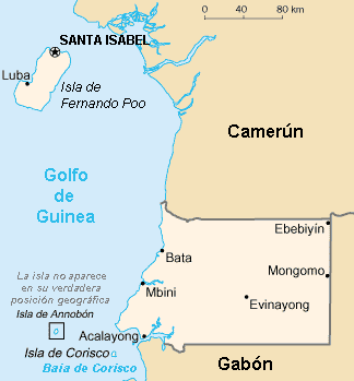
Mapa de Guinea Ecuatorial en español / Equatorial Guinea in Spanish--revision of World Fact Book map
This image is in the public domain because it contains materials that originally came from the United States Central Intelligence Agency's World Factbook.
|
 |
File history
Click on a date/time to view the file as it appeared at that time.
| Date/Time | Thumbnail | Dimensions | User | Comment | |
|---|---|---|---|---|---|
| current | 03:50, 12 February 2022 | | 324 × 349 (7 KB) | Lojwe (talk | contribs) | Frame removed |
| 15:39, 30 June 2011 |  | 330 × 355 (9 KB) | Galjundi7 (talk | contribs) | Old names of the cities during the Spanish occupation | |
| 15:38, 30 June 2011 |  | 330 × 355 (9 KB) | Galjundi7 (talk | contribs) | Old names of the cities during the Spanish occupation | |
| 09:45, 19 May 2005 |  | 330 × 355 (10 KB) | Danny~commonswiki (talk | contribs) | {{GFDL}} Equatorial Guinea map in Spanish, based on the World Fact Book | |
| 10:21, 18 May 2005 |  | 330 × 355 (10 KB) | Danny~commonswiki (talk | contribs) | {{GFDL)) Equatorial Guinea in Spanish--revision of World Fact Book map |
You cannot overwrite this file.
File usage on Commons
The following 3 pages use this file:
File usage on other wikis
The following other wikis use this file:
- Usage on ast.wikipedia.org
- Usage on azb.wikipedia.org
- Usage on be.wikipedia.org
- Usage on ca.wikipedia.org
- Usage on en.wikipedia.org
- Usage on es.wikipedia.org
- Usage on fr.wikipedia.org
- Usage on gag.wikipedia.org
- Usage on gl.wikipedia.org
- Usage on hy.wikipedia.org
- Usage on ia.wikipedia.org
- Usage on la.wikipedia.org
- Usage on oc.wikipedia.org
- Usage on pt.wikipedia.org
- Usage on ru.wikipedia.org
- Usage on uk.wikipedia.org
- Usage on www.wikidata.org