File:Fire 20020815-22 lrg.gif
Jump to navigation
Jump to search
Size of this preview: 800 × 400 pixels. Other resolutions: 320 × 160 pixels | 640 × 320 pixels | 1,280 × 640 pixels.
Original file (1,280 × 640 pixels, file size: 46 KB, MIME type: image/gif)
Captions
Captions
Add a one-line explanation of what this file represents
Summary[edit]
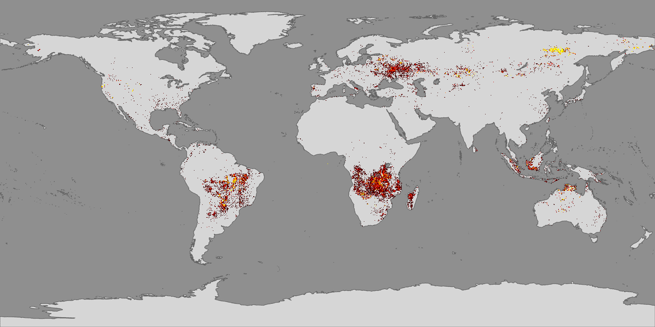
New satellite maps showing fire activity across the entire Earth for the past year are providing a unique picture of seasonal and yearly fire activity.
Licensing[edit]
| This file is in the public domain in the United States because it was solely created by NASA. NASA copyright policy states that "NASA material is not protected by copyright unless noted". (See Template:PD-USGov, NASA copyright policy page or JPL Image Use Policy.) | ||
 |
Warnings:
|
File history
Click on a date/time to view the file as it appeared at that time.
| Date/Time | Thumbnail | Dimensions | User | Comment | |
|---|---|---|---|---|---|
| current | 22:08, 16 November 2005 | | 1,280 × 640 (46 KB) | Severino666~commonswiki (talk | contribs) | New satellite maps showing fire activity across the entire Earth for the past year are providing a unique picture of seasonal and yearly fire activity. Category:Geography |
You cannot overwrite this file.
File usage on Commons
There are no pages that use this file.
File usage on other wikis
The following other wikis use this file:
- Usage on nl.wikibooks.org