File:Gale big.jpg
Jump to navigation
Jump to search
Size of this preview: 800 × 554 pixels. Other resolutions: 320 × 222 pixels | 640 × 443 pixels | 1,024 × 709 pixels | 1,280 × 887 pixels | 2,953 × 2,046 pixels.
Original file (2,953 × 2,046 pixels, file size: 1.26 MB, MIME type: image/jpeg)
Captions
Captions
Add a one-line explanation of what this file represents


Summary[edit]
| Description |
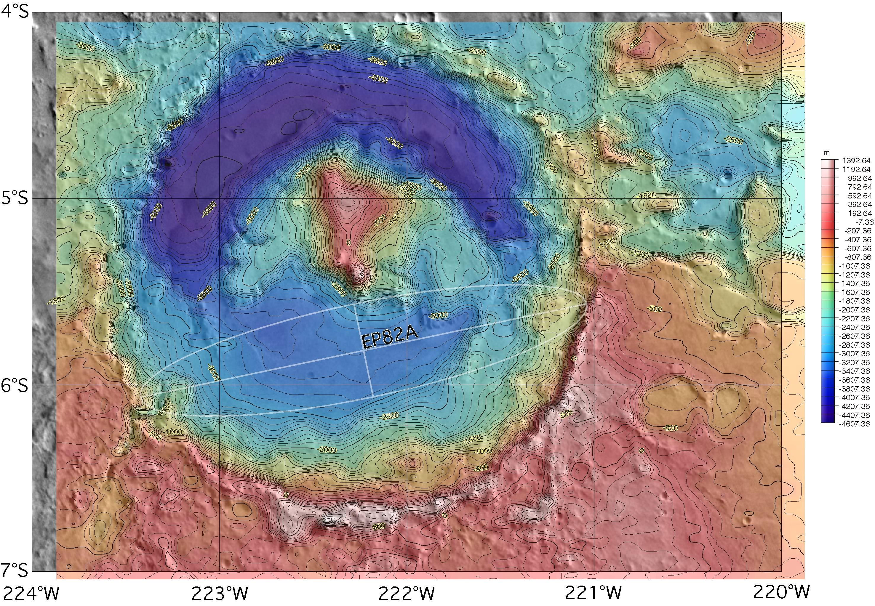
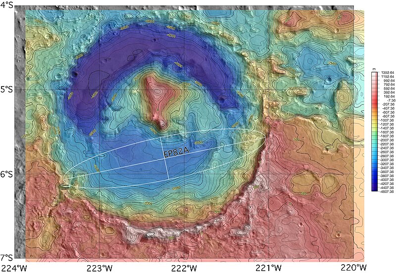
English: Topographic map of Gale crater on Mars, with the proposed but rejected landing ellipse for the MER-A superimposed. The MER lander was ultimately sent elsewhere, but the opposite side of the crater was selected for the 2011 Mars Science Laboratory rover. |
| Source | http://marsoweb.nas.nasa.gov/landingsites/mer2003/topsites/Gale/ (image link) |
| Author | NASA; MOLA topographic map gridded, colored and contoured by Scott Anderson |
| Other versions |
 |
| Location on Mars | View this and other nearby images on: Google Maps |
|---|
Licensing[edit]
| This file is in the public domain in the United States because it was solely created by NASA. NASA copyright policy states that "NASA material is not protected by copyright unless noted". (See Template:PD-USGov, NASA copyright policy page or JPL Image Use Policy.) | ||
 |
Warnings:
|
File history
Click on a date/time to view the file as it appeared at that time.
| Date/Time | Thumbnail | Dimensions | User | Comment | |
|---|---|---|---|---|---|
| current | 02:08, 13 November 2007 | | 2,953 × 2,046 (1.26 MB) | Bryan Derksen (talk | contribs) | {{Information |Description={{en|Topographic map of Gale crater on Mars, with the proposed landing ellipse for the en:Mars Exploration Rover MER-A superimposed. The MER lander was ultimately sent elsewhere, but the site is also a candidate for the upco |
You cannot overwrite this file.
File usage on Commons
The following page uses this file:
File usage on other wikis
The following other wikis use this file:
- Usage on be.wikipedia.org
- Usage on hr.wikipedia.org
- Usage on hy.wikipedia.org
- Usage on id.wikipedia.org
- Usage on pt.wikipedia.org
- Usage on ro.wikipedia.org
- Usage on uk.wikipedia.org