File:Graham Island BC.PNG
Jump to navigation
Jump to search

Size of this preview: 791 × 600 pixels. Other resolutions: 317 × 240 pixels | 633 × 480 pixels | 806 × 611 pixels.
Original file (806 × 611 pixels, file size: 36 KB, MIME type: image/png)
Captions
Captions
Add a one-line explanation of what this file represents
| Description |
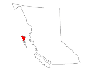
English: Graham Island marked at the map of British Columbia, Canada. Polski: Wyspa Grahama zaznaczona na mapie Kolumbii Brytyjskiej. |
| Date | (UTC) |
| Source | |
| Author |
|
| Other versions | Derivative works of this file: Moresby Island BC.PNG |
| This is a retouched picture, which means that it has been digitally altered from its original version. The original can be viewed here: Britsih Columbia outline.PNG:
|
I, the copyright holder of this work, hereby publish it under the following license:
| I, the copyright holder of this work, release this work into the public domain. This applies worldwide. In some countries this may not be legally possible; if so: I grant anyone the right to use this work for any purpose, without any conditions, unless such conditions are required by law. |
Original upload log[edit]
This image is a derivative work of the following images:
- File:Britsih_Columbia_outline.PNG licensed with PD-self
- 2008-07-22T03:34:35Z Urban Walnut 806x611 (37329 Bytes) {{Information |Description={{en|1=Outline of the province of British Columbia, Canada.}} |Source=Own work by uploader |Author=[[User:Urban Walnut|Urban Walnut]] |Date=21 July 2008 |Permission= |other_versions= }} {{ImageUplo
Uploaded with derivativeFX
File history
Click on a date/time to view the file as it appeared at that time.
| Date/Time | Thumbnail | Dimensions | User | Comment | |
|---|---|---|---|---|---|
| current | 09:12, 16 October 2010 | | 806 × 611 (36 KB) | Olos88 (talk | contribs) | red color instead of orange |
| 09:09, 16 October 2010 |  | 806 × 611 (36 KB) | Olos88 (talk | contribs) | {{Information |Description={{en|1=Graham Island marked at the map of British Columbia, Canada.}} {{pl|1=Wyspa Grahama zaznaczona na mapie Kolumbii Brytyjskiej.}} |Source=*File:Britsih_Columbia_outline.PNG |Date=2010-10-16 09:07 (UTC) |Author=*[[:Fil |
You cannot overwrite this file.
File usage on Commons
The following page uses this file:
File usage on other wikis
The following other wikis use this file:
- Usage on lt.wikipedia.org