File:Hraniční přechod, Nedašova Lhota - Červený Kameň, okres Zlín.jpg
Vai alla navigazione
Vai alla ricerca
Dimensioni di questa anteprima: 800 × 532 pixel. Altre risoluzioni: 320 × 213 pixel | 640 × 426 pixel | 1 024 × 681 pixel | 1 280 × 852 pixel | 2 560 × 1 703 pixel | 4 310 × 2 868 pixel.
File originale (4 310 × 2 868 pixel, dimensione del file: 6,38 MB, tipo MIME: image/jpeg)
Didascalie
Didascalie
Aggiungi una brevissima spiegazione di ciò che questo file rappresenta
Dettagli
[modifica]
| Descrizione |
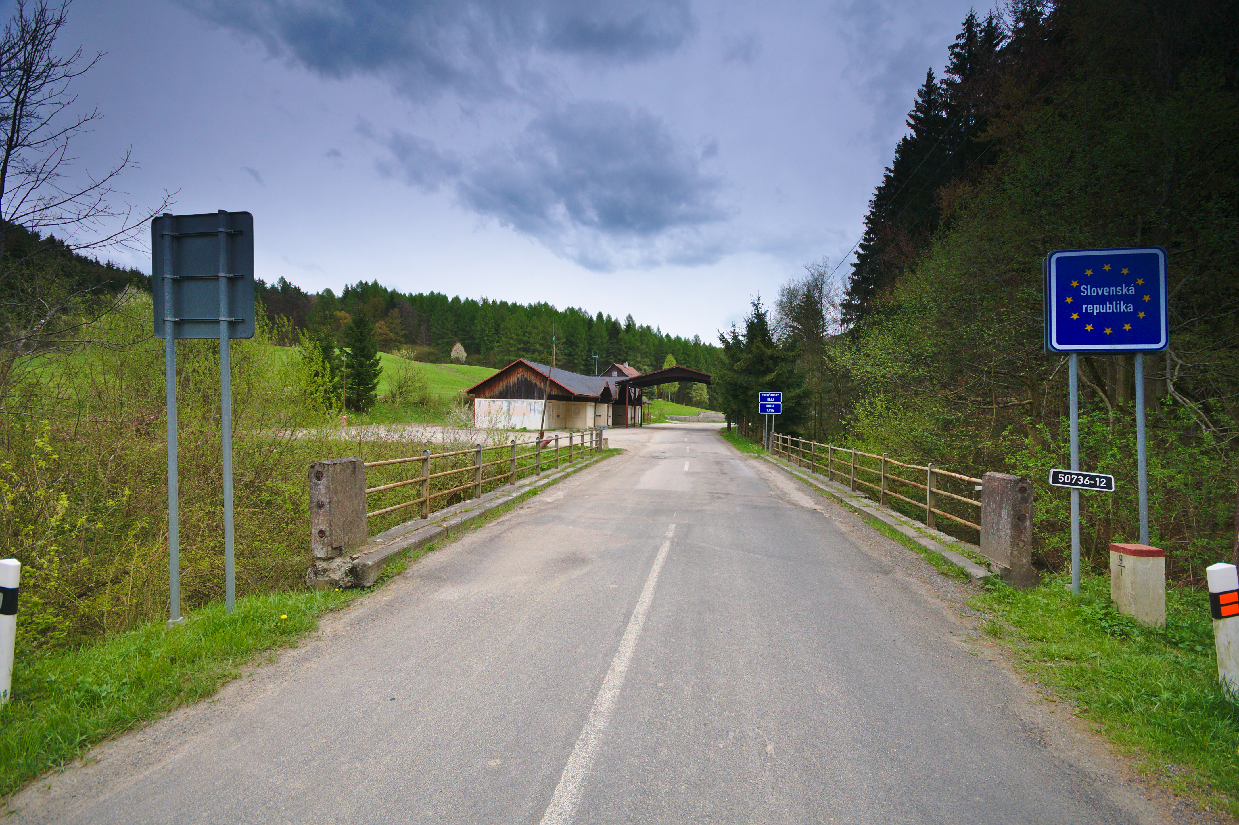
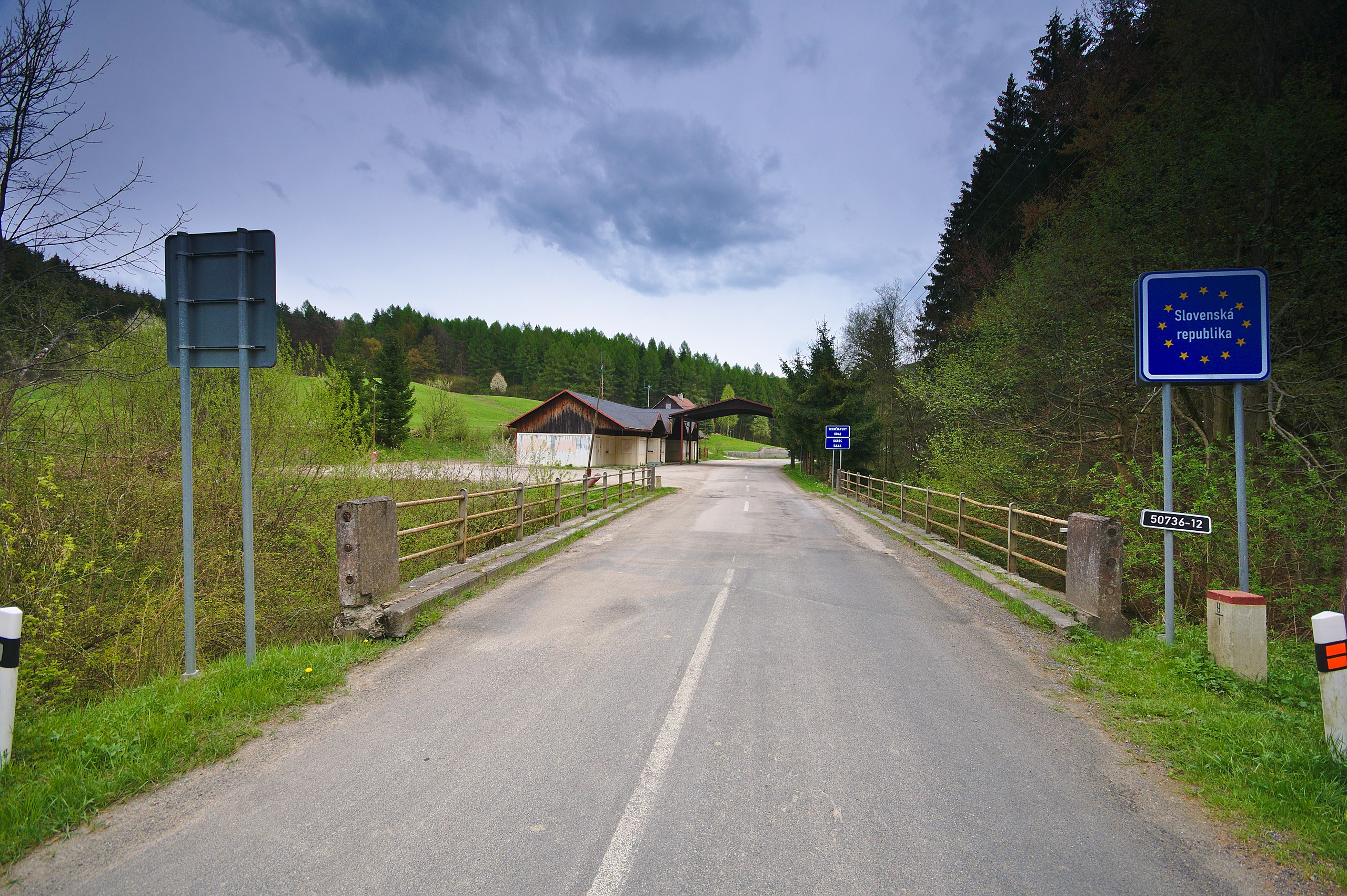
Čeština: Hraniční přechod, Nedašova Lhota - Červený Kameň, okres Zlín |
| Data | |
| Fonte | Opera propria |
| Autore | Jiří Komárek |
| Licenza (Riusare questo file) |
Io, detentore del copyright su quest'opera, dichiaro di pubblicarla con la seguente licenza: Questo file è disponibile in base alla licenza Creative Commons Attribuzione-Condividi allo stesso modo 4.0 Internazionale
 I. Licence
 In printed material: Photo: © Jiří Komárek, JiriKomarek.net, Licence: Creative Commons BY-SA 4.0 (URL: https://creativecommons.org/licenses/by/4.0/legalcode), Source: Wikimedia Commons The author of this picture, Jiří Komárek, published this file under the Creative Commons Licence Attribution-ShareAlike 4.0. The image can be used freely under the license, as long as the author is mentioned in the following form in the caption or for printed products in the image credits: © Jiří Komárek, JiriKomarek.net, CC BY-SA 4.0.
It is also necessary to provide a copy of the license or at least its full Internet address (https://creativecommons.org/licenses/by/4.0/legalcode). In online media is in use in addition to the aforementioned copyright and license specifying a reference (link) to put on the original image - so this page with descriptions and license conditions. For more information or examples of use can be found at re-use (with example file). Modifications have to be declared as such.
If you need another license to use or a different resolution, so please contact the author before using.
From printed materials and other tangible products that use that work, the user is asked to send a copy to the author. The mailing address can be requested via the contact options.
In the case of a breach of the license conditions, the rights granted hereunder will expire automatically. The author reserves the right in this case to assert injunctive relief and damages.
II. Disclaimer
It is possible that third parties are to be considered for example in case of trademark, design or personality rights. You are responsible to check and respect these rights in the publication in the respective medium or country.
Please note the General disclaimer.
III. Contact
E-mail me to JiriKomarek.net@gmail.com or visit the author's website
 Please do not upload an updated image here without consultation with the author. The author would like to make corrections only at his own source.
|
| Luogo dello scatto | | Posizione di questa e altre immagini su: OpenStreetMap |
|---|
Cronologia del file
Fare clic su un gruppo data/ora per vedere il file come si presentava nel momento indicato.
| Data/Ora | Miniatura | Dimensioni | Utente | Commento | |
|---|---|---|---|---|---|
| attuale | 22:15, 6 giu 2016 | | 4 310 × 2 868 (6,38 MB) | Jiří Komárek (discussione | contributi) | VicuñaUploader 1.23 |
Impossibile sovrascrivere questo file.
Utilizzo del file
Le seguenti 2 pagine usano questo file:
Utilizzo globale del file
Anche i seguenti wiki usano questo file:
- Usato nelle seguenti pagine di cs.wikipedia.org:
- Usato nelle seguenti pagine di eo.wikipedia.org:
- Usato nelle seguenti pagine di it.wikipedia.org:
- Usato nelle seguenti pagine di sk.wikipedia.org:
- Usato nelle seguenti pagine di www.wikidata.org: