File:Ireland location map.svg
קפיצה לניווט
קפיצה לחיפוש

גודל התצוגה המקדימה הזאת מסוג PNG של קובץ ה־SVG הזה: 481 × 599 פיקסלים. רזולוציות אחרות: 192 × 240 פיקסלים | 385 × 480 פיקסלים | 616 × 768 פיקסלים | 822 × 1,024 פיקסלים | 1,643 × 2,048 פיקסלים | 1,450 × 1,807 פיקסלים.
לקובץ המקורי (קובץ SVG, הגודל המקורי: 1,450 × 1,807 פיקסלים, גודל הקובץ: 938 ק"ב)
כיתובים
כיתובים
נא להוסיף משפט שמסביר מה הקובץ מייצג
תקציר[עריכה]
| תיאור |
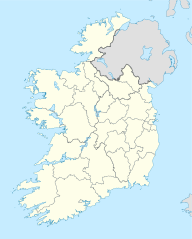
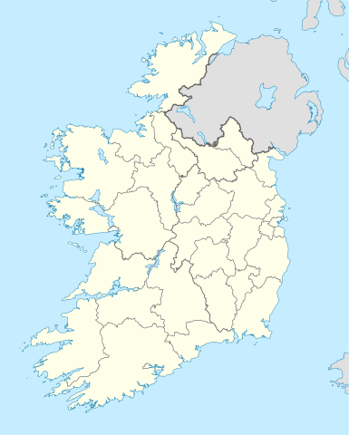
Deutsch: Positionskarte von Irland
Quadratische Plattkarte, N-S-Streckung 170 %. Geographische Begrenzung der Karte:
English: Location map of Ireland
Equirectangular projection, N/S stretching 170 %. Geographic limits of the map:
|
| תאריך יצירה | 01-07-2008 |
| מקור | own work, using United States National Imagery and Mapping Agency data |
| יוצר | NordNordWest |
| גרסאות אחרות |
DerivativeVersions |


|
This map has been made or improved in the German Kartenwerkstatt (Map Lab). You can propose maps to improve as well.
|
רישיון[עריכה]
אני, בעל זכויות היוצרים על היצירה הזאת, מפרסם אותה בזאת תחת הרישיונות הבאים:

|
מוענקת בכך הרשות להעתיק, להפיץ או לשנות את המסמך הזה, לפי תנאי הרישיון לשימוש חופשי במסמכים של גנו, גרסה 1.2 או כל גרסה מאוחרת יותר שתפורסם על־ידי המוסד לתוכנה חופשית; ללא פרקים קבועים, ללא טקסט עטיפה קדמית וללא טקסט עטיפה אחורית. עותק של הרישיון כלול בפרק שכותרתו הרישיון לשימוש חופשי במסמכים של גנו. |
הקובץ הזה מתפרסם לפי תנאי רישיון קריאייטיב קומונז ייחוס-שיתוף זהה 3.0 לא מותאם.
- הנכם רשאים:
- לשתף – להעתיק, להפיץ ולהעביר את העבודה
- לערבב בין עבודות – להתאים את העבודה
- תחת התנאים הבאים:
- ייחוס – יש לתת ייחוס הולם, לתת קישור לרישיון, ולציין אם נעשו שינויים. אפשר לעשות את זה בכל צורה סבירה, אבל לא בשום צורה שמשתמע ממנה שמעניק הרישיון תומך בך או בשימוש שלך.
- שיתוף זהה – אם תיצרו רמיקס, תשנו, או תבנו על החומר, חובה עליכם להפיץ את התרומות שלך לפי תנאי רישיון זהה או תואם למקור.
הנכם מוזמנים לבחור את הרישיון הרצוי בעיניכם.
היסטוריית הקובץ
ניתן ללחוץ על תאריך/שעה כדי לראות את הקובץ כפי שנראה באותו זמן.
| תאריך/שעה | תמונה ממוזערת | ממדים | משתמש | הערה | |
|---|---|---|---|---|---|
| נוכחית | 06:45, 18 ביולי 2020 | | 1,807 × 1,450 (938 ק"ב) | Chipmunkdavis (שיחה | תרומות) | Adding toggle to display pre-2014 boundaries, adjusting some code for names and shape |
| 06:47, 11 ביולי 2020 |  | 1,807 × 1,450 (908 ק"ב) | Chipmunkdavis (שיחה | תרומות) | Overhauling code, together with code from File:Galway City in Ireland.svg (itself derived from this file), to be both simpler and more easily editable. All islands are now grouped with their mainland county, and counties are grouped into provinces. Groups exist for traditional counties where divided. | |
| 12:08, 12 בספטמבר 2014 |  | 1,807 × 1,450 (597 ק"ב) | Ravenpuff (שיחה | תרומות) | Retry that | |
| 11:57, 12 בספטמבר 2014 |  | 1,807 × 1,450 (597 ק"ב) | Ravenpuff (שיחה | תרומות) | Merged North Tipperary and South Tiperrary, Limerick and County Limerick, Waterford and County Waterford (Local Government Reform Act 2014) | |
| 18:04, 1 בספטמבר 2009 |  | 1,807 × 1,450 (598 ק"ב) | NordNordWest (שיחה | תרומות) | ||
| 19:08, 25 באוגוסט 2008 |  | 1,807 × 1,450 (599 ק"ב) | NordNordWest (שיחה | תרומות) | size correction | |
| 18:13, 19 ביולי 2008 |  | 602 × 483 (581 ק"ב) | NordNordWest (שיחה | תרומות) | ||
| 14:13, 1 ביולי 2008 |  | 602 × 483 (554 ק"ב) | NordNordWest (שיחה | תרומות) | {{Information |Description= {{de|Positionskarte von Irland}} Quadratische Plattkarte, N-S-Streckung 170 %. Geographische Begrenzung der Karte: * N: 55.6° N * S: 51.2° N * W: 11.0° W * O: 5.0° W {{en|Location map of [[:en:Ireland|Ireland |
אין באפשרותך לדרוס את הקובץ הזה.
שימוש בקובץ
הדפים הבאים משתמשים בקובץ הזה:
- Republic of Ireland / Poblacht na hÉireann
- User:NordNordWest/Gallery/Location maps
- User:SpinnerLaserz/Flags/Flags of Ireland/Ireland
- File:600x748-Carte-de-l'Irlande-R.jpg
- File:Carlow in Ireland.svg
- File:Cavan in Ireland.svg
- File:Clare in Ireland.svg
- File:Connacht in Ireland.svg
- File:Cork City in Ireland.svg
- File:Cork in Ireland.svg
- File:Donegal in Ireland.svg
- File:Dublin City in Ireland.svg
- File:Dun Laoghaire-Rathdown in Ireland.svg
- File:Fingal in Ireland.svg
- File:Galway City in Ireland.svg
- File:Galway in Ireland.svg
- File:Ireland location map.svg
- File:Ireland location map Border region.svg
- File:Ireland location map Dublin region.svg
- File:Ireland location map Mid-East.svg
- File:Ireland location map South-East.svg
- File:Ireland location map South East.svg
- File:Ireland location map South West.svg
- File:Ireland location map West region.svg
- File:Ireland with counties.svg
- File:Kerry in Ireland.svg
- File:Kildare in Ireland.svg
- File:Kilkenny in Ireland.svg
- File:Laois in Ireland.svg
- File:Leinster in Ireland.svg
- File:Leitrim in Ireland.svg
- File:Limerick City in Ireland.svg
- File:Limerick in Ireland.svg
- File:Longford in Ireland.svg
- File:Louth in Ireland.svg
- File:Mayo in Ireland.svg
- File:Meath in Ireland.svg
- File:Monaghan in Ireland.svg
- File:Munster in Ireland.svg
- File:North Tipperary in Ireland.svg
- File:Offaly in Ireland.svg
- File:Roscommon in Ireland.svg
- File:Sligo in Ireland.svg
- File:South Dublin in Ireland.svg
- File:South Tipperary in Ireland.svg
- File:Ulster in Ireland.svg
- File:Waterford City in Ireland.svg
- File:Waterford in Ireland.svg
- File:Westmeath in Ireland.svg
- File:Wexford in Ireland.svg
- File:Wicklow in Ireland.svg
שימוש גלובלי בקובץ
אתרי הוויקי השונים הבאים משתמשים בקובץ זה:
- שימוש באתר af.wikipedia.org
- שימוש באתר am.wikipedia.org
- שימוש באתר ar.wikipedia.org
- שימוש באתר arz.wikipedia.org
- שימוש באתר ba.wikipedia.org
- שימוש באתר be-tarask.wikipedia.org
- שימוש באתר be.wikipedia.org
- שימוש באתר bg.wikipedia.org
צפייה בשימושים גלובליים נוספים של קובץ זה.