File:Island Pond RR Station.JPG
Jump to navigation
Jump to search

Size of this preview: 800 × 534 pixels. Other resolutions: 320 × 214 pixels | 640 × 427 pixels | 1,024 × 683 pixels | 1,280 × 854 pixels | 1,876 × 1,252 pixels.
Original file (1,876 × 1,252 pixels, file size: 731 KB, MIME type: image/jpeg)
Captions
Captions
Add a one-line explanation of what this file represents
|
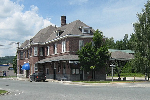
This is an image of a place or building that is listed on the National Register of Historic Places in the United States of America. Its reference number is 79000275. |
| Description |
English: Former Grand Trunk station in Island Pond (Brighton), Vermont. Contributing building in the Island Pond Historic District of the National Register of Historic Places. Building now houses a bank and the UTG (Unified Towns and Gores) of Essex County office. |
||
| Date | |||
| Source | Own work | ||
| Author | Mfwills | ||
| Permission (Reusing this file) |
I, the copyright holder of this work, hereby publish it under the following licenses: This file is licensed under the Creative Commons Attribution-Share Alike 3.0 Unported, 2.5 Generic, 2.0 Generic and 1.0 Generic license.
You may select the license of your choice. |

| Object location | | View this and other nearby images on: OpenStreetMap |
|---|
File history
Click on a date/time to view the file as it appeared at that time.
| Date/Time | Thumbnail | Dimensions | User | Comment | |
|---|---|---|---|---|---|
| current | 07:05, 12 October 2013 | | 1,876 × 1,252 (731 KB) | Carol.Christiansen (talk | contribs) | Cropped |
| 19:00, 25 December 2009 |  | 2,592 × 1,944 (1.89 MB) | Mfwills (talk | contribs) | {{Information |Description={{en|1=Former Grand Trunk station in Island Pond (Brighton), Vermont. Contributing building in the Island Pond Historic District of the National Register of Historic Places. Building now houses a bank and the office of the Unorg |
You cannot overwrite this file.
File usage on Commons
The following page uses this file:
File usage on other wikis
The following other wikis use this file:
- Usage on ar.wikipedia.org
- Usage on azb.wikipedia.org
- Usage on ca.wikipedia.org
- Usage on ceb.wikipedia.org
- Usage on ce.wikipedia.org
- Usage on cy.wikipedia.org
- Usage on de.wikipedia.org
- Usage on en.wikipedia.org
- Usage on es.wikipedia.org
- Usage on fa.wikipedia.org
- Usage on fr.wikipedia.org
- Usage on it.wikipedia.org
- Usage on lld.wikipedia.org
- Usage on pl.wikipedia.org
- Usage on sh.wikipedia.org
- Usage on sr.wikipedia.org
- Usage on tt.wikipedia.org
- Usage on uk.wikipedia.org
- Usage on www.wikidata.org
Metadata
Categories:
- July 2008 in Vermont
- Island Pond, Vermont
- Bank buildings in Vermont
- Brick buildings in Vermont
- Former train stations in Vermont
- Historic districts in Vermont
- National Register of Historic Places in Essex County, Vermont
- Rail stations on the National Register of Historic Places in Vermont
- Former Grand Trunk Railway stations
- Red brick buildings in the United States
- SUVs in Vermont
- Trees in Vermont
- Clouds and blue sky in Vermont
- Buildings in Essex County, Vermont
- Awnings in Vermont
- GMC Yukon (GMT820)