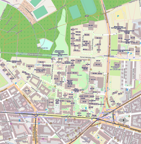
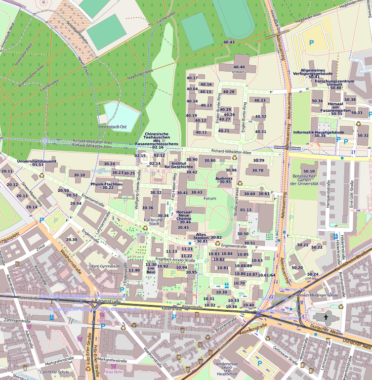
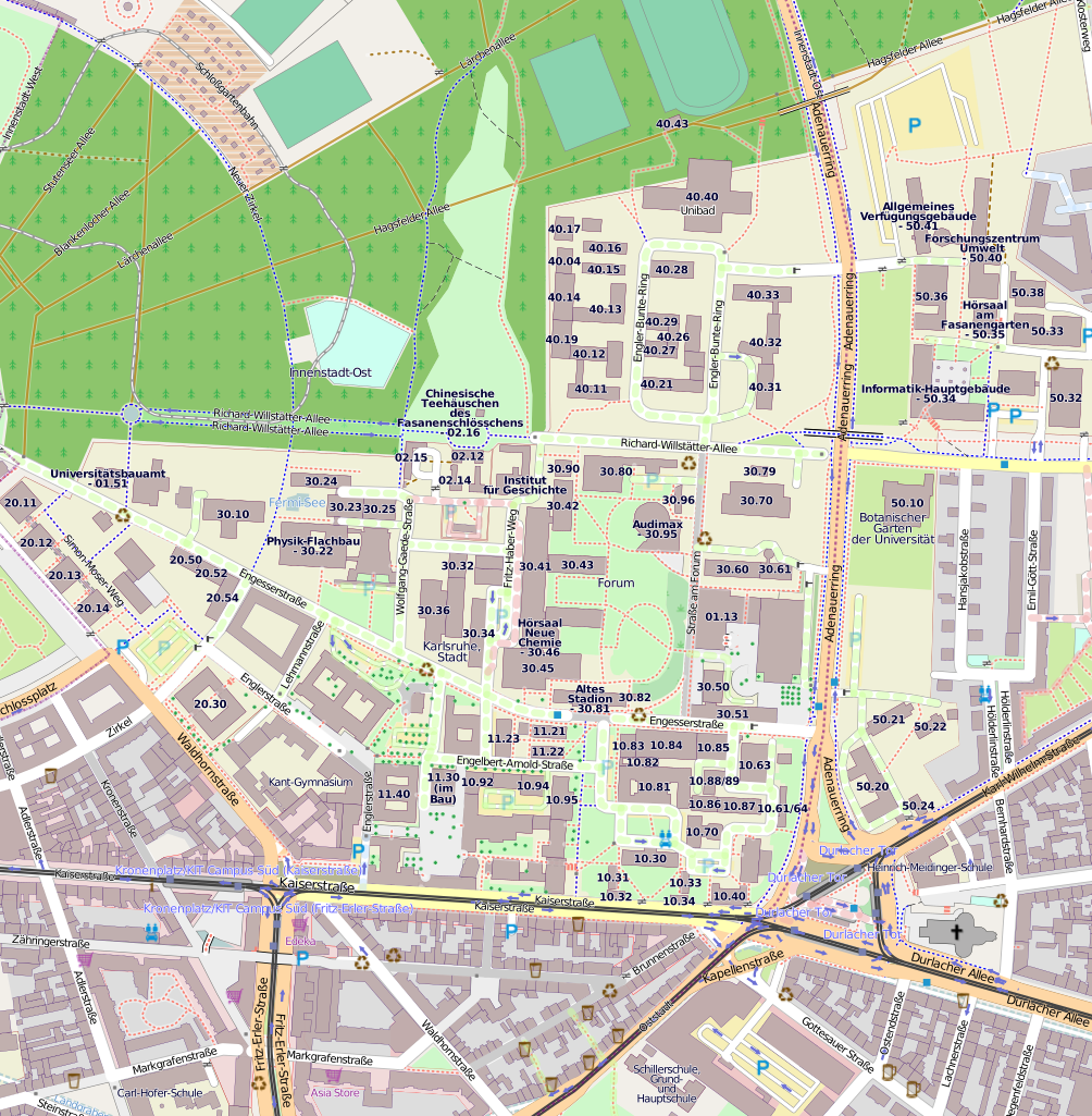
File:KIT - Campus Sued.svg
Jump to navigation
Jump to search

Size of this PNG preview of this SVG file: 588 × 600 pixels. Other resolutions: 235 × 240 pixels | 471 × 480 pixels | 753 × 768 pixels | 1,004 × 1,024 pixels | 2,009 × 2,048 pixels | 1,124 × 1,146 pixels.
Original file (SVG file, nominally 1,124 × 1,146 pixels, file size: 4.15 MB)
Captions
Captions
Add a one-line explanation of what this file represents
Summary[edit]
Deutsch: Karlsruher Institut für Technologie, Campus Süd
Licensing[edit]
| Description |
This map was created from OpenStreetMap project data, collected by the community. This map may be incomplete, and may contain errors. Don't rely solely on it for navigation. |
| Date | |
| Source | openstreetmap.org |
| Creator |
OpenStreetMap contributors |
| Permission (Reusing this file) |
OpenStreetMap data and maps are licensed under the Creative Commons Attribution-ShareAlike 2.0 license (CC-BY-SA 2.0). This file is licensed under the Creative Commons Attribution-Share Alike 2.0 Generic license.
|
| Georeferencing | If inappropriate please set warp_status = skip to hide. |
| Annotations | This image is annotated: View the annotations at Commons |


File history
Click on a date/time to view the file as it appeared at that time.
| Date/Time | Thumbnail | Dimensions | User | Comment | |
|---|---|---|---|---|---|
| current | 08:52, 2 May 2011 | | 1,124 × 1,146 (4.15 MB) | MartinThoma (talk | contribs) | {{Information |Description ={{de|1=Karlsruher Institut für Technologie, Campus Süd}} |Source =http://www.openstreetmap.org/?lat=49.01245&lon=8.41399&zoom=16&layers=M |Author =OpenStreetmap Project |Date =2011-05-02 |Permissi |
You cannot overwrite this file.
File usage on Commons
The following page uses this file:
File usage on other wikis
The following other wikis use this file:
- Usage on ar.wikipedia.org
- Usage on de.wikipedia.org
- Usage on ro.wikipedia.org