File:Karte Oblast Saratow.png
Jump to navigation
Jump to search
Size of this preview: 800 × 565 pixels. Other resolutions: 320 × 226 pixels | 640 × 452 pixels | 1,024 × 724 pixels | 1,280 × 905 pixels | 1,500 × 1,060 pixels.
Original file (1,500 × 1,060 pixels, file size: 96 KB, MIME type: image/png)
Captions
Captions
Add a one-line explanation of what this file represents
Summary
[edit]
| Description |
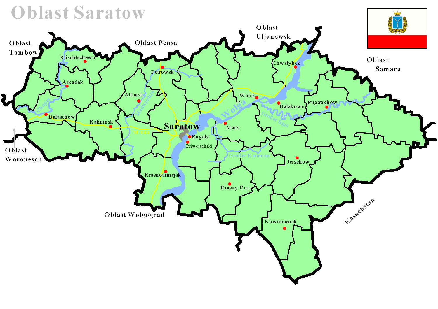
Deutsch: Karte des Oblast Saratow mit Rajons, Städten, Flüssen und Fernstraßen
English: map of the Saratov Oblast, including Raions, Cities, Rivers and Highways |
| Date | |
| Source | Own work |
| Author | (JA ALT) |
Licensing
[edit]
| This work has been released into the public domain by its author, I, JA ALT. This applies worldwide. In some countries this may not be legally possible; if so: I, JA ALT grants anyone the right to use this work for any purpose, without any conditions, unless such conditions are required by law. |
File history
Click on a date/time to view the file as it appeared at that time.
| Date/Time | Thumbnail | Dimensions | User | Comment | |
|---|---|---|---|---|---|
| current | 23:08, 8 June 2015 | | 1,500 × 1,060 (96 KB) | Cmdrjameson (talk | contribs) | Compressed with pngout. Reduced by 54kB (36% decrease). |
| 09:06, 11 June 2007 |  | 1,500 × 1,060 (151 KB) | JA ALT (talk | contribs) | {{Information |Description={{de| Karte des Oblast Saratow mit Rajons, Städten, Flüssen und Fernstraßen}} {{en|map of the Saratov Oblast, including Raions, Cities, Rivers and Highways}} |Source=self-made |Date=2007-06-11 |Author= (JA ALT |
You cannot overwrite this file.
File usage on Commons
There are no pages that use this file.
File usage on other wikis
The following other wikis use this file:
- Usage on de.wikipedia.org
- Usage on eo.wikipedia.org
- Usage on mdf.wikipedia.org
- Usage on uk.wikipedia.org