File:La2-demis-onega.png
קפיצה לניווט
קפיצה לחיפוש
גודל התצוגה המקדימה הזאת: 411 × 600 פיקסלים. רזולוציות אחרות: 164 × 240 פיקסלים | 585 × 854 פיקסלים.
לקובץ המקורי (585 × 854 פיקסלים, גודל הקובץ: 93 ק"ב, סוג MIME: image/png)
כיתובים
כיתובים
נא להוסיף משפט שמסביר מה הקובץ מייצג
תקציר[עריכה]
| תיאור |
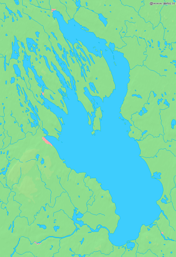
English: Lake Onega in Russia.
Bounding box West 33.5°, South 60.8°, East 36.7°, North 63°. Center at 61°54′00″N 35°06′00″E / 61.90000°N 35.10000°E. |
| תאריך יצירה | |
| מקור | Demis map server |
| יוצר | Demis map server |
| גרסאות אחרות |
Derivative works of this file: |
This image is in the public domain because it came from the site https://www.demis.nl/products/web-map-server/examples/ and was released by the copyright holder. Permission is granted to copy, distribute and/or modify this map since it is based on free of copyright images from: www.demis.nl. See also approval email on de.wp and its clarification.
|
| This work has been released into the public domain by its copyright holder, www.demis.nl. This applies worldwide. יש מדינות שבהן הדבר אינו אפשרי על פי חוק, אם כך: www.demis.nl מעניק לכל אחד את הזכות להשתמש ביצירה הזאת לכל מטרה, ללא שום תנאי, אלא אם כן תנאים כאלה נדרשים לפי החוק.
|
היסטוריית הקובץ
ניתן ללחוץ על תאריך/שעה כדי לראות את הקובץ כפי שנראה באותו זמן.
| תאריך/שעה | תמונה ממוזערת | ממדים | משתמש | הערה | |
|---|---|---|---|---|---|
| נוכחית | 11:10, 30 באוגוסט 2005 | | 854 × 585 (93 ק"ב) | LA2 (שיחה | תרומות) | Lake Onega in Russia. {{demis-pd}} category:Maps of Russia |
אין באפשרותך לדרוס את הקובץ הזה.
שימוש בקובץ
הדפים הבאים משתמשים בקובץ הזה:
שימוש גלובלי בקובץ
אתרי הוויקי השונים הבאים משתמשים בקובץ זה:
- שימוש באתר af.wikipedia.org
- שימוש באתר az.wikipedia.org
- שימוש באתר bo.wikipedia.org
- שימוש באתר de.wikipedia.org
- שימוש באתר eo.wikipedia.org
- שימוש באתר es.wikipedia.org
- שימוש באתר et.wikipedia.org
- שימוש באתר fa.wikipedia.org
- שימוש באתר fiu-vro.wikipedia.org
- שימוש באתר fi.wikipedia.org
- שימוש באתר fr.wikipedia.org
- שימוש באתר gl.wikipedia.org
- שימוש באתר he.wikipedia.org
- שימוש באתר it.wikipedia.org
- שימוש באתר ja.wikipedia.org
- שימוש באתר la.wikipedia.org
- שימוש באתר nn.wikipedia.org
- שימוש באתר no.wikipedia.org
- שימוש באתר pl.wikipedia.org
- שימוש באתר pt.wikipedia.org
- שימוש באתר sh.wikipedia.org
- שימוש באתר sk.wikipedia.org
- שימוש באתר sr.wikipedia.org
- שימוש באתר sv.wikipedia.org
- שימוש באתר sw.wikipedia.org
- שימוש באתר vep.wikipedia.org
- שימוש באתר zh-yue.wikipedia.org
- שימוש באתר zh.wikipedia.org