File:Location map India Telangana.png
Jump to navigation
Jump to search

Size of this preview: 800 × 556 pixels. Other resolutions: 320 × 223 pixels | 640 × 445 pixels | 1,018 × 708 pixels.
Original file (1,018 × 708 pixels, file size: 206 KB, MIME type: image/png)
Captions
Captions
Add a one-line explanation of what this file represents
Summary[edit]
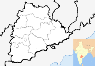
| Description | Location map of Andhra Pradesh. Coordinates: top=19.957, bottom=12.522, left=76.593, right=84.935. | |||
| Date | ||||
| Source |
|
|||
| Author |
|
|||
| Other versions |
Location map India Andhra Pradesh.png |

.svg)
.svg)
.svg)
| This is a retouched picture, which means that it has been digitally altered from its original version. The original can be viewed here: Andhra Pradesh locator map (1956-2014).svg:
|
Licensing[edit]
I, the copyright holder of this work, hereby publish it under the following license:
This file is licensed under the Creative Commons Attribution-Share Alike 3.0 Unported license.
- You are free:
- to share – to copy, distribute and transmit the work
- to remix – to adapt the work
- Under the following conditions:
- attribution – You must give appropriate credit, provide a link to the license, and indicate if changes were made. You may do so in any reasonable manner, but not in any way that suggests the licensor endorses you or your use.
- share alike – If you remix, transform, or build upon the material, you must distribute your contributions under the same or compatible license as the original.
File history
Click on a date/time to view the file as it appeared at that time.
| Date/Time | Thumbnail | Dimensions | User | Comment | |
|---|---|---|---|---|---|
| current | 02:04, 26 September 2014 | | 1,018 × 708 (206 KB) | Udaykiran07 (talk | contribs) | Reverted to version as of 02:02, 26 September 2014 |
| 02:04, 26 September 2014 |  | 1,018 × 708 (206 KB) | Udaykiran07 (talk | contribs) | Reverted to version as of 02:02, 26 September 2014 | |
| 02:03, 26 September 2014 |  | 1,018 × 708 (206 KB) | Udaykiran07 (talk | contribs) | Reverted to version as of 02:02, 26 September 2014 | |
| 02:03, 26 September 2014 |  | 643 × 600 (75 KB) | Udaykiran07 (talk | contribs) | Reverted to version as of 08:02, 7 August 2014 | |
| 02:02, 26 September 2014 |  | 1,018 × 708 (206 KB) | Udaykiran07 (talk | contribs) | centered the state of telangana added the state boundaries of chhattisgarh ad orissa | |
| 08:02, 7 August 2014 |  | 643 × 600 (75 KB) | Kaderus (talk | contribs) | Reverted to version as of 08:43, 26 June 2014 | |
| 07:54, 7 August 2014 |  | 643 × 600 (73 KB) | Kaderus (talk | contribs) | Removed AP state border lines. | |
| 08:43, 26 June 2014 |  | 643 × 600 (75 KB) | RaviC (talk | contribs) | - AP districts | |
| 04:40, 2 June 2014 |  | 643 × 600 (107 KB) | RaviC (talk | contribs) | + inset map | |
| 22:09, 1 June 2014 |  | 643 × 600 (71 KB) | RaviC (talk | contribs) | {{Information |Description=Location map of Andhra Pradesh. Coordinates: top=19.957, bottom=12.522, left=76.593, right=84.935. |Source=*Location map India Andhra Pradesh.png<br>Andhra_Pradesh_locator_map.svg and... |
You cannot overwrite this file.
File usage on Commons
There are no pages that use this file.
File usage on other wikis
The following other wikis use this file:
- Usage on az.wikipedia.org