File:Location map United States Cleveland.png
Jump to navigation
Jump to search
No higher resolution available.
Location_map_United_States_Cleveland.png (610 × 388 pixels, file size: 300 KB, MIME type: image/png)
Captions
Captions
Add a one-line explanation of what this file represents
| Description |
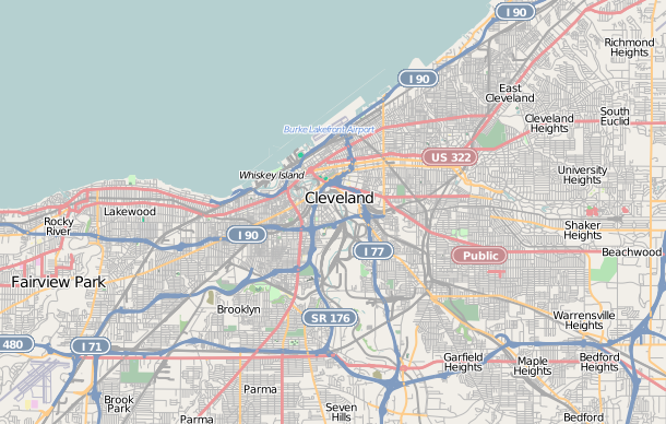
This map of Cleveland, Ohio was created from OpenStreetMap project data, collected by the community. This map may be incomplete, and may contain errors. Don't rely solely on it for navigation. |
|||||||||
| Date | (see file history) | |||||||||
| Source | openstreetmap.org | |||||||||
| Creator |
OpenStreetMap contributors |
|||||||||
| Permission (Reusing this file) |
OpenStreetMap data and maps are licensed under the Creative Commons Attribution-ShareAlike 2.0 license (CC-BY-SA 2.0). This file is licensed under the Creative Commons Attribution-Share Alike 2.0 Generic license.
|
|||||||||
| Geotemporal data | ||||||||||
| Bounding box |
|
|||||||||
| Georeferencing | If inappropriate please set warp_status = skip to hide. | |||||||||
File history
Click on a date/time to view the file as it appeared at that time.
| Date/Time | Thumbnail | Dimensions | User | Comment | |
|---|---|---|---|---|---|
| current | 00:10, 6 March 2011 | | 610 × 388 (300 KB) | Hillrhpc (talk | contribs) | {{OpenStreetMap |location= Cleveland, Ohio |authors=User:Hillrhpc |top= 41.573 |bottom= 41.390 |left= -81.873 |right= -81.489 }} Category:OpenStreetMap maps of the United States Category:Cleveland, Ohio |
You cannot overwrite this file.
File usage on Commons
There are no pages that use this file.
File usage on other wikis
The following other wikis use this file:
- Usage on ar.wikipedia.org
- Usage on azb.wikipedia.org
- Usage on ceb.wikipedia.org
- Usage on en.wikipedia.org
- Progressive Field
- USS Cod
- Cleveland Browns Stadium
- Rocket Mortgage FieldHouse
- Cleveland Stadium
- League Park
- Saint Ignatius High School (Cleveland)
- Cleveland Arcade
- Warehouse District, Cleveland
- Irishtown Bend
- Playhouse Square
- Great Lakes Science Center
- Buckeye–Shaker
- Ohio City, Cleveland
- Broadway–Slavic Village
- Temple Tifereth-Israel
- West Side Market
- Public Square, Cleveland
- Hope Memorial Bridge
- Detroit–Superior Bridge
- Children's Museum of Cleveland
- Dunham Tavern
- Rocket Engine Test Facility
- St. John's Episcopal Church (Cleveland, Ohio)
- St. Michael the Archangel Church (Cleveland, Ohio)
- Wade Memorial Chapel
- Adelbert Hall
- Allen Memorial Medical Library
- Alta Public Library
- Archwood Avenue Historic District
- Archwood Congregational Church
- Franklin Castle
- Fenn Tower
- Dittrick Museum of Medical History
- Society for Savings Building
- Superior Building
- Guardian Bank Building
- First Church of Christ, Scientist (Cleveland, Ohio)
- Maltz Performing Arts Center
- Third Church of Christ, Scientist (Cleveland, Ohio)
- Cleveland Home for Aged Colored People
- Zero Gravity Research Facility
- Cuyahoga County Courthouse
- Plaza Apartments (Cleveland, Ohio)
- Phillip Gaensslen House
- Dr. William Gifford House
- Southworth House (Cleveland, Ohio)
View more global usage of this file.